How to get to Babylon Systems by bus?
Click on the bus route to see step by step directions with maps, line arrival times and updated time schedules.
From Amazon Web Services - IAD21, Fairfax County
148 minFrom Reston Town Center, Fairfax County
156 minFrom Amazon Iad28, Fairfax County
118 minFrom Dulles Discovery, Fairfax County
128 minFrom Hookers & Blow, Fairfax County
156 minFrom Ashby Ponds, Loudoun County
90 minFrom Northern Virginia Community College - Loudoun Campus, Loudoun County
94 minFrom Chantilly, VA, Fairfax County
155 minFrom Sterling VA USA, Loudoun County
113 min
Bus stops near Babylon Systems in Loudoun County
Bus lines to Babylon Systems in Loudoun County
What are the closest stations to Babylon Systems?
The closest stations to Babylon Systems are:
- Miller Dr & Pink Azalea Te is 175 yards away, 3 min walk.
- Compass Creek Plaza is 1426 yards away, 17 min walk.
Which bus lines stop near Babylon Systems?
These bus lines stop near Babylon Systems: 351, 56, 70.
What’s the nearest bus station to Babylon Systems in Loudoun County?
The nearest bus station to Babylon Systems in Loudoun County is Miller Dr & Pink Azalea Te. It’s a 3 min walk away.
What time is the first bus to Babylon Systems in Loudoun County?
The 56 is the first bus that goes to Babylon Systems in Loudoun County. It stops nearby at 7:30 AM.
What time is the last bus to Babylon Systems in Loudoun County?
The 56 is the last bus that goes to Babylon Systems in Loudoun County. It stops nearby at 6:52 PM.
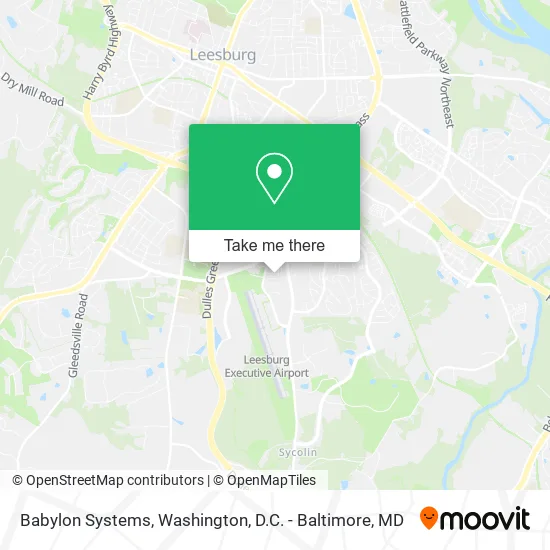
See Babylon Systems, Loudoun County, on the map
Public Transit to Babylon Systems in Loudoun County
Wondering how to get to Babylon Systems in Loudoun County? Moovit helps you find the best way to get to Babylon Systems with step-by-step directions from the nearest public transit station.
Moovit provides free maps and live directions to help you navigate through your city. View schedules, routes, timetables, and find out how long does it take to get to Babylon Systems in real time.
Looking for the nearest stop or station to Babylon Systems? Check out this list of stops closest to your destination: Miller Dr & Pink Azalea Te; Compass Creek Plaza.
Bus: 351, 56, 70, 55.
Want to see if there’s another route that gets you there at an earlier time? Moovit helps you find alternative routes or times. Get directions from and directions to Babylon Systems easily from the Moovit App or Website.
We make riding to Babylon Systems easy, which is why over 1.5 million users, including users in Loudoun County, trust Moovit as the best app for public transit. You don’t need to download an individual bus app or train app, Moovit is your all-in-one transit app that helps you find the best bus time or train time available.
For information on prices of bus and metro, costs and ride fares to Babylon Systems, please check the Moovit app.
Use the app to navigate to popular places including to the airport, hospital, stadium, grocery store, mall, coffee shop, school, college, and university.
Babylon Systems Address: 341 Pink Azalea Ter SE Leesburg, VA 20175 street in Loudoun County
- Rice Web Consulting,
- Five Guys,
- Atmc,
- Cornerstone Musalla,
- Credit Union 1,
- Navy Federal Credit Union,
- ATM,
- SONIC,
- Flagship Carwash,
- General Services Department,
- Loudoun County Master Gardeners,
- Carl D Collis,
- Cornerstone Chapel,
- Cool Spring Elementary School,
- Cool Spring Elementary School (Loudoun County Public Schools, Elementary Schools, Cool Spring),
- Prime Storage,
- 815 Tall Oak Sq SE ,
- Smithsonian Institution National Museum of Natural History,
- Popeyes LOUISIANA KITCHEN,
- Chipotle
Places Near Babylon Systems (Loudoun County)
- Warner Theatre, Washington,
- Pennsylvania Ave NW (3rd st and pennsylvania), Washington,
- M&T Bank Stadium, Baltimore,
- Capital One Arena, Washington,
- National Zoo, Washington,
- Museum Of The Bible, Washington,
- National Museum of African American History and Culture, Washington,
- Amazon Hq2, Arlington County,
- Rock Creek Tennis Center, Washington,
- Georgetown, Washington,
- Sibley Memorial Hospital, Washington,
- Washington National Cathedral, Washington,
- Basilica of the National Shrine, Washington,
- National Mall, Washington,
- Camden Yards, Baltimore,
- Washington DC VA Medical Center, Washington,
- The Anthem, Washington,
- Marriott Marquis Washington, DC, Washington,
- PG Mall, Prince George's County,
- Westfield Montgomery Mall, Montgomery County
How to get to popular places in Washington, D.C. - Baltimore, MD with public transit
Get around Loudoun County by public transit!
Traveling around Loudoun County has never been so easy. See step by step directions as you travel to any attraction, street or major public transit station. View bus and train schedules, arrival times, service alerts and detailed routes on a map, so you know exactly how to get to anywhere in Loudoun County.
When traveling to any destination around Loudoun County use Moovit's Live Directions with Get Off Notifications to know exactly where and how far to walk, how long to wait for your line, and how many stops are left. Moovit will alert you when it's time to get off — no need to constantly re-check whether yours is the next stop.
Wondering how to use public transit in Loudoun County or how to pay for public transit in Loudoun County? Moovit public transit app can help you navigate your way with public transit easily, and at minimum cost. It includes public transit fees, ticket prices, and costs. Looking for a map of Loudoun County public transit lines? Moovit public transit app shows all public transit maps in Loudoun County with all Bus, Train, Metro, Light Rail and Ferry routes and stops on an interactive map.
Washington, D.C. - Baltimore, MD has 5 transit type(s), including: Bus, Train, Metro, Light Rail and Ferry, operated by several transit agencies, including WMATA, Montgomery County Ride On, Fairfax Connector, TheBus, PRTC, DASH - Alexandria, Arlington Transit (ART), RTA of Central Maryland, MDOT MTA, MDOT MTA Light RailLink, MDOT MTA Commuter Bus, MDOT MTA Local Bus, FXBGO!, Virginia Railway Express (VRE) and MARC