How to get to Bacci Marbles by bus?
Click on the bus route to see step by step directions with maps, line arrival times and updated time schedules.
From Arena of Versilia, Montignoso
51 minFrom Bussoladomani Park, Union of Municipalities of Versilia
37 minFrom Stiava Municipal Sports Field, Union of Municipalities of Versilia
119 minFrom Heart Hospital, Massa
20 minFrom Snai Point, Horse Racing, Sports, Betting, Union of Municipalities of Versilia
107 minFrom Carrefour, Massa
76 minFrom Le Dune Free Beach, Forte Dei Marmi
47 minFrom Lido di Camaiore, Camaiore
57 minFrom Viareggio Beach, Viareggio
46 minFrom Maremonti Shopping Center, Massa
78 min
How to get to Bacci Marbles by train?
Click on the train route to see step by step directions with maps, line arrival times and updated time schedules.
Bus stops near Bacci Marbles in Pietrasanta
Train station near Bacci Marbles in Pietrasanta
- Forte Dei Marmi-Seravezza-Querceta, 19 min walk,VIEW
Bus lines to Bacci Marbles in Pietrasanta
What are the closest stations to Bacci Marbles?
The closest stations to Bacci Marbles are:
- Via Aurelia #160 is 159 meters away, 3 min walk.
- Via Aurelia Agip Gas Station is 192 meters away, 4 min walk.
- Forte Dei Marmi-Seravezza-Querceta is 1449 meters away, 19 min walk.
Which bus lines stop near Bacci Marbles?
These bus lines stop near Bacci Marbles: E25, E26, E35, E41.
Which train line stops near Bacci Marbles?
R (Pisa/Livorno)
What’s the nearest train station to Bacci Marbles in Pietrasanta?
The nearest train station to Bacci Marbles in Pietrasanta is Forte Dei Marmi-Seravezza-Querceta. It’s a 19 min walk away.
What’s the nearest bus station to Bacci Marbles in Pietrasanta?
The nearest bus station to Bacci Marbles in Pietrasanta is Via Aurelia #160. It’s a 3 min walk away.
What time is the first train to Bacci Marbles in Pietrasanta?
The R is the first train that goes to Bacci Marbles in Pietrasanta. It stops nearby at 5:49 AM.
What time is the last train to Bacci Marbles in Pietrasanta?
The R is the last train that goes to Bacci Marbles in Pietrasanta. It stops nearby at 11:16 PM.
What time is the first bus to Bacci Marbles in Pietrasanta?
The E35 is the first bus that goes to Bacci Marbles in Pietrasanta. It stops nearby at 7:28 AM.
What time is the last bus to Bacci Marbles in Pietrasanta?
The E35 is the last bus that goes to Bacci Marbles in Pietrasanta. It stops nearby at 8:17 PM.
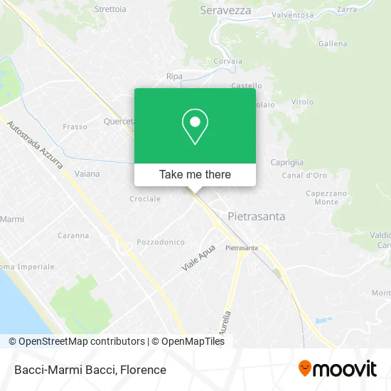
See Bacci Marbles, Pietrasanta, on the map
Public Transit to Bacci Marbles in Pietrasanta
Wondering how to get to Bacci Marbles in Pietrasanta? Moovit helps you find the best way to get to Bacci Marbles with step-by-step directions from the nearest public transit station.
Moovit provides free maps and live directions to help you navigate through your city. View schedules, routes, timetables, and find out how long does it take to get to Bacci Marbles in real time.
Looking for the nearest stop or station to Bacci Marbles? Check out this list of stops closest to your destination: Via Aurelia #160; Via Aurelia Agip Gas Station; Forte Dei Marmi-Seravezza-Querceta.
Bus: E25, E26, E35, E41, E36, E38.Train: R.
Want to see if there’s another route that gets you there at an earlier time? Moovit helps you find alternative routes or times. Get directions from and directions to Bacci Marbles easily from the Moovit App or Website.
We make riding to Bacci Marbles easy, which is why over 1.5 million users, including users in Pietrasanta, trust Moovit as the best app for public transit. You don’t need to download an individual bus app or train app, Moovit is your all-in-one transit app that helps you find the best bus time or train time available.
For information on prices of bus and train, costs and ride fares to Bacci Marbles, please check the Moovit app.
Use the app to navigate to popular places including to the airport, hospital, stadium, grocery store, mall, coffee shop, school, college, and university.
Bacci Marbles Address: Via Aurelia Nord, 55045 Pietrasanta street in Pietrasanta
- TRONY,
- Maremmani Physiotherapy Studio,
- Cooperative,
- La Viola Aesthetics,
- Danzarte,
- Eni,
- Amazon Locker-Vinicio,
- Print House by Bacci & Vitiello,
- Mechanical Workshop by Bruno Paoli & Antonio Matteucci,
- Onix Telmar by Mazza Angelo & C.,
- Olos AC ASD,
- Vanity Hair Style,
- Apua Stone,
- Ciardella Paola,
- Versilink Computer Notebook Smartphone Cartridges Toner,
- Fabbricotti Fabrizio,
- Dal Porto Anna,
- Le Pietre,
- Antognazzi Ugo,
- Cemenbit
Places Near Bacci Marbles (Pietrasanta)
- I Gigli, Campi Bisenzio,
- Asmana, Campi Bisenzio,
- Mandela Forum (Nelson Mandela Forum), Florence,
- Tobacco Manufacture, Florence,
- Wanny Palace, Florence,
- Michelangelo Square, Florence,
- Viola Park, Bagno a Ripoli,
- Piero Palagi Hospital Facility-Florence, Florence,
- Nelson Mandela Forum, Florence,
- Artemio Franchi Municipal Stadium, Florence,
- Campi Bisenzio, Campi Bisenzio,
- Torregalli Hospital Scandicci *, Scandicci,
- OOO, Florence,
- Cascine Park, Florence,
- Santa Maria Novella Station, Florence,
- IKEA Florence, Sesto Fiorentino,
- Michelangelo Square, Florence,
- Verdi Theater, Florence,
- Santa Maria Nuova Hospital, Florence,
- Field of Mars, Florence
How to get to popular places in Florence with public transit
Get around Pietrasanta by public transit!
Traveling around Pietrasanta has never been so easy. See step by step directions as you travel to any attraction, street or major public transit station. View bus and train schedules, arrival times, service alerts and detailed routes on a map, so you know exactly how to get to anywhere in Pietrasanta.
When traveling to any destination around Pietrasanta use Moovit's Live Directions with Get Off Notifications to know exactly where and how far to walk, how long to wait for your line, and how many stops are left. Moovit will alert you when it's time to get off — no need to constantly re-check whether yours is the next stop.
Wondering how to use public transit in Pietrasanta or how to pay for public transit in Pietrasanta? Moovit public transit app can help you navigate your way with public transit easily, and at minimum cost. It includes public transit fees, ticket prices, and costs. Looking for a map of Pietrasanta public transit lines? Moovit public transit app shows all public transit maps in Pietrasanta with all Bus, Train, Light Rail, Ferry and Funicular routes and stops on an interactive map.
Florence has 5 transit type(s), including: Bus, Train, Light Rail, Ferry and Funicular, operated by several transit agencies, including Florence Urban - Tuscan Bus Lines, GEST, Florence and Province - Tuscan Bus Lines, Livorno and Province - Tuscan Bus Lines, Arezzo, Florence and Provinces - Tuscan Bus Lines, Prato and Province - Tuscan Bus Lines, Massa, Carrara and Province - Tuscan Bus Lines, Pisa and Province - Tuscan Bus Lines, Grosseto, Siena and Provinces - Tuscan Bus Lines, Arezzo, Siena and Provinces - Tuscan Bus Lines, Pistoia and Province - Tuscan Bus Lines, Siena and Province - Tuscan Bus Lines, Arezzo and Province - Tuscan Bus Lines, Lucca and Province - Tuscan Bus Lines and Trenitalia