How to get to Badiola by bus?
Click on the bus route to see step by step directions with maps, line arrival times and updated time schedules.
From Le Pozze Di Lecchi, Gaiole In Chianti
461 minFrom Figline Valdarno, Figline Valdarno
36 minFrom Serristori Hospital, Figline and Incisa Valdarno
39 minFrom Hu Norcenni Girasole Village, Figline Valdarno
59 minFrom Gaiole In Chianti, Gaiole In Chianti
454 minFrom Sammezzano Castle, Reggello
198 minFrom Norcenni Girasole Club, Figline Valdarno
60 minFrom Vallombrosa, Reggello
292 minFrom Greve In Chianti, Greve In Chianti
199 minFrom Korian-Frate Sole Care Home, Figline Valdarno
51 min
How to get to Badiola by train?
Click on the train route to see step by step directions with maps, line arrival times and updated time schedules.
Bus stops near Badiola in San Giovanni Valdarno
Train station near Badiola in San Giovanni Valdarno
- San Giovanni Valdarno, 24 min walk,VIEW
Bus lines to Badiola in San Giovanni Valdarno
- ORANGE, San Giovanni Valdarno Depot Stop,VIEW
- AL10, Loro Ciuffenna Gruissan Street (Post Office),VIEW
- A, Terranuova-Penna-Montemarciano-Nuova Squarcia,VIEW
- YELLOW, Terranuova-Loro-Malva-San Giovanni-Ville-Terranuova,VIEW
- MIV09, Piandiscò-Castelfranco-Via Botriolo-San Giovanni-Montevarchi,VIEW
- MIV09, Faella,VIEW
- BLU, Blue Line,VIEW
- D, Ville-Badiola-Treggiaia,VIEW
- MIV01, Levane-Montevarchi-Hospital-San Giovanni,VIEW
- MIV03, Montevarchi-Terranuova-San Giovanni Valdarno,VIEW
- MIV04, Levane-Ponte Leonardo-Terranuova-Ponte Leonardo-Montevarchi,VIEW
- MIV05, Montevarchi-Via Chiantigiana-Cavriglia-Neri-Castelnuovo dei Sabbioni-Meleto-Santa Barbara-San Giovanni Valdarno,VIEW
- MIV06, Cavriglia-Vacchereccia-San Giovanni,VIEW
- MIV08, Piandiscò-Castelfranco-Faella-Figline-San Giovanni-Montevarchi,VIEW
- MIV10, Loro-Terranuova-Via Poggilupi/Via Ville-San Giovanni Valdarno,VIEW
- SI91, Siena-Ambra-Montevarchi-San Giovanni Valdarno,VIEW
- SI330, Arezzo-Montevarchi-San Giovanni Valdarno-Figline Valdarno-Florence,VIEW
- 351 A, Montevarchi-Figline Valdarno-Incisa Valdarno-Florence,VIEW
- 353 A, Reggello-Figline Valdarno-Incisa Valdarno-Florence,VIEW
- 353 B, Reggello-Figline Valdarno-Incisa Valdarno-Florence,VIEW
What are the closest stations to Badiola?
The closest stations to Badiola are:
- Church of St. Mary Junction is 27 meters away, 1 min walk.
- Santa Maria (Badiola) is 277 meters away, 5 min walk.
- Santa Maria (Badiola) Return is 301 meters away, 5 min walk.
- La Bianca Restaurant is 1092 meters away, 15 min walk.
- Peace Square is 1173 meters away, 16 min walk.
- Masaccio Middle School (Square) is 1193 meters away, 17 min walk.
- San Giovanni Valdarno is 1793 meters away, 24 min walk.
Which bus lines stop near Badiola?
These bus lines stop near Badiola: 351 A, 353 A, YELLOW, MIV07, MIV08, MIV09, SI330.
Which train line stops near Badiola?
R (Foligno)
What’s the nearest train station to Badiola in San Giovanni Valdarno?
The nearest train station to Badiola in San Giovanni Valdarno is San Giovanni Valdarno. It’s a 24 min walk away.
What’s the nearest bus station to Badiola in San Giovanni Valdarno?
The nearest bus station to Badiola in San Giovanni Valdarno is Church of St. Mary Junction. It’s a 1 min walk away.
What time is the first train to Badiola in San Giovanni Valdarno?
The R is the first train that goes to Badiola in San Giovanni Valdarno. It stops nearby at 6:10 AM.
What time is the last train to Badiola in San Giovanni Valdarno?
The R is the last train that goes to Badiola in San Giovanni Valdarno. It stops nearby at 12:11 AM.
What time is the first bus to Badiola in San Giovanni Valdarno?
The 351 A is the first bus that goes to Badiola in San Giovanni Valdarno. It stops nearby at 5:35 AM.
What time is the last bus to Badiola in San Giovanni Valdarno?
The MIV08 is the last bus that goes to Badiola in San Giovanni Valdarno. It stops nearby at 6:31 PM.
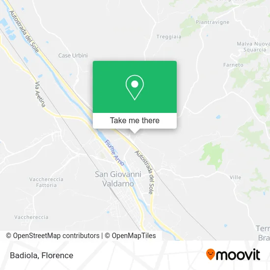
See Badiola, San Giovanni Valdarno, on the map
Public Transit to Badiola in San Giovanni Valdarno
Wondering how to get to Badiola in San Giovanni Valdarno? Moovit helps you find the best way to get to Badiola with step-by-step directions from the nearest public transit station.
Moovit provides free maps and live directions to help you navigate through your city. View schedules, routes, timetables, and find out how long does it take to get to Badiola in real time.
Looking for the nearest stop or station to Badiola? Check out this list of stops closest to your destination: Church of St. Mary Junction; Santa Maria (Badiola); Santa Maria (Badiola) Return; La Bianca Restaurant; Peace Square; Masaccio Middle School (Square); San Giovanni Valdarno.
Bus: 351 A, 353 A, YELLOW, MIV07, MIV08, MIV09, SI330, ORANGE, AL10, A, YELLOW, BLU, D, MIV01, MIV03, MIV04, 360 A.Train: R.
Want to see if there’s another route that gets you there at an earlier time? Moovit helps you find alternative routes or times. Get directions from and directions to Badiola easily from the Moovit App or Website.
We make riding to Badiola easy, which is why over 1.5 million users, including users in San Giovanni Valdarno, trust Moovit as the best app for public transit. You don’t need to download an individual bus app or train app, Moovit is your all-in-one transit app that helps you find the best bus time or train time available.
For information on prices of bus and train, costs and ride fares to Badiola, please check the Moovit app.
Use the app to navigate to popular places including to the airport, hospital, stadium, grocery store, mall, coffee shop, school, college, and university.
Badiola Address: Strada degli Urbini street in San Giovanni Valdarno
- Lucky Animals Center,
- Arno East,
- Valdarno Jazz Festival,
- Eco-Sei by Mei Antonella,
- House of Retreats and Camping / Poggio di Loro,
- La Drinkeria,
- Biolandia San Miniato,
- Valdarnese Construction,
- Duferco Energia,
- Fashion Artisan Museum Srl,
- Amarti Love & Design,
- Dpiù Supermarket Bucine,
- Iris - Dental Clinic,
- Mauro Nardi,
- Amicimiei Bar,
- Municipal Stadium,
- Public Schools,
- I. C. Masaccio,
- State Educational Directorate,
- M.B. Constructions
Places Near Badiola (San Giovanni Valdarno)
- Mandela Forum (Nelson Mandela Forum), Florence,
- Verdi Theater, Florence,
- Nelson Mandela Forum, Florence,
- Michelangelo Square, Florence,
- Field of Mars, Florence,
- I Gigli, Campi Bisenzio,
- Artemio Franchi Municipal Stadium, Florence,
- Santa Maria Nuova Hospital, Florence,
- Michelangelo Square, Florence,
- IKEA Florence, Sesto Fiorentino,
- Wanny Palace, Florence,
- Campi Bisenzio, Campi Bisenzio,
- Piero Palagi Hospital Facility-Florence, Florence,
- OOO, Florence,
- Viola Park, Bagno a Ripoli,
- Santa Maria Novella Station, Florence,
- Cascine Park, Florence,
- Torregalli Hospital Scandicci *, Scandicci,
- Asmana, Campi Bisenzio,
- Tobacco Manufacture, Florence
How to get to popular places in Florence with public transit
Get around San Giovanni Valdarno by public transit!
Traveling around San Giovanni Valdarno has never been so easy. See step by step directions as you travel to any attraction, street or major public transit station. View bus and train schedules, arrival times, service alerts and detailed routes on a map, so you know exactly how to get to anywhere in San Giovanni Valdarno.
When traveling to any destination around San Giovanni Valdarno use Moovit's Live Directions with Get Off Notifications to know exactly where and how far to walk, how long to wait for your line, and how many stops are left. Moovit will alert you when it's time to get off — no need to constantly re-check whether yours is the next stop.
Wondering how to use public transit in San Giovanni Valdarno or how to pay for public transit in San Giovanni Valdarno? Moovit public transit app can help you navigate your way with public transit easily, and at minimum cost. It includes public transit fees, ticket prices, and costs. Looking for a map of San Giovanni Valdarno public transit lines? Moovit public transit app shows all public transit maps in San Giovanni Valdarno with all Bus, Train, Light Rail, Ferry and Funicular routes and stops on an interactive map.
Florence has 5 transit type(s), including: Bus, Train, Light Rail, Ferry and Funicular, operated by several transit agencies, including Florence Urban - Tuscan Bus Lines, GEST, Livorno and Province - Tuscan Bus Lines, Arezzo, Florence and Provinces - Tuscan Bus Lines, Prato and Province - Tuscan Bus Lines, Lucca and Province - Tuscan Bus Lines, Massa, Carrara and Province - Tuscan Bus Lines, Pisa and Province - Tuscan Bus Lines, Grosseto, Siena and Provinces - Tuscan Bus Lines, Arezzo, Siena and Provinces - Tuscan Bus Lines, Florence and Province - Tuscan Bus Lines, Pistoia and Province - Tuscan Bus Lines, Siena and Province - Tuscan Bus Lines, Arezzo and Province - Tuscan Bus Lines and Trenitalia