How to get to Balaji Developers by bus?
Click on the bus route to see step by step directions with maps, line arrival times and updated time schedules.
From Gajanan Maharaj Bhaktnivas Alandi, Pune & Velhe
52 minFrom Amazon-PNQ3, Rajgurunagar
43 minFrom RTO Pimpri Chinchwad, Pune & Velhe
94 minFrom Moshi, Pune & Velhe
40 minFrom International Exhibition Center Project, Pune & Velhe
44 minFrom Nighoje, Pune & Velhe
44 minFrom Mit Alandi Campus, Pune & Velhe
59 minFrom Nimgaon Khandoba Temple, Rajgurunagar
96 minFrom Shri Gajanan Maharaj Sansthan Bhakta Niwas, Pune & Velhe
51 minFrom Talawade Road, Pune & Velhe
61 min
Bus stops near Balaji Developers in Rajgurunagar
Bus lines to Balaji Developers in Rajgurunagar
- 120, Bhosari,VIEW
- 343, Chakan Ambethan Chowk,VIEW
- 384, Chakan Ambethan Chowk (Circular),VIEW
- 343A, Maruti Mandir Talegaon Dabhade,VIEW
- 343B, Samarth Vidyalaya Talegaon Dabhade,VIEW
- 385, Chakan Ambethan Chowk (Circular),VIEW
- 343C, Chakan Ambethan Chowk,VIEW
- 352, Rajgurunagar Law College - Pune Station,VIEW
- 358, Bhosari - Rajgurunagar Law College,VIEW
- 364, Alandi Darshan - Chakan Ambethan Chowk,VIEW
- 370, Bhosari - Davadi Gaon,VIEW
- 352A, Bhosari - Rajgurunagar Law College,VIEW
- 358A, Bhosari - Vasuli,VIEW
- 359A, Pimplegurav - Rajgurunagar Law College,VIEW
- 384A, Bhosari - Chakan Ambethan Chowk,VIEW
- 385A, Bhosari - Chakan Ambethan Chowk,VIEW
- SHUTTLE 1, Pune Station To Chakan Ambethan Chowk,VIEW
- 353A, Bhosari - Shikrapur ST Stand,VIEW
- 359B, Rajgurunagar Law College To Bhosari,VIEW
- SHUTTLE 1, Chakan Ambethan Chowk To Ma.Na.Pa Bhavan,VIEW
What are the closest stations to Balaji Developers?
The closest stations to Balaji Developers are:
- Ranubai Mala is 367 meters away, 5 min walk.
- Chakan Talegaon Chowk is 1028 meters away, 14 min walk.
Which bus lines stop near Balaji Developers?
These bus lines stop near Balaji Developers: 120, 370, 384.
What’s the nearest bus station to Balaji Developers in Rajgurunagar?
The nearest bus station to Balaji Developers in Rajgurunagar is Ranubai Mala. It’s a 5 min walk away.
What time is the first bus to Balaji Developers in Rajgurunagar?
The 358 is the first bus that goes to Balaji Developers in Rajgurunagar. It stops nearby at 5:15 AM.
What time is the last bus to Balaji Developers in Rajgurunagar?
The 358 is the last bus that goes to Balaji Developers in Rajgurunagar. It stops nearby at 12:20 AM.
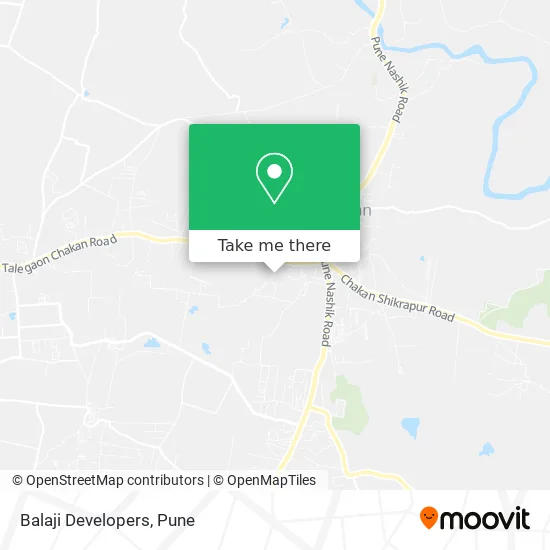
See Balaji Developers, Rajgurunagar, on the map
Public Transit to Balaji Developers in Rajgurunagar
Wondering how to get to Balaji Developers in Rajgurunagar? Moovit helps you find the best way to get to Balaji Developers with step-by-step directions from the nearest public transit station.
Moovit provides free maps and live directions to help you navigate through your city. View schedules, routes, timetables, and find out how long does it take to get to Balaji Developers in real time.
Looking for the nearest stop or station to Balaji Developers? Check out this list of stops closest to your destination: Ranubai Mala; Chakan Talegaon Chowk.
Bus: 120, 370, 384, 343, 343A, 343B, 385, 343C, 352, 358, 364, 352A, 353A, 359B, SHUTTLE 1.
Want to see if there’s another route that gets you there at an earlier time? Moovit helps you find alternative routes or times. Get directions from and directions to Balaji Developers easily from the Moovit App or Website.
We make riding to Balaji Developers easy, which is why over 1.5 million users, including users in Rajgurunagar, trust Moovit as the best app for public transit. You don’t need to download an individual bus app or train app, Moovit is your all-in-one transit app that helps you find the best bus time or train time available.
For information on prices of bus, costs and ride fares to Balaji Developers, please check the Moovit app.
Use the app to navigate to popular places including to the airport, hospital, stadium, grocery store, mall, coffee shop, school, college, and university.
Balaji Developers Address: खेड 410501 MH street in Rajgurunagar
- Jai Ganesh Aluminium and Glass Works,
- Hotel Janai Devi,
- Swastik Engineering Works,
- Apna Ghar Society,
- Aapla Ghar Chakan Talegaon,
- Sai Ganga,
- Mauli Niwas,
- Mayur Doodh Dairy,
- Reliance Jio,
- Swami Samarth Niwas,
- Cosmos Bank,
- Sujata Saree Centre,
- Sameer Gas Agency,
- All Pop Plaster Sharif,
- Amol Gas Agency,
- Manish Hair Saloon,
- Shri Balaji Kirana Store,
- Sangita Ladies Tailor,
- Aai Vadilancha Aashirwad,
- Aradhya Ladies
Places Near Balaji Developers (Rajgurunagar)
- Tulshibaug, Pune & Velhe,
- Senapati Bapat Road, Pune & Velhe,
- Symbiosis Lavale Bus Stop, Pune & Velhe,
- Ion Digital Zone, Pune & Velhe,
- Pvr Icon - Pavilion Mall, Pune & Velhe,
- M G Road, Pune & Velhe,
- Westend Mall, Pune & Velhe,
- Laxmi Road, Pune & Velhe,
- Sarasbaug, Pune & Velhe,
- ISKCON Nvcc Temple, Pune & Velhe,
- Chaturshringi Temple, Pune & Velhe,
- BAPS Shri Swaminarayan Mandir, Pune & Velhe,
- Vishwakarma Institute Of Technology (Vit), Pune & Velhe,
- Swaminarayan Mandir, Pune & Velhe,
- ISKCON Pune, Pune & Velhe,
- Dagdusheth Halwai Ganpati Mandir, Pune & Velhe,
- Pune Okayama Friendship Garden, Pune & Velhe,
- Cognizant Deccan Campus (CDC), Paud,
- Dagadusheth Halwai Ganapati Temple, Pune & Velhe,
- Fc Road, Pune & Velhe
How to get to popular places in Pune with public transit
Get around Rajgurunagar by public transit!
Traveling around Rajgurunagar has never been so easy. See step by step directions as you travel to any attraction, street or major public transit station. View bus and train schedules, arrival times, service alerts and detailed routes on a map, so you know exactly how to get to anywhere in Rajgurunagar.
When traveling to any destination around Rajgurunagar use Moovit's Live Directions with Get Off Notifications to know exactly where and how far to walk, how long to wait for your line, and how many stops are left. Moovit will alert you when it's time to get off — no need to constantly re-check whether yours is the next stop.
Wondering how to use public transit in Rajgurunagar or how to pay for public transit in Rajgurunagar? Moovit public transit app can help you navigate your way with public transit easily, and at minimum cost. It includes public transit fees, ticket prices, and costs. Looking for a map of Rajgurunagar public transit lines? Moovit public transit app shows all public transit maps in Rajgurunagar with all Bus, Train and Metro routes and stops on an interactive map.
Pune has 3 transit type(s), including: Bus, Train and Metro, operated by several transit agencies, including Pune Metro (Maha Metro), PMPML, PMPML Night Bus Service (Ratrani) and Central Railways (Indian Railways)