Directions to Baltec Freios (Colombo) with public transportation
The following transit lines have routes that pass near Baltec Freios
How to get to Baltec Freios by bus?
Click on the bus route to see step by step directions with maps, line arrival times and updated time schedules.
From Centro Politécnico - UFPR, Jardim Das Américas
54 minFrom Alto Da Rua XV, Alto Da Rua XV
47 minFrom Praça Eufrásio Corrêia, Centro
46 minFrom Rua Barão do Serro Azul 134, Centro
46 minFrom Shopping Jardim Das Américas, Jardim Das Américas
56 minFrom Shopping Jardim das Américas, Jardim Das Américas
58 minFrom Praça Osório, Centro
50 minFrom Expotrade, Pinhais
77 minFrom Rua Jacarezinho, Mercês
52 minFrom Rua Desembargador Westphalen, Rebouças
48 min
Bus stops near Baltec Freios in Colombo
Bus lines to Baltec Freios in Colombo
- S01 ROÇA GRANDE / GUADALUPE (VIA SANTA CÂNDIDA), Terminal Roça Grande → Terminal Guadalupe,VIEW
- S31 ROÇA GRANDE / SANTA CÂNDIDA, Terminal Roça Grande → Terminal Santa Cândida,VIEW
- B72 COLOMBO / GUADALUPE (VIA T. ROÇA GRANDE), Terminal Sede Colombo → Terminal Guadalupe,VIEW
- B73 JARDIM OSASCO / GUADALUPE, Jardim Osasco → Terminal Guadalupe,VIEW
- 231 BANESTADO / CALIFÓRNIA, Terminal Santa Cândida → Califórnia,VIEW
- B76 SÃO SEBASTIÃO / GUADALUPE, SÃO SEBASTIÃO / GUADALUPE,VIEW
- B78 SÃO GABRIEL / GUADALUPE, SÃO GABRIEL / GUADALUPE,VIEW
- S89 SÃO SEBASTIÃO / GUADALUPE (VIA SÃO GABRIEL), SÃO SEBASTIÃO / GUADALUPE (via SÃO GABRIEL),VIEW
What are the closest stations to Baltec Freios?
The closest stations to Baltec Freios are:
- Rodovia da Uva (PR 417), 450 is 187 meters away, 3 min walk.
- Estr. Nova de Colombo, 6500 is 748 meters away, 10 min walk.
- Estrada de Santa Cândida, 1103 is 1512 meters away, 20 min walk.
Which bus lines stop near Baltec Freios?
These bus lines stop near Baltec Freios: B72 COLOMBO / GUADALUPE (VIA T. ROÇA GRANDE), B73 JARDIM OSASCO / GUADALUPE, S31 ROÇA GRANDE / SANTA CÂNDIDA.
What’s the nearest bus station to Baltec Freios in Colombo?
The nearest bus station to Baltec Freios in Colombo is Rodovia da Uva (PR 417), 450. It’s a 3 min walk away.
What time is the first bus to Baltec Freios in Colombo?
The 231 BANESTADO / CALIFÓRNIA is the first bus that goes to Baltec Freios in Colombo. It stops nearby at 5:00 AM.
What time is the last bus to Baltec Freios in Colombo?
The B72 COLOMBO / GUADALUPE (VIA T. ROÇA GRANDE) is the last bus that goes to Baltec Freios in Colombo. It stops nearby at 1:00 AM.
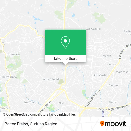
See Baltec Freios, Colombo, on the map
Public Transit to Baltec Freios in Colombo
Wondering how to get to Baltec Freios in Colombo? Moovit helps you find the best way to get to Baltec Freios with step-by-step directions from the nearest public transit station.
Moovit provides free maps and live directions to help you navigate through your city. View schedules, routes, timetables, and find out how long does it take to get to Baltec Freios in real time.
Looking for the nearest stop or station to Baltec Freios? Check out this list of stops closest to your destination: Rodovia da Uva (PR 417); Estr. Nova de Colombo; Estrada de Santa Cândida.
Bus: B72 COLOMBO / GUADALUPE (VIA T. ROÇA GRANDE), B73 JARDIM OSASCO / GUADALUPE, S31 ROÇA GRANDE / SANTA CÂNDIDA, S01 ROÇA GRANDE / GUADALUPE (VIA SANTA CÂNDIDA), 231 BANESTADO / CALIFÓRNIA, B76 SÃO SEBASTIÃO / GUADALUPE, B78 SÃO GABRIEL / GUADALUPE, S89 SÃO SEBASTIÃO / GUADALUPE (VIA SÃO GABRIEL).
Want to see if there’s another route that gets you there at an earlier time? Moovit helps you find alternative routes or times. Get directions from and directions to Baltec Freios easily from the Moovit App or Website.
We make riding to Baltec Freios easy, which is why over 1.5 million users, including users in Colombo, trust Moovit as the best app for public transit. You don’t need to download an individual bus app or train app, Moovit is your all-in-one transit app that helps you find the best bus time or train time available.
For information on prices of bus, costs and ride fares to Baltec Freios, please check the Moovit app.
Use the app to navigate to popular places including to the airport, hospital, stadium, grocery store, mall, coffee shop, school, college, and university.
Baltec Freios Address: Rua Azemiro Ferreira da Silva, 125 Roça Grande Colombo-PR 83402-010 street in Colombo
- Multi Rede,
- Deise Cristina de Paula,
- Brecho da Tabata,
- Baltec,
- Madufer Ferro e Aço Ltda,
- Associação de Pais e Mestres da Escola Municipal Jardim das Flores J,
- Transportadora Santa Lúzia Ltda,
- Escola Municipal Jardim Das Flores,
- Condominio Residencial Jose Milani,
- Carnetti Lajes,
- Academia Ph.D Sports Colombo Rod. da Uva,
- Rodovia da Uva Km 2 537,
- Residencial Milani,
- Suprema Cimento,
- Pompadour Motel,
- Motel Monier,
- Js Eletronica,
- Pr-417,
- Lava Car Sr.Esponja,
- Brito Air
Places Near Baltec Freios (Colombo)
- Campo Largo, Campo,
- Jardim Botânico de Curitiba PR, Centro,
- Hospital Universitário Evangélico de Curitiba, Bigorrilho,
- Arena Da Baixada - Curitiba,
- Jockey Plaza Shopping Center, Tarumã,
- Hospital Da Cruz Vermelha, Batel,
- Pontifícia Universidade Católica do Paraná (PUCPR), Prado Velho,
- Hospital do Rocio, Campo,
- Rua Martim Afonso 558, Mercês,
- Hospital Angelina Caron, Campina Grande Do Sul,
- Hospital Nossa Senhora Das Graças, Mercês,
- Shopping Estação, Rebouças,
- Hospital Erasto Gaertner, Jardim Das Américas,
- Parque Barigui, Mercês,
- Rua General Mário Tourinho, Campina Do Siqueira,
- Hospital de Clínicas (HC - UFPR), Centro,
- Hospital Madalena Sofia, Bairro Alto,
- Park Shopping Barigüi, Mossunguê,
- Hhhhh, Fazendinha,
- Shopping Palladium, Portão
How to get to popular places in Curitiba Region with public transit
Get around Colombo by public transit!
Traveling around Colombo has never been so easy. See step by step directions as you travel to any attraction, street or major public transit station. View bus and train schedules, arrival times, service alerts and detailed routes on a map, so you know exactly how to get to anywhere in Colombo.
When traveling to any destination around Colombo use Moovit's Live Directions with Get Off Notifications to know exactly where and how far to walk, how long to wait for your line, and how many stops are left. Moovit will alert you when it's time to get off — no need to constantly re-check whether yours is the next stop.
Wondering how to use public transit in Colombo or how to pay for public transit in Colombo? Moovit public transit app can help you navigate your way with public transit easily, and at minimum cost. It includes public transit fees, ticket prices, and costs. Looking for a map of Colombo public transit lines? Moovit public transit app shows all public transit maps in Colombo with all Bus and Cable Car routes and stops on an interactive map.
Curitiba Region has 2 transit type(s), including: Bus and Cable Car, operated by several transit agencies, including Sistema Integrado de Mobilidade (URBS), Sistema Integrado de Mobilidade (AMEP), URBS (Cartões bancários e Dinheiro), URBS (Cartões bancários / Cartão URBS), AMEP (Cartões bancários / Cartão MetroCard), AMEP (Cartões bancários / Cartão MetroCard / Dinheiro), Viação Colombo (Dinheiro), TRIAR (Cartão TRIAR / Dinheiro), Empresa Curitiba Cerro Azul (Dinheiro), Expresso Nossa Senhora da Penha (Dinheiro), Empresa Campo Alto Tijucas (Dinheiro), Auto Viação São José (Cartão VEM / Dinheiro), BRT S/A (Cartão VEM / Dinheiro), TransPiedade (Cartão Cidadão / Dinheiro) and Oceânica Sul (Cartão Transporte / Dinheiro)