How to get to Baltimore Police Department by bus?
Click on the bus route to see step by step directions with maps, line arrival times and updated time schedules.
From Giant Food Stores
40 minFrom Walmart
72 minFrom I-695 @ Exit 27 (Dulaney Valley Road/MD 146)
54 minFrom Pigtown / Washington Village
46 minFrom Patterson Park
61 minFrom Joseph Meyerhoff Symphony Hall
47 minFrom Walmart Supercenter
73 minFrom Lord Baltimore Hotel
48 minFrom Fells Point
55 minFrom Harford Road
47 min
How to get to Baltimore Police Department by metro?
Click on the metro route to see step by step directions with maps, line arrival times and updated time schedules.
Bus stops near Baltimore Police Department
Metro station near Baltimore Police Department
- Rogers Ave Metro, 9 min walk,VIEW
Light Rail stations near Baltimore Police Department
- Cold Spring Lane, 28 min walk,VIEW
Bus lines to Baltimore Police Department
What are the closest stations to Baltimore Police Department?
The closest stations to Baltimore Police Department are:
- Belvedere Ave & Nelson Ave FS Eb is 215 yards away, 3 min walk.
- Belvedere Ave & Elderon Ave Nb is 266 yards away, 4 min walk.
- Groveland Ave & Garrison Blvd Mid Wb is 374 yards away, 5 min walk.
- Reisterstown Rd & Belvedere Ave Nb is 421 yards away, 5 min walk.
- Garrison Blvd & Groveland Ave Sb is 444 yards away, 6 min walk.
- Rogers Ave Metro is 737 yards away, 9 min walk.
- Cold Spring Lane is 2362 yards away, 28 min walk.
Which bus lines stop near Baltimore Police Department?
These bus lines stop near Baltimore Police Department: 31, 83.
Which metro line stops near Baltimore Police Department?
METRO (Towards Owing Mills)
What’s the nearest light rail station to Baltimore Police Department?
The nearest light rail station to Baltimore Police Department is Cold Spring Lane. It’s a 28 min walk away.
What’s the nearest metro station to Baltimore Police Department?
The nearest metro station to Baltimore Police Department is Rogers Ave Metro. It’s a 9 min walk away.
What’s the nearest bus station to Baltimore Police Department?
The nearest bus station to Baltimore Police Department is Belvedere Ave & Nelson Ave FS Eb. It’s a 3 min walk away.
What time is the first light rail to Baltimore Police Department?
The LIGHT RAILLINK is the first light rail that goes to Baltimore Police Department. It stops nearby at 4:28 AM.
What time is the last light rail to Baltimore Police Department?
The LIGHT RAILLINK is the last light rail that goes to Baltimore Police Department. It stops nearby at 12:45 AM.
What time is the first metro to Baltimore Police Department?
The METRO is the first metro that goes to Baltimore Police Department. It stops nearby at 3:45 AM.
What time is the last metro to Baltimore Police Department?
The METRO is the last metro that goes to Baltimore Police Department. It stops nearby at 12:23 AM.
What time is the first bus to Baltimore Police Department?
The 80 is the first bus that goes to Baltimore Police Department. It stops nearby at 3:01 AM.
What time is the last bus to Baltimore Police Department?
The 80 is the last bus that goes to Baltimore Police Department. It stops nearby at 2:46 AM.
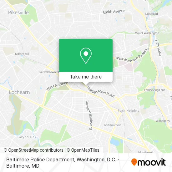
See Baltimore Police Department on the map
Public Transportation to Baltimore Police Department
Wondering how to get to Baltimore Police Department? Moovit helps you find the best way to get to Baltimore Police Department with step-by-step directions from the nearest public transit station.
Moovit provides free maps and live directions to help you navigate through your city. View schedules, routes, timetables, and find out how long does it take to get to Baltimore Police Department in real time.
Looking for the nearest stop or station to Baltimore Police Department? Check out this list of stops closest to your destination: Belvedere Ave & Nelson Ave FS Eb; Belvedere Ave & Elderon Ave Nb; Groveland Ave & Garrison Blvd Mid Wb; Reisterstown Rd & Belvedere Ave Nb; Garrison Blvd & Groveland Ave Sb; Rogers Ave Metro; Cold Spring Lane.
Bus: 31, 83, 34, 82, 28, 80.Metro: METRO.
Want to see if there’s another route that gets you there at an earlier time? Moovit helps you find alternative routes or times. Get directions from and directions to Baltimore Police Department easily from the Moovit App or Website.
We make riding to Baltimore Police Department easy, which is why over 1.7 million users, including users in Baltimore, trust Moovit as the best app for public transit. You don’t need to download an individual bus app or train app, Moovit is your all-in-one transit app that helps you find the best bus time or train time available.
For information on prices of bus and metro, costs and ride fares to Baltimore Police Department, please check the Moovit app.
Use the app to navigate to popular places including to the airport, hospital, stadium, grocery store, mall, coffee shop, school, college, and university.
Baltimore Police Department Address: 5271 Reisterstown Rd street in Baltimore
- Baltimore Police Department - Northwestern District,
- New Mt Zion Holy,
- Reisterstown Rd (Reisterstown Rd & belvedere),
- Mva,
- Maryland Motor Vehicle Administration (MVA),
- Reisterstown Rd & Garrison Ave NB,
- Total by Verizon,
- Good Guys Auto,
- 202,
- Reisterstown and Rogers,
- 5011 Arbutus Avenue,
- Fire Station,
- Penhurst Park,
- Autumn Lake at Arlington West,
- W Northern Pkwy (reisterstown road and W Northern Pkwy),
- Reisterstown Rd & Northern Pkwy,
- Tiger Mart,
- Rogers Station (Metro) NB,
- Park Heights Avenue & Rogers Avenue Northbound,
- Park Heights Avenue & Northern Parkway Northbound
Places Near Baltimore Police Department
- Georgetown, Washington,
- M&T Bank Stadium, Baltimore,
- Capital One Arena, Washington,
- Pennsylvania Ave NW (3rd st and pennsylvania), Washington,
- Marriott Marquis Washington, DC, Washington,
- Museum Of The Bible, Washington,
- Amazon Hq2, Arlington County,
- PG Mall, Prince George's County,
- Westfield Montgomery Mall, Montgomery County,
- The Anthem, Washington,
- National Zoo, Washington,
- National Museum of African American History and Culture, Washington,
- Camden Yards, Baltimore,
- Basilica of the National Shrine, Washington,
- Washington National Cathedral, Washington,
- Warner Theatre, Washington,
- National Theatre, Washington,
- Washington DC VA Medical Center, Washington,
- Sibley Memorial Hospital, Washington,
- Rock Creek Tennis Center, Washington
How to get to popular places in Washington, D.C. - Baltimore, MD with public transit
Get around Baltimore by public transit!
Traveling around Baltimore has never been so easy. See step by step directions as you travel to any attraction, street or major public transit station. View bus and train schedules, arrival times, service alerts and detailed routes on a map, so you know exactly how to get to anywhere in Baltimore.
When traveling to any destination around Baltimore use Moovit's Live Directions with Get Off Notifications to know exactly where and how far to walk, how long to wait for your line, and how many stops are left. Moovit will alert you when it's time to get off — no need to constantly re-check whether yours is the next stop.
Wondering how to use public transit in Baltimore or how to pay for public transit in Baltimore? Moovit public transit app can help you navigate your way with public transit easily, and at minimum cost. It includes public transit fees, ticket prices, and costs. Looking for a map of Baltimore public transit lines? Moovit public transit app shows all public transit maps in Baltimore with all Bus, Train, Metro, Light Rail and Ferry routes and stops on an interactive map.
Washington, D.C. - Baltimore, MD has 5 transit type(s), including: Bus, Train, Metro, Light Rail and Ferry, operated by several transit agencies, including WMATA, Montgomery County Ride On, Fairfax Connector, TheBus, PRTC, DASH - Alexandria, Arlington Transit (ART), RTA of Central Maryland, MDOT MTA, MDOT MTA Light RailLink, MDOT MTA Commuter Bus, MDOT MTA Local Bus, FXBGO!, Virginia Railway Express (VRE) and MARC