How to get to Banco BPI by bus?
Click on the bus route to see step by step directions with maps, line arrival times and updated time schedules.
From Gare de Bercy, Paris
52 minFrom Hopital Lariboisière, Paris
67 minFrom Rue de la Roquette, Paris
56 minFrom Porte Maillot, Paris
30 minFrom Basilique du Sacré-Cœur de Montmartre (Basilique du Sacré-Cœur), Paris
68 minFrom Rue Popincourt, Paris
53 minFrom Cachan, Cachan
60 minFrom Quai de Valmy, Paris
69 minFrom Monnaie de Paris, Paris
45 minFrom Rambouillet, Paris
57 min
How to get to Banco BPI by metro?
Click on the metro route to see step by step directions with maps, line arrival times and updated time schedules.
From Gare de Bercy, Paris
49 minFrom Hopital Lariboisière, Paris
46 minFrom Rue de la Roquette, Paris
41 minFrom Porte Maillot, Paris
29 minFrom Basilique du Sacré-Cœur de Montmartre (Basilique du Sacré-Cœur), Paris
52 minFrom Rue Popincourt, Paris
41 minFrom Quai de Valmy, Paris
41 minFrom Monnaie de Paris, Paris
42 minFrom Rambouillet, Paris
48 min
Bus stops near Banco BPI in Boulogne-Billancourt
Metro stations near Banco BPI in Boulogne-Billancourt
Bus lines to Banco BPI in Boulogne-Billancourt
- N12, Romainville - Carnot - Pont De Sèvres,VIEW
- N61, Georges Pompidou - Gare Montparnasse,VIEW
- N161, Gare Montparnasse - La Verrière Gare - Quai C,VIEW
- N162, Gare Montparnasse - Gare De Rambouillet - Prud'homme,VIEW
- SUBB N, Hôtel de Ville - Les Passages,VIEW
- 42, Cours de L'Ile Seguin,VIEW
- 123, Porte D'Auteuil - Métro,VIEW
- 126, Parc de Saint-Cloud,VIEW
- 175, Les Bruyères,VIEW
- SUBB S, Hôtel de Ville de Boulogne-Billancourt,VIEW
What are the closest stations to Banco BPI?
The closest stations to Banco BPI are:
- Marcel Sembat is 2 meters away, 1 min walk.
- Boulogne Jean Jaurès is 74 meters away, 2 min walk.
- Gallieni - Belle Feuille is 390 meters away, 6 min walk.
- Porte de Saint-Cloud is 650 meters away, 9 min walk.
Which metro line stops near Banco BPI?
9 (Pont de Sèvres)
Which bus lines stop near Banco BPI?
These bus lines stop near Banco BPI: 123, 126, 42, 72.
What’s the nearest metro station to Banco BPI in Boulogne-Billancourt?
The nearest metro station to Banco BPI in Boulogne-Billancourt is Boulogne Jean Jaurès. It’s a 2 min walk away.
What’s the nearest bus station to Banco BPI in Boulogne-Billancourt?
The nearest bus station to Banco BPI in Boulogne-Billancourt is Marcel Sembat. It’s a 1 min walk away.
What time is the first metro to Banco BPI in Boulogne-Billancourt?
The 9 is the first metro that goes to Banco BPI in Boulogne-Billancourt. It stops nearby at 5:30 AM.
What time is the last metro to Banco BPI in Boulogne-Billancourt?
The 9 is the last metro that goes to Banco BPI in Boulogne-Billancourt. It stops nearby at 1:15 AM.
What time is the first bus to Banco BPI in Boulogne-Billancourt?
The N61 is the first bus that goes to Banco BPI in Boulogne-Billancourt. It stops nearby at 3:00 AM.
What time is the last bus to Banco BPI in Boulogne-Billancourt?
The N12 is the last bus that goes to Banco BPI in Boulogne-Billancourt. It stops nearby at 3:56 AM.
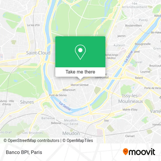
See Banco BPI, Boulogne-Billancourt, on the map
Public Transit to Banco BPI in Boulogne-Billancourt
Wondering how to get to Banco BPI in Boulogne-Billancourt? Moovit helps you find the best way to get to Banco BPI with step-by-step directions from the nearest public transit station.
Moovit provides free maps and live directions to help you navigate through your city. View schedules, routes, timetables, and find out how long does it take to get to Banco BPI in real time.
Looking for the nearest stop or station to Banco BPI? Check out this list of stops closest to your destination: Marcel Sembat; Boulogne Jean Jaurès; Gallieni - Belle Feuille; Porte de Saint-Cloud.
Metro: 9, 10.Bus: 123, 126, 42, 72, N12, N61, N161, N162, SUBB N.
Want to see if there’s another route that gets you there at an earlier time? Moovit helps you find alternative routes or times. Get directions from and directions to Banco BPI easily from the Moovit App or Website.
We make riding to Banco BPI easy, which is why over 1.5 million users, including users in Boulogne-Billancourt, trust Moovit as the best app for public transit. You don’t need to download an individual bus app or train app, Moovit is your all-in-one transit app that helps you find the best bus time or train time available.
For information on prices of metro, bus and RER, costs and ride fares to Banco BPI, please check the Moovit app.
Use the app to navigate to popular places including to the airport, hospital, stadium, grocery store, mall, coffee shop, school, college, and university.
Location: Boulogne-Billancourt, Paris
- 108 Avenue Edouard Vaillant,
- KFC,
- Marcel Sembat-Métro,
- Kaiser Kebab,
- Marcel Sembat-Métro,
- O'Tacos,
- 92 Boulevard de la République,
- Tf1 Sa,
- Arrêt Marcel Sembat [123,126,175,SUBB],
- Boulevard Jean Jaurès & Place Marcel Sembat,
- Ibis Styles,
- Métro Marcel Sembat [9],
- Station de Métro Marcel Sembat,
- Accenture APO,
- McDonald's,
- Café Chérie,
- COURIR,
- 92100 Boulogne-Billancourt,
- Naf Naf,
- Cobrason
Places Near Banco BPI (Boulogne-Billancourt)
- Hôpital Pitié Salpêtrière, Paris,
- Hôpital Saint-Joseph, Paris,
- Hopital Lariboisière, Paris,
- Marché Saint-Pierre, Paris,
- Galeries Lafayette, Paris,
- Hopital Foch, Suresnes,
- Institut Curie, Paris,
- Atelier Des Lumieres, Paris,
- Hôpital Henri Mondor, Creteil,
- Théâtre Mogador, Paris,
- Gare Routière Flixbus, Paris,
- Créteil Soleil, Creteil,
- Hôpital Necker, Paris,
- Galeries Lafayette Haussmann, Paris,
- Fondation Louis Vuitton, Paris,
- Hôpital Beaujon, Clichy,
- Hôpital Cochin, Paris,
- Centre Hospitalier des 15/20, Paris,
- Hôpital de la Pitié-Salpêtrière, Paris,
- 29 Rue Manin, Paris
How to get to popular places in Paris with public transit
Get around Boulogne-Billancourt by public transit!
Traveling around Boulogne-Billancourt has never been so easy. See step by step directions as you travel to any attraction, street or major public transit station. View bus and train schedules, arrival times, service alerts and detailed routes on a map, so you know exactly how to get to anywhere in Boulogne-Billancourt.
When traveling to any destination around Boulogne-Billancourt use Moovit's Live Directions with Get Off Notifications to know exactly where and how far to walk, how long to wait for your line, and how many stops are left. Moovit will alert you when it's time to get off — no need to constantly re-check whether yours is the next stop.
Wondering how to use public transit in Boulogne-Billancourt or how to pay for public transit in Boulogne-Billancourt? Moovit public transit app can help you navigate your way with public transit easily, and at minimum cost. It includes public transit fees, ticket prices, and costs. Looking for a map of Boulogne-Billancourt public transit lines? Moovit public transit app shows all public transit maps in Boulogne-Billancourt with all Bus, Train, Metro, Light Rail, RER, Funicular and Gondola routes and stops on an interactive map.
Paris has 7 transit type(s), including: Bus, Train, Metro, Light Rail, RER, Funicular and Gondola, operated by several transit agencies, including RATP, RER, RER Bus de remplacement, Train, Train Bus de remplacement, Tramway Bus de remplacement, TER, ADP, Magical Shuttle, Argenteuil - Boucles de Seine, Autocars Dominique, Bièvre, Brie et 2 Morin, Le Bus - C.C. du Clermontois and Cœur d’Essonne