How to get to Banco de Chile by bus?
Click on the bus route to see step by step directions with maps, line arrival times and updated time schedules.
From Maderas Rarinco, Los Ángeles
31 minFrom Villa Génesis, Los Ángeles
28 minFrom Club de Campo San Andres, Los Ángeles
29 minFrom Cementerio Parque Del Sur, Los Ángeles
31 minFrom Peaje Lateral María Dolores, Los Ángeles
40 minFrom Subestación Duqueco Transnet, Los Ángeles
46 minFrom Cmpc, Los Ángeles
45 minFrom Plaza San Marcos, Los Ángeles
39 minFrom Edificio Corporativo Cmpc, Los Ángeles
43 minFrom Vistas de Curamavida, Los Ángeles
28 min
Bus stops near Banco de Chile in Los Ángeles
Bus lines to Banco de Chile in Los Ángeles
- C10-I, Villa Lomas de Sta María - Villa Parques Nacionales,VIEW
- C19-I, Las Trancas - Av. Oriente,VIEW
- C20-I, Laguna del Laja - Villa Grecia,VIEW
- C23-I, Principal - Marsella,VIEW
- C7V-I, Principal - Bioleche,VIEW
- C19V-I, Las Tranca - Villa Grecia,VIEW
- C20V-I, Laguna del Laja - Villa Grecia,VIEW
- C29V-I, Villa ColoColo - El Avellano,VIEW
- C20V2-I, Laguna del Laja - El Avellano,VIEW
- C21-I, El Manzano - Villa Los Profesores,VIEW
- C30-I, El avellano - Pobl. 11 de Septiembre,VIEW
- C10-R, Villa Francia - Villa Los Profesores,VIEW
- C19-R, Villa Parques Nacionales - Las Trancas,VIEW
- C20-R, Villa Francia - Las Trancas,VIEW
- C23-R, Villa Parques Nacionales - Aeródromo,VIEW
- C7V-R, Villa Parques Nacionales - Aerodromo,VIEW
- C19V-R, El Avellano - Regimiento Los Angeles,VIEW
- C20V-R, El Avellano - Las Trancas,VIEW
- C29V-R, El Avellano - Villa ColoColo,VIEW
- C20V2-R, El Avellano - Las Trancas,VIEW
What are the closest stations to Banco de Chile?
The closest stations to Banco de Chile are:
- Guillermo Marconi / Cost Quilque Norte is 190 meters away, 3 min walk.
- Guillermo Marconi / Luis Soto is 262 meters away, 4 min walk.
- Ricardo Vicuna / Sta. Maria is 325 meters away, 5 min walk.
- Ricardo Vicuna / Francisco De Aguirre is 383 meters away, 6 min walk.
- Alemania / Genaro Reyes is 542 meters away, 7 min walk.
Which bus lines stop near Banco de Chile?
These bus lines stop near Banco de Chile: 5V-I, 7-I, C20V2-R, C21-I, C7-I.
What’s the nearest bus station to Banco de Chile in Los Ángeles?
The nearest bus station to Banco de Chile in Los Ángeles is Guillermo Marconi / Cost Quilque Norte. It’s a 3 min walk away.
What time is the first bus to Banco de Chile in Los Ángeles?
The 5-R is the first bus that goes to Banco de Chile in Los Ángeles. It stops nearby at 7:20 AM.
What time is the last bus to Banco de Chile in Los Ángeles?
The 5V-I is the last bus that goes to Banco de Chile in Los Ángeles. It stops nearby at 8:43 PM.
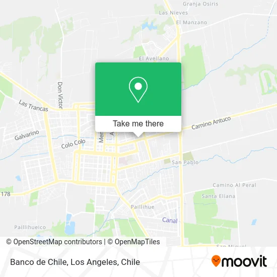
See Banco de Chile, Los Ángeles, on the map
Public Transit to Banco de Chile in Los Ángeles
Wondering how to get to Banco de Chile in Los Ángeles? Moovit helps you find the best way to get to Banco de Chile with step-by-step directions from the nearest public transit station.
Moovit provides free maps and live directions to help you navigate through your city. View schedules, routes, timetables, and find out how long does it take to get to Banco de Chile in real time.
Looking for the nearest stop or station to Banco de Chile? Check out this list of stops closest to your destination: Guillermo Marconi / Cost Quilque Norte; Guillermo Marconi / Luis Soto; Ricardo Vicuna / Sta. Maria; Ricardo Vicuna / Francisco De Aguirre; Alemania / Genaro Reyes.
Bus: 5V-I, 7-I, C20V2-R, C21-I, C7-I, C10-I, C19-I, C20-I, C23-I, C7V-I, C30-I, C10-R, C19-R, C20-R, C7-R, C10V-R, 5V-R, 5-I, C10V-I, 5-R.
Want to see if there’s another route that gets you there at an earlier time? Moovit helps you find alternative routes or times. Get directions from and directions to Banco de Chile easily from the Moovit App or Website.
We make riding to Banco de Chile easy, which is why over 1.7 million users, including users in Los Ángeles, trust Moovit as the best app for public transit. You don’t need to download an individual bus app or train app, Moovit is your all-in-one transit app that helps you find the best bus time or train time available.
For information on prices of bus, costs and ride fares to Banco de Chile, please check the Moovit app.
Use the app to navigate to popular places including to the airport, hospital, stadium, grocery store, mall, coffee shop, school, college, and university.
Banco de Chile Address: Av. Alemania 610 street in Los Ángeles
- Dirección de Tránsito,
- Lavanderia cordillera,
- Villa Presidente Balmaceda,
- PRT - Planta de Revisión Técnica Biobío,
- Terma Urbana,
- Plaza Pedro Lagos,
- Centro de Mediacion Familiar,
- Asociación Chilena de Seguridad (ACHS),
- Clínica Los Andes,
- Achs,
- Parroquia Sagrada Familia,
- Villa Mininco,
- Tottus,
- Burger City Los Angeles,
- av. marconi, los angeles,
- Ecofor Servicios Forestales Ltda.,
- Escuela F-907 República De Grecia,
- Homecenter,
- Lider,
- Homecenter Sodimac
Places Near Banco de Chile (Los Ángeles)
- Terminal Rural Vega Techada, Los Ángeles,
- Villa Parque Historiadores, Los Ángeles,
- Villa Jardines De La Republica (Av. Gabriela Mistral), Los Ángeles,
- Villa Galilea, Los Ángeles,
- Antuco, Los Ángeles,
- Villa Parque Lauquen, Los Ángeles,
- Villa Las Tranqueras, Los Ángeles,
- Villa los Alcaldes, Los Ángeles,
- Avenida Las industrias - Los Ángeles, Los Ángeles,
- Villa Mininco, Los Ángeles,
- Villa España, Los Ángeles,
- Jardines de Rucalhue, Los Ángeles,
- Los Ángeles Chile, Los Ángeles,
- Clínica Los Andes, Los Ángeles,
- Terminal Rodoviario Sta. María de Los Ángeles, Los Ángeles,
- camino cerro colorado, Los Ángeles,
- Parque Lauquen Pje 7 Oriente Los Angeles Chile, Los Ángeles,
- Villa Lomas De Santa María, Los Ángeles,
- 2° Juzgado de Policia Local, Los Angeles., Los Ángeles,
- Ruta Q-61-R (Los Ángeles - Santa Bárbara / Ralco), Los Ángeles
How to get to popular places in Los Angeles, Chile with public transit
Get around Los Ángeles by public transit!
Traveling around Los Ángeles has never been so easy. See step by step directions as you travel to any attraction, street or major public transit station. View bus and train schedules, arrival times, service alerts and detailed routes on a map, so you know exactly how to get to anywhere in Los Ángeles.
When traveling to any destination around Los Ángeles use Moovit's Live Directions with Get Off Notifications to know exactly where and how far to walk, how long to wait for your line, and how many stops are left. Moovit will alert you when it's time to get off — no need to constantly re-check whether yours is the next stop.
Wondering how to use public transit in Los Ángeles or how to pay for public transit in Los Ángeles? Moovit public transit app can help you navigate your way with public transit easily, and at minimum cost. It includes public transit fees, ticket prices, and costs. Looking for a map of Los Ángeles public transit lines? Moovit public transit app shows all public transit maps in Los Ángeles with all bus routes and stops on an interactive map.
Los Angeles, Chile has 1 transit type(s), including: bus, operated by several transit agencies, including Paillihue, Chiprodal Bolson, Iansa Avellano, Orompello Montecea, Transportes de pasajeros S.A., El esfuerzo, Paillihue Bolson, Ciudades de Chile, Las Americas, Linea Azul, Paillihue Avellano, Expreso Araucano, Sotracoli, San Sebastian and Duqueco