How to get to Bank99 by bus?
Click on the bus route to see step by step directions with maps, line arrival times and updated time schedules.
From Prager Straße, Floridsdorf
56 minFrom Wien,Leopoldstadt, Leopoldstadt
75 minFrom Romawiese, Floridsdorf
54 minFrom Privatklinik Döbling, Döbling
104 minFrom Zum Schwaigerwirt, Floridsdorf
44 minFrom KH Nord, Floridsdorf
33 minFrom Brigittenauer Bad, Brigittenau
92 minFrom Prater, Leopoldstadt
106 minFrom Bundesspielplatz Peter-Rehnelt-Wiese, Leopoldstadt
88 minFrom Hannovermarkt, Brigittenau
87 min
How to get to Bank99 by train?
Click on the train route to see step by step directions with maps, line arrival times and updated time schedules.
From Prager Straße, Floridsdorf
46 minFrom Wien,Leopoldstadt, Leopoldstadt
46 minFrom Romawiese, Floridsdorf
45 minFrom Privatklinik Döbling, Döbling
54 minFrom Zum Schwaigerwirt, Floridsdorf
34 minFrom KH Nord, Floridsdorf
37 minFrom Brigittenauer Bad, Brigittenau
53 minFrom Prater, Leopoldstadt
49 minFrom Bundesspielplatz Peter-Rehnelt-Wiese, Leopoldstadt
58 minFrom Hannovermarkt, Brigittenau
52 min
How to get to Bank99 by subway?
Click on the subway route to see step by step directions with maps, line arrival times and updated time schedules.
From Wien,Leopoldstadt, Leopoldstadt
57 minFrom Romawiese, Floridsdorf
66 minFrom Privatklinik Döbling, Döbling
67 minFrom Zum Schwaigerwirt, Floridsdorf
78 minFrom KH Nord, Floridsdorf
90 minFrom Brigittenauer Bad, Brigittenau
66 minFrom Prater, Leopoldstadt
57 minFrom Bundesspielplatz Peter-Rehnelt-Wiese, Leopoldstadt
71 minFrom Hannovermarkt, Brigittenau
68 min
Bus stops near Bank99 in Gemeinde Gerasdorf Bei Wien
Train stations near Bank99 in Gemeinde Gerasdorf Bei Wien
Subway station near Bank99 in Gemeinde Gerasdorf Bei Wien
- Leopoldau, Wien, 32 min walk,VIEW
Bus lines to Bank99 in Gemeinde Gerasdorf Bei Wien
What are the closest stations to Bank99?
The closest stations to Bank99 are:
- Gerasdorf Postamt is 47 meters away, 1 min walk.
- Gerasdorf Leopoldauer Straße is 171 meters away, 3 min walk.
- Gerasdorf B.Wien Bahnhof is 1131 meters away, 15 min walk.
- Wien Süßenbrunn is 1723 meters away, 23 min walk.
- Leopoldau, Wien is 2487 meters away, 32 min walk.
- Wien Leopoldau is 2682 meters away, 35 min walk.
Which train lines stop near Bank99?
These train lines stop near Bank99: REX7, S2.
Which subway line stops near Bank99?
U1 (Leopoldau)
Which bus lines stop near Bank99?
These bus lines stop near Bank99: 510, 511, N25.
What’s the nearest train station to Bank99 in Gemeinde Gerasdorf Bei Wien?
The nearest train station to Bank99 in Gemeinde Gerasdorf Bei Wien is Gerasdorf B.Wien Bahnhof. It’s a 15 min walk away.
What’s the nearest bus station to Bank99 in Gemeinde Gerasdorf Bei Wien?
The nearest bus station to Bank99 in Gemeinde Gerasdorf Bei Wien is Gerasdorf Postamt. It’s a 1 min walk away.
What time is the first subway to Bank99 in Gemeinde Gerasdorf Bei Wien?
The U1 is the first subway that goes to Bank99 in Gemeinde Gerasdorf Bei Wien. It stops nearby at 4:51 AM.
What time is the last subway to Bank99 in Gemeinde Gerasdorf Bei Wien?
The U1 is the last subway that goes to Bank99 in Gemeinde Gerasdorf Bei Wien. It stops nearby at 12:50 AM.
What time is the first train to Bank99 in Gemeinde Gerasdorf Bei Wien?
The S2 is the first train that goes to Bank99 in Gemeinde Gerasdorf Bei Wien. It stops nearby at 4:39 AM.
What time is the last train to Bank99 in Gemeinde Gerasdorf Bei Wien?
The S3 is the last train that goes to Bank99 in Gemeinde Gerasdorf Bei Wien. It stops nearby at 12:45 AM.
What time is the first bus to Bank99 in Gemeinde Gerasdorf Bei Wien?
The 510 is the first bus that goes to Bank99 in Gemeinde Gerasdorf Bei Wien. It stops nearby at 5:01 AM.
What time is the last bus to Bank99 in Gemeinde Gerasdorf Bei Wien?
The 510 is the last bus that goes to Bank99 in Gemeinde Gerasdorf Bei Wien. It stops nearby at 12:02 AM.
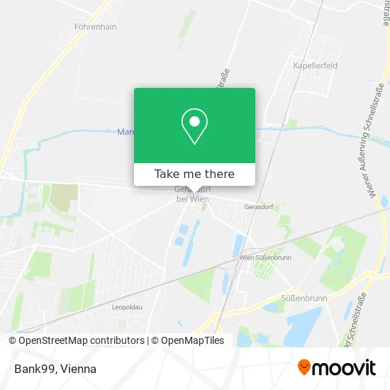
See Bank99, Gemeinde Gerasdorf Bei Wien, on the map
Public Transit to Bank99 in Gemeinde Gerasdorf Bei Wien
Wondering how to get to Bank99 in Gemeinde Gerasdorf Bei Wien? Moovit helps you find the best way to get to Bank99 with step-by-step directions from the nearest public transit station.
Moovit provides free maps and live directions to help you navigate through your city. View schedules, routes, timetables, and find out how long does it take to get to Bank99 in real time.
Looking for the nearest stop or station to Bank99? Check out this list of stops closest to your destination: Gerasdorf Postamt; Gerasdorf Leopoldauer Straße; Gerasdorf B.Wien Bahnhof; Wien Süßenbrunn; Leopoldau; Wien Leopoldau.
Train: REX7, S2, REX2, S7, 902-W, R1, REX1, R1, REX1, S1, S1, CJX9, S3, CJX9, S3.Subway: U1.Bus: 510, 511, N25, 25B.
Want to see if there’s another route that gets you there at an earlier time? Moovit helps you find alternative routes or times. Get directions from and directions to Bank99 easily from the Moovit App or Website.
We make riding to Bank99 easy, which is why over 1.5 million users, including users in Gemeinde Gerasdorf Bei Wien, trust Moovit as the best app for public transit. You don’t need to download an individual bus app or train app, Moovit is your all-in-one transit app that helps you find the best bus time or train time available.
For information on prices of bus, subway, train and light rail, costs and ride fares to Bank99, please check the Moovit app.
Use the app to navigate to popular places including to the airport, hospital, stadium, grocery store, mall, coffee shop, school, college, and university.
Bank99 Address: Friedhofsgasse street in Gemeinde Gerasdorf Bei Wien
- Swarovski,
- ESPRIT,
- KOC Garten- und,
- Dr. Astrid Udvardi,
- Leopoldauer Straße,
- Kirchengasse Rathaus,
- Dr. Edyta Osarovsky-Sasin,
- Team Zanyath,
- BIORESONANZ HOLOPATHIE f MENSCH & TIER - Mag Andrea Pisecky,
- Bezirkshauptmannschaft Korneuburg Außenstelle Gerasdorf (BH Korneubug Außenstelle Gerasdorf),
- Ulrike Storny,
- Emotionaudio Alexander Schoiber E.U.,
- Franz-Wallner-Gasse,
- Stadtsaal,
- Bäckerei Hirschvogel,
- VW & Audi Autoverwertung Gerhard Migsch,
- Nordfishing77.At,
- Vianello G3 Wien,
- Teichgasse 1,
- Minarskywasser
Places Near Bank99 (Gemeinde Gerasdorf Bei Wien)
- Zentralfriedhof Halle 3, Simmering,
- Kabarett Simpl, 1., Innere Stadt,
- Schiffsanleger Wien-Nussdorf, Döbling,
- Leopoldauer Alm, Floridsdorf,
- Auhof-Center, Penzing,
- Ghegastraße 3, Landstraße,
- Strandbad Gänsehäufel, Donaustadt,
- Klinik Floridsdorf (Krankenhaus Nord), Floridsdorf,
- Setagayapark, Döbling,
- Ronacher, 1., Innere Stadt,
- Türkenschanzpark, Währing,
- Wien Rennbahn Freudenau, Leopoldstadt,
- Schweizerhaus (Karl Kolariks Schweizerhaus), Leopoldstadt,
- Raimund-Theater, Mariahilf,
- Donauzentrum, Donaustadt,
- Mariahilfer Strasse, Mariahilf,
- Thomas-Klestil-Platz, Landstraße,
- 10er Marie, Ottakring,
- Lugner City, Rudolfsheim-Fünfhaus,
- Feuerhalle Simmering, Simmering
How to get to popular places in Austria with public transit
Get around Gemeinde Gerasdorf Bei Wien by public transit!
Traveling around Gemeinde Gerasdorf Bei Wien has never been so easy. See step by step directions as you travel to any attraction, street or major public transit station. View bus and train schedules, arrival times, service alerts and detailed routes on a map, so you know exactly how to get to anywhere in Gemeinde Gerasdorf Bei Wien.
When traveling to any destination around Gemeinde Gerasdorf Bei Wien use Moovit's Live Directions with Get Off Notifications to know exactly where and how far to walk, how long to wait for your line, and how many stops are left. Moovit will alert you when it's time to get off — no need to constantly re-check whether yours is the next stop.
Wondering how to use public transit in Gemeinde Gerasdorf Bei Wien or how to pay for public transit in Gemeinde Gerasdorf Bei Wien? Moovit public transit app can help you navigate your way with public transit easily, and at minimum cost. It includes public transit fees, ticket prices, and costs. Looking for a map of Gemeinde Gerasdorf Bei Wien public transit lines? Moovit public transit app shows all public transit maps in Gemeinde Gerasdorf Bei Wien with all Bus, Train, Subway, Light Rail, Ferry and Funicular routes and stops on an interactive map.
Austria has 6 transit type(s), including: Bus, Train, Subway, Light Rail, Ferry and Funicular, operated by several transit agencies, including Wiener Linien GmbH & Co KG, Vienna Airport Lines, OEBB Personenverkehr AG Kundenservice, Wiener Lokalbahnen GmbH, City Air Terminal Betriebsgesellschaft m.b.H., CAT, Österreichische Postbus AG, VOR GmbH, Graz Linien, Graz-Köflacher Bahn und Busbetrieb GmbH, Steiermarkbahn und Bus GmbH, Linz Linien GmbH, Salzburg AG (Salzburger Lokalbahn), Salzburg AG (OBus) and KMG Klagenfurt Mobil GmbH