Directions to Bankers Insurance (Staunton) with public transportation
The following transit lines have routes that pass near Bankers Insurance
 Bus: 250 CONNECTOR, BRCC SOUTH, BRCC NORTH, WEST / NORTH LOOP.
- Train: CARDINAL.
How to get to Bankers Insurance by bus?
Click on the bus route to see step by step directions with maps, line arrival times and updated time schedules.
Bus stops near Bankers Insurance in Staunton
Train station near Bankers Insurance in Staunton
- Staunton Amtrak Station, 20 min walk,VIEW
Bus lines to Bankers Insurance in Staunton
What are the closest stations to Bankers Insurance?
The closest stations to Bankers Insurance are:
- Frederick St / N Central Ave is 52 yards away, 1 min walk.
- Staunton Public Library is 141 yards away, 3 min walk.
- Staunton Amtrak Station is 1658 yards away, 20 min walk.
Which bus lines stop near Bankers Insurance?
These bus lines stop near Bankers Insurance: 250 CONNECTOR, BRCC SOUTH.
What’s the nearest train station to Bankers Insurance in Staunton?
The nearest train station to Bankers Insurance in Staunton is Staunton Amtrak Station. It’s a 20 min walk away.
What’s the nearest bus station to Bankers Insurance in Staunton?
The nearest bus station to Bankers Insurance in Staunton is Frederick St / N Central Ave. It’s a 1 min walk away.
What time is the first bus to Bankers Insurance in Staunton?
The WEST / NORTH LOOP is the first bus that goes to Bankers Insurance in Staunton. It stops nearby at 6:30 AM.
What time is the last bus to Bankers Insurance in Staunton?
The 250 CONNECTOR is the last bus that goes to Bankers Insurance in Staunton. It stops nearby at 9:30 PM.
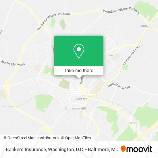
See Bankers Insurance, Staunton, on the map
Public Transit to Bankers Insurance in Staunton
Wondering how to get to Bankers Insurance in Staunton? Moovit helps you find the best way to get to Bankers Insurance with step-by-step directions from the nearest public transit station.
Moovit provides free maps and live directions to help you navigate through your city. View schedules, routes, timetables, and find out how long does it take to get to Bankers Insurance in real time.
Looking for the nearest stop or station to Bankers Insurance? Check out this list of stops closest to your destination: Frederick St / N Central Ave; Staunton Public Library; Staunton Amtrak Station.
Bus: 250 CONNECTOR, BRCC SOUTH, BRCC NORTH, WEST / NORTH LOOP.Train: CARDINAL.
Want to see if there’s another route that gets you there at an earlier time? Moovit helps you find alternative routes or times. Get directions from and directions to Bankers Insurance easily from the Moovit App or Website.
We make riding to Bankers Insurance easy, which is why over 1.5 million users, including users in Staunton, trust Moovit as the best app for public transit. You don’t need to download an individual bus app or train app, Moovit is your all-in-one transit app that helps you find the best bus time or train time available.
For information on prices of bus, costs and ride fares to Bankers Insurance, please check the Moovit app.
Use the app to navigate to popular places including to the airport, hospital, stadium, grocery store, mall, coffee shop, school, college, and university.
Bankers Insurance Address: 320 N Central Ave Staunton, VA 24401 street in Staunton
- ACP Staunton Office,
- EV Charging Station,
- Beautiful Hair Care Salon,
- Bears & Blankets Child Care,
- Thomas Wooden Railway Systems & Clothing,
- Staunton Trains & Hobbies,
- Tiger Solar,
- Culligan Water Conditioning,
- Altenergy,
- Rolling Pin Pastries,
- Gloria's Pupuseria,
- I C Wings,
- Staunton Glass & Mirror,
- Staunton Station 1,
- Dave's Carpets,
- Hershey Tire,
- Jumbo Antique Fire Engine Museum,
- Staunton Fire & Rescue,
- Baha'I Faith Center,
- Jenkins Security Services
Places Near Bankers Insurance (Staunton)
- The Anthem, Washington,
- Pennsylvania Ave NW (3rd st and pennsylvania), Washington,
- National Zoo, Washington,
- National Museum of African American History and Culture, Washington,
- Georgetown, Washington,
- Camden Yards, Baltimore,
- Rock Creek Tennis Center, Washington,
- Amazon Hq2, Arlington County,
- PG Mall, Prince George's County,
- Warner Theatre, Washington,
- Washington DC VA Medical Center, Washington,
- M&T Bank Stadium, Baltimore,
- National Mall, Washington,
- Basilica of the National Shrine, Washington,
- Museum Of The Bible, Washington,
- Capital One Arena, Washington,
- Westfield Montgomery Mall, Montgomery County,
- Marriott Marquis Washington, DC, Washington,
- Washington National Cathedral, Washington,
- Sibley Memorial Hospital, Washington
How to get to popular places in Washington, D.C. - Baltimore, MD with public transit
Get around Staunton by public transit!
Traveling around Staunton has never been so easy. See step by step directions as you travel to any attraction, street or major public transit station. View bus and train schedules, arrival times, service alerts and detailed routes on a map, so you know exactly how to get to anywhere in Staunton.
When traveling to any destination around Staunton use Moovit's Live Directions with Get Off Notifications to know exactly where and how far to walk, how long to wait for your line, and how many stops are left. Moovit will alert you when it's time to get off — no need to constantly re-check whether yours is the next stop.
Wondering how to use public transit in Staunton or how to pay for public transit in Staunton? Moovit public transit app can help you navigate your way with public transit easily, and at minimum cost. It includes public transit fees, ticket prices, and costs. Looking for a map of Staunton public transit lines? Moovit public transit app shows all public transit maps in Staunton with all Bus, Train, Metro, Light Rail and Ferry routes and stops on an interactive map.
Washington, D.C. - Baltimore, MD has 5 transit type(s), including: Bus, Train, Metro, Light Rail and Ferry, operated by several transit agencies, including WMATA, Montgomery County Ride On, Fairfax Connector, TheBus, PRTC, DASH - Alexandria, Arlington Transit (ART), RTA of Central Maryland, MDOT MTA, MDOT MTA Light RailLink, MDOT MTA Commuter Bus, MDOT MTA Local Bus, FXBGO!, Virginia Railway Express (VRE) and MARC