How to get to Banque Populaire by bus?
Click on the bus route to see step by step directions with maps, line arrival times and updated time schedules.
From Garons, Garons
33 minFrom Fontaine De L'Arboretum, Marguerittes
60 minFrom Aire Nîmes Marguerite, Marguerittes
44 minFrom Effia Stmt, Manduel
50 minFrom St-Gervasy, Saint-Gervasy
41 minFrom Collège De Clarensac, Clarensac
41 minFrom D42, Saint-Gilles
50 minFrom 30980, Saint-Dionizy
72 minFrom Purple Campus Marguerittes, Marguerittes
40 minFrom Amazon Locker-Hubrecht, Saint-Dionizy
63 min
Bus stops near Banque Populaire in Nimes
Bus lines to Banque Populaire in Nimes
- 13, Mas Des Rosiers,VIEW
- 15, Laennec,VIEW
- 51, Nîmes Gare Routiere,VIEW
- 52, Saint Come Et Maruejols,VIEW
- 61, Nîmes Gare Feucheres,VIEW
- T1, Gambetta - Coupole,VIEW
- T2, Paloma,VIEW
- T3, Gare Feucheres,VIEW
- T4, Caissargues,VIEW
- 16, Ville Active,VIEW
- 227, Nîmes Gare Routiere,VIEW
- 77, Jaures,VIEW
- 6, CALVAS - CARRE SUD,VIEW
- 11, BERNIS - MILHAUD - GARE TRIAIRE,VIEW
- 218, GARONS - CAISSARGUES - LAMOUR - GARE ROUTIERE,VIEW
- 219, SAINT GILLES - A54 - GARE ROUTIERE,VIEW
- 804A, MOULEZAN - NIMES,VIEW
- 804B, LEDIGNAN - NIMES,VIEW
- 70, Hauts De Nîmes,VIEW
- 78, Jaures,VIEW
What are the closest stations to Banque Populaire?
The closest stations to Banque Populaire are:
- Musée Romanité is 94 meters away, 2 min walk.
- Severine is 197 meters away, 3 min walk.
- Dhuoda is 377 meters away, 5 min walk.
- Jaurès is 473 meters away, 7 min walk.
- Planas is 489 meters away, 7 min walk.
- Triaire is 560 meters away, 8 min walk.
Which bus lines stop near Banque Populaire?
These bus lines stop near Banque Populaire: 51, T1, T2, T4.
What’s the nearest bus station to Banque Populaire in Nimes?
The nearest bus station to Banque Populaire in Nimes is Musée Romanité. It’s a 2 min walk away.
What time is the first bus to Banque Populaire in Nimes?
The T1 is the first bus that goes to Banque Populaire in Nimes. It stops nearby at 5:29 AM.
What time is the last bus to Banque Populaire in Nimes?
The T2 is the last bus that goes to Banque Populaire in Nimes. It stops nearby at 1:04 AM.
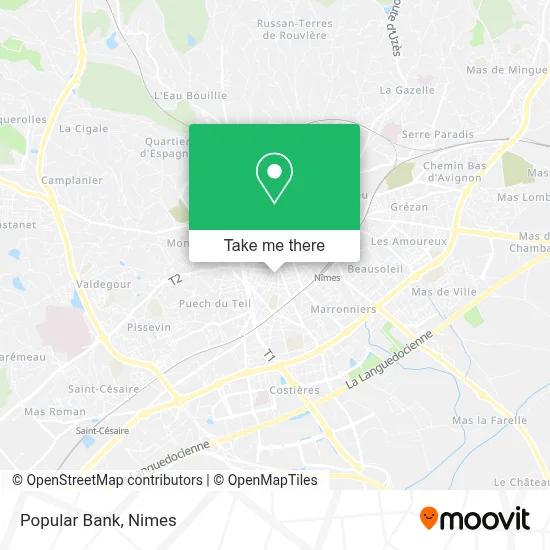
See Banque Populaire, Nimes, on the map
Public Transit to Banque Populaire in Nimes
Wondering how to get to Banque Populaire in Nimes? Moovit helps you find the best way to get to Banque Populaire with step-by-step directions from the nearest public transit station.
Moovit provides free maps and live directions to help you navigate through your city. View schedules, routes, timetables, and find out how long does it take to get to Banque Populaire in real time.
Looking for the nearest stop or station to Banque Populaire? Check out this list of stops closest to your destination: Musée Romanité; Severine; Dhuoda; Jaurès; Planas; Triaire.
Bus: 51, T1, T2, T4, 13, 15, 52, 61, 16, 227, 77, 6, 11, 218, 219, 804A, 70, 78.
Want to see if there’s another route that gets you there at an earlier time? Moovit helps you find alternative routes or times. Get directions from and directions to Banque Populaire easily from the Moovit App or Website.
We make riding to Banque Populaire easy, which is why over 1.5 million users, including users in Nimes, trust Moovit as the best app for public transit. You don’t need to download an individual bus app or train app, Moovit is your all-in-one transit app that helps you find the best bus time or train time available.
For information on prices of bus, costs and ride fares to Banque Populaire, please check the Moovit app.
Use the app to navigate to popular places including to the airport, hospital, stadium, grocery store, mall, coffee shop, school, college, and university.
Banque Populaire Address: Rue Saint-Rémy 30900 Nîmes street in Nimes
- Saysanavong Nguyen Chansouk,
- Proxi Super,
- Rue Saint Rémy 3,
- Goodmarket la République,
- Le Lydie,
- Capadoce Kebab,
- Play Recording Agency,
- Raphaël,
- Shoes Services,
- Wood's Burger,
- Vigneron Patrick,
- Turbo,
- Les Chouchous de Sevy,
- Boucherie Charcuterie,
- Adia,
- Tacos Bowls,
- Pp Délice,
- Oklm Snack,
- Dr. Alteirac Jean-Jacques,
- La Boîte à Outils
Places Near Banque Populaire (Nimes)
- Geant Casino,
- Polyclinique Du Grand Sud,
- Le Parnasse, Nîmes,
- Saint-Césaire,
- Aire De Covoiturage Nîmes Ouest,
- Jardins de la Fontaine,
- Rue Gilles Roberval 285,
- Parc Kennedy,
- CHU de Nîmes - Hôpital universitaire Carémeau,
- E.Leclerc,
- Les 7 Collines,
- Centre hospitalier Caremeau,
- VILLE ACTIVE, Nîmes,
- La Galerie - Cap Costières,
- Kinepolis,
- Clinique Franciscaine,
- Carrefour Nîmes Sud,
- Rond-Point Kilomètre Delta, Nîmes,
- Hôpital Privé Les Franciscaines,
- École Nationale De Police
How to get to popular places in Nimes with public transit
Get around Nimes by public transit!
Traveling around Nimes has never been so easy. See step by step directions as you travel to any attraction, street or major public transit station. View bus and train schedules, arrival times, service alerts and detailed routes on a map, so you know exactly how to get to anywhere in Nimes.
When traveling to any destination around Nimes use Moovit's Live Directions with Get Off Notifications to know exactly where and how far to walk, how long to wait for your line, and how many stops are left. Moovit will alert you when it's time to get off — no need to constantly re-check whether yours is the next stop.
Wondering how to use public transit in Nimes or how to pay for public transit in Nimes? Moovit public transit app can help you navigate your way with public transit easily, and at minimum cost. It includes public transit fees, ticket prices, and costs. Looking for a map of Nimes public transit lines? Moovit public transit app shows all public transit maps in Nimes with all bus routes and stops on an interactive map.
Nimes has 1 transit type(s), including: bus, operated by several transit agencies, including TANGO