How to get to Banque Populaire by bus?
Click on the bus route to see step by step directions with maps, line arrival times and updated time schedules.
From Hôpital Percy, Clamart
65 minFrom Ambassade de Roumanie, Paris
38 minFrom Bouillon Chartier, Paris
48 minFrom Marché d'Aligre, Paris
80 minFrom IKEA, Franconville
76 minFrom Clinique Mont-Louis, Paris
63 minFrom 16e Arrondissement, Paris
60 minFrom Clinique du Mont-Louis, Paris
62 minFrom Avenue de Flandre, Paris
69 minFrom Rue de Lille, Paris
50 min
How to get to Banque Populaire by train?
Click on the train route to see step by step directions with maps, line arrival times and updated time schedules.
How to get to Banque Populaire by metro?
Click on the metro route to see step by step directions with maps, line arrival times and updated time schedules.
From Hôpital Percy, Clamart
78 minFrom Ambassade de Roumanie, Paris
49 minFrom Bouillon Chartier, Paris
42 minFrom Marché d'Aligre, Paris
52 minFrom Clinique Mont-Louis, Paris
56 minFrom 16e Arrondissement, Paris
51 minFrom Clinique du Mont-Louis, Paris
56 minFrom Avenue de Flandre, Paris
50 minFrom Rue de Lille, Paris
45 min
Bus stops near Banque Populaire in Courbevoie
Train station near Banque Populaire in Courbevoie
- Gare D'Asnieres, 14 min walk,VIEW
Metro station near Banque Populaire in Courbevoie
- Pont de Levallois - Bécon, 17 min walk,VIEW
Bus lines to Banque Populaire in Courbevoie
- 167, Audra - Pont De Levallois - Bécon,VIEW
- 275, La Défense (calder - Miro) - Pont De Levallois - Bécon - Métro,VIEW
- A, Bus RER A,VIEW
- L, L Transilien,VIEW
- N52, Gare De Cormeilles-En-Parisis - Gare Saint-Lazare,VIEW
- J, Gare Saint-Lazare,VIEW
- 178, La Défense (Voie Perronet Nord),VIEW
- 277, Nanterre - Anatole France,VIEW
- 278, Les Bruyères - La Défense (voie Perronet Sud),VIEW
- 363, Nanterre - Préfecture Rer - Les Bruyères,VIEW
- 175, Les Bruyères,VIEW
What are the closest stations to Banque Populaire?
The closest stations to Banque Populaire are:
- Place de Belgique / Bécon Les Bruyères is 186 meters away, 3 min walk.
- Chevreul is 447 meters away, 6 min walk.
- Franklin is 520 meters away, 7 min walk.
- Les Bruyères is 537 meters away, 7 min walk.
- Gare D'Asnieres is 1036 meters away, 14 min walk.
- Pont de Levallois - Bécon is 1273 meters away, 17 min walk.
Which train line stops near Banque Populaire?
L (Paris-Saint-Lazare)
Which metro line stops near Banque Populaire?
3 (Gallieni)
Which bus lines stop near Banque Populaire?
These bus lines stop near Banque Populaire: 163, 164, 167, 175, 275, 277.
What’s the nearest metro station to Banque Populaire in Courbevoie?
The nearest metro station to Banque Populaire in Courbevoie is Pont de Levallois - Bécon. It’s a 17 min walk away.
What’s the nearest train station to Banque Populaire in Courbevoie?
The nearest train station to Banque Populaire in Courbevoie is Gare D'Asnieres. It’s a 14 min walk away.
What’s the nearest bus station to Banque Populaire in Courbevoie?
The nearest bus station to Banque Populaire in Courbevoie is Place de Belgique / Bécon Les Bruyères. It’s a 3 min walk away.
What time is the first metro to Banque Populaire in Courbevoie?
The 3 is the first metro that goes to Banque Populaire in Courbevoie. It stops nearby at 5:30 AM.
What time is the last metro to Banque Populaire in Courbevoie?
The 3 is the last metro that goes to Banque Populaire in Courbevoie. It stops nearby at 1:15 AM.
What time is the first train to Banque Populaire in Courbevoie?
The J is the first train that goes to Banque Populaire in Courbevoie. It stops nearby at 4:59 AM.
What time is the last train to Banque Populaire in Courbevoie?
The J is the last train that goes to Banque Populaire in Courbevoie. It stops nearby at 1:10 AM.
What time is the first bus to Banque Populaire in Courbevoie?
The N52 is the first bus that goes to Banque Populaire in Courbevoie. It stops nearby at 3:06 AM.
What time is the last bus to Banque Populaire in Courbevoie?
The N52 is the last bus that goes to Banque Populaire in Courbevoie. It stops nearby at 3:25 AM.
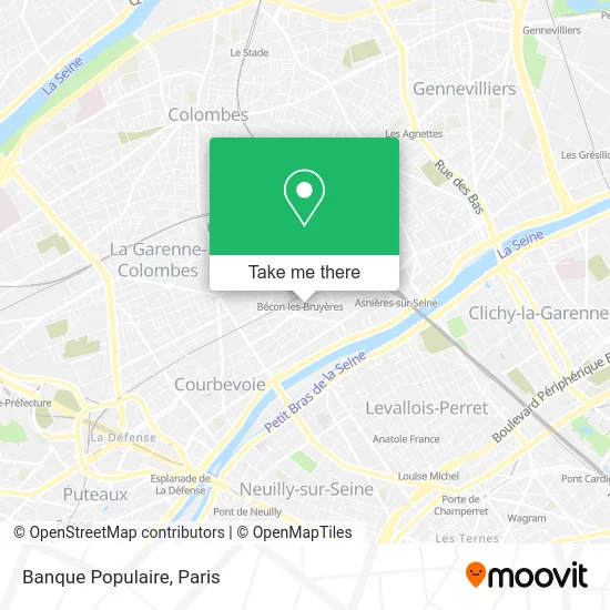
See Banque Populaire, Courbevoie, on the map
Public Transit to Banque Populaire in Courbevoie
Wondering how to get to Banque Populaire in Courbevoie? Moovit helps you find the best way to get to Banque Populaire with step-by-step directions from the nearest public transit station.
Moovit provides free maps and live directions to help you navigate through your city. View schedules, routes, timetables, and find out how long does it take to get to Banque Populaire in real time.
Looking for the nearest stop or station to Banque Populaire? Check out this list of stops closest to your destination: Place de Belgique / Bécon Les Bruyères; Chevreul; Franklin; Les Bruyères; Gare D'Asnieres; Pont de Levallois - Bécon.
Train: L, J.Metro: 3.Bus: 163, 164, 167, 175, 275, 277, A, L, N52, J, 178.
Want to see if there’s another route that gets you there at an earlier time? Moovit helps you find alternative routes or times. Get directions from and directions to Banque Populaire easily from the Moovit App or Website.
We make riding to Banque Populaire easy, which is why over 1.5 million users, including users in Courbevoie, trust Moovit as the best app for public transit. You don’t need to download an individual bus app or train app, Moovit is your all-in-one transit app that helps you find the best bus time or train time available.
For information on prices of metro, bus and train, costs and ride fares to Banque Populaire, please check the Moovit app.
Use the app to navigate to popular places including to the airport, hospital, stadium, grocery store, mall, coffee shop, school, college, and university.
Banque Populaire Address: 46 Avenue Pasteur 92400 Courbevoie street in Courbevoie
- Cabalo Nina,
- BRED,
- Lupin,
- Pressing Uni Press,
- Brakha,
- Sarl Cds,
- Amj Creation,
- Boulangerie Pasteur,
- 3 Avenue Gallieni,
- Oubihi el Hachm,
- Dr. Montigny Jean-Paul,
- Dr. Kouyoumdjian Jacques,
- Mille&Zim Cave de Bécon,
- Sg,
- Le Rapid Bar,
- Sarl Primeurs Services,
- Olivier Boccassini Mao B,
- Immocitiz,
- Blanchon Jean-Luc,
- Librairie le Baron Perché
Places Near Banque Populaire (Courbevoie)
- Galeries Lafayette Haussmann, Paris,
- Théâtre Mogador, Paris,
- Hôpital Henri Mondor, Creteil,
- Hopital Foch, Suresnes,
- Hôpital Pitié Salpêtrière, Paris,
- Hôpital Cochin, Paris,
- Gare Routière Flixbus, Paris,
- Institut Curie, Paris,
- Fondation Louis Vuitton, Paris,
- Hôpital Saint-Joseph, Paris,
- Hôpital Beaujon, Clichy,
- Hôpital Necker, Paris,
- Hôpital de la Pitié-Salpêtrière, Paris,
- Atelier Des Lumieres, Paris,
- Hopital Lariboisière, Paris,
- Galeries Lafayette, Paris,
- Centre Hospitalier des 15/20, Paris,
- Marché Saint-Pierre, Paris,
- Créteil Soleil, Creteil,
- 29 Rue Manin, Paris
How to get to popular places in Paris with public transit
Get around Courbevoie by public transit!
Traveling around Courbevoie has never been so easy. See step by step directions as you travel to any attraction, street or major public transit station. View bus and train schedules, arrival times, service alerts and detailed routes on a map, so you know exactly how to get to anywhere in Courbevoie.
When traveling to any destination around Courbevoie use Moovit's Live Directions with Get Off Notifications to know exactly where and how far to walk, how long to wait for your line, and how many stops are left. Moovit will alert you when it's time to get off — no need to constantly re-check whether yours is the next stop.
Wondering how to use public transit in Courbevoie or how to pay for public transit in Courbevoie? Moovit public transit app can help you navigate your way with public transit easily, and at minimum cost. It includes public transit fees, ticket prices, and costs. Looking for a map of Courbevoie public transit lines? Moovit public transit app shows all public transit maps in Courbevoie with all Bus, Train, Metro, Light Rail, RER, Funicular and Gondola routes and stops on an interactive map.
Paris has 7 transit type(s), including: Bus, Train, Metro, Light Rail, RER, Funicular and Gondola, operated by several transit agencies, including RATP, RER, RER Bus de remplacement, Train, Train Bus de remplacement, Tramway Bus de remplacement, TER, ADP, Magical Shuttle, Argenteuil - Boucles de Seine, Autocars Dominique, Bièvre, Brie et 2 Morin, Le Bus - C.C. du Clermontois and Cœur d’Essonne