How to get to Gianni Bar by bus?
Click on the bus route to see step by step directions with maps, line arrival times and updated time schedules.
From Marina of San Nicola, Ladispoli
126 minFrom GRA - Exit 4 - Trionfale, Roma
58 minFrom Passoscuro, Fiumicino
133 minFrom Collegiata Salus Infirmorum Care Home, Roma
79 minFrom Bambino Gesù Hospital - Palidoro, Fiumicino
129 minFrom La Giustiniana, Roma
34 minFrom Trevignano Romano, Trevignano Romano
68 minFrom Enrico Bassano Street 10, Roma
55 minFrom La Storta, Roma
55 min
How to get to Gianni Bar by train?
Click on the train route to see step by step directions with maps, line arrival times and updated time schedules.
Train station near Gianni Bar in Bracciano
- Vigna Di Valle, 1 min walk,VIEW
Bus stops near Gianni Bar in Bracciano
Bus lines to Gianni Bar in Bracciano
- C, Hospital to Vigna Di Valle,VIEW
- C/F, Settevene Palo (Km 2.4) > Vigna Di Valle,VIEW
- C1, Hospital > San Pantaleo > Vigna Di Valle,VIEW
- SC BIS, Bracciano 2 to Vigna Di Valle,VIEW
- COTRAL, Bracciano | Lecci Street Via Aceri,VIEW
- COTRAL, Roma Saxa Rubra - Oriolo Romano,VIEW
- COTRAL, Rome Saxa Rubra - Barbarano Romano,VIEW
- COTRAL, Anguillara Sabazia - Bassano Romano,VIEW
- COTRAL, Roma Saxa Rubra - Manziana,VIEW
- COTRAL, Roma Saxa Rubra - Blera,VIEW
- COTRAL, Roma Cornelia - Blera,VIEW
- COTRAL, Roma Saxa Rubra - Tolfa,VIEW
- COTRAL, Roma Saxa Rubra - Bassano Romano,VIEW
- COTRAL, Osteria Nuova - Oriolo Romano,VIEW
- COTRAL, Osteria Nuova - Manziana,VIEW
- COTRAL, Roma Saxa Rubra - Allumiere,VIEW
- COTRAL, Ladispoli Piazza Marescotti,VIEW
- COTRAL, Cerveteri | Moro Square,VIEW
What are the closest stations to Gianni Bar?
The closest stations to Gianni Bar are:
- Vigna Di Valle is 27 meters away, 1 min walk.
- 14 Pratigliolo Road is 455 meters away, 6 min walk.
- Bracciano | Bonifica Street Pratigliolo Street is 571 meters away, 8 min walk.
- Bracciano | Braccianese Street Bonifica Street is 626 meters away, 9 min walk.
Which bus lines stop near Gianni Bar?
These bus lines stop near Gianni Bar: 23, C, COTRAL.
Which train line stops near Gianni Bar?
FL3
What’s the nearest train station to Gianni Bar in Bracciano?
The nearest train station to Gianni Bar in Bracciano is Vigna Di Valle. It’s a 1 min walk away.
What’s the nearest bus station to Gianni Bar in Bracciano?
The nearest bus station to Gianni Bar in Bracciano is 14 Pratigliolo Road. It’s a 6 min walk away.
What time is the first train to Gianni Bar in Bracciano?
The FL3 is the first train that goes to Gianni Bar in Bracciano. It stops nearby at 5:45 AM.
What time is the last train to Gianni Bar in Bracciano?
The FL3 is the last train that goes to Gianni Bar in Bracciano. It stops nearby at 10:35 PM.
What time is the first bus to Gianni Bar in Bracciano?
The COTRAL is the first bus that goes to Gianni Bar in Bracciano. It stops nearby at 5:17 AM.
What time is the last bus to Gianni Bar in Bracciano?
The FL3 BUS is the last bus that goes to Gianni Bar in Bracciano. It stops nearby at 11:29 PM.
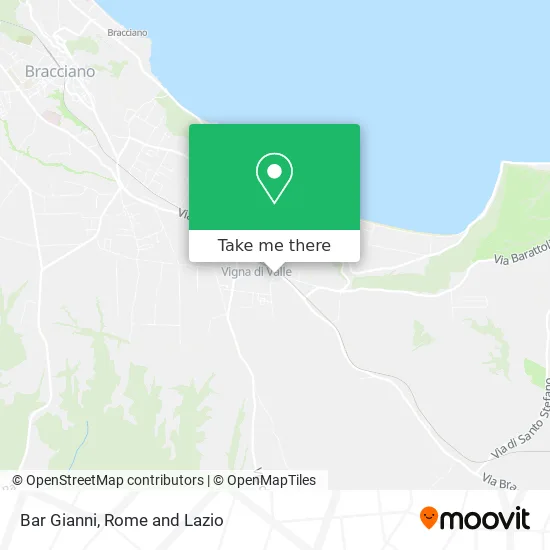
See Gianni Bar, Bracciano, on the map
Public Transit to Gianni Bar in Bracciano
Wondering how to get to Gianni Bar in Bracciano? Moovit helps you find the best way to get to Gianni Bar with step-by-step directions from the nearest public transit station.
Moovit provides free maps and live directions to help you navigate through your city. View schedules, routes, timetables, and find out how long does it take to get to Gianni Bar in real time.
Looking for the nearest stop or station to Gianni Bar? Check out this list of stops closest to your destination: Vigna Di Valle; 14 Pratigliolo Road; Bracciano | Bonifica Street Pratigliolo Street; Bracciano | Braccianese Street Bonifica Street.
Bus: 23, C, COTRAL, C/F, C1, SC BIS.Train: FL3.
Want to see if there’s another route that gets you there at an earlier time? Moovit helps you find alternative routes or times. Get directions from and directions to Gianni Bar easily from the Moovit App or Website.
We make riding to Gianni Bar easy, which is why over 1.5 million users, including users in Bracciano, trust Moovit as the best app for public transit. You don’t need to download an individual bus app or train app, Moovit is your all-in-one transit app that helps you find the best bus time or train time available.
For information on prices of bus and train, costs and ride fares to Gianni Bar, please check the Moovit app.
Use the app to navigate to popular places including to the airport, hospital, stadium, grocery store, mall, coffee shop, school, college, and university.
Gianni Bar Address: Via del Cannone, 1 00062 Bracciano street in Bracciano
- Bar Tabacchi,
- Vigna Di Valle Station,
- Vigna Di Valle,
- Calabrese Claudio,
- Santa Maria Mother of the Church Church,
- Santa Maria Mother of the Church,
- Effegiesse,
- Ice Gio',
- Banca di Credito Cooperativo di Roma Cooperative Society,
- Caerite Canine Center,
- Capparella Antonio,
- Beauty Car,
- Vigna di Valle Station,
- Garden House,
- Vigna di Valle Vacation Home,
- The Magic of a,
- Massimo Lanini,
- Individual Company,
- Stefano Paolucci,
- Rinascente Pharmacy by Dr. Carrieri
Places Near Gianni Bar (Bracciano)
- Gemelli Polyclinic, Roma,
- Cristo Re Hospital, Roma,
- IDI (Dermopatico Dell'Immacolata Institute), Roma,
- Trastevere Quarter, Roma,
- The Wow Side, Fiumicino,
- Coppedè Quarter, Roma,
- Paths, Roma,
- Santa Maria Maggiore, Roma,
- Termini Station, Roma,
- The Sail, Roma,
- Villa Borghese, Roma,
- Gravity, Roma,
- Tiber Island, Roma,
- Scuderie Del Quirinale, Roma,
- Auditorium Music Park, Roma,
- Tor Vergata, Roma,
- Casilino Polyclinic, Roma,
- Roma Est Shopping Center, Roma,
- Olympic Stadium, Rome, Roma,
- Sandro Pertini Hospital, Roma
How to get to popular places in Rome and Lazio with public transit
Get around Bracciano by public transit!
Traveling around Bracciano has never been so easy. See step by step directions as you travel to any attraction, street or major public transit station. View bus and train schedules, arrival times, service alerts and detailed routes on a map, so you know exactly how to get to anywhere in Bracciano.
When traveling to any destination around Bracciano use Moovit's Live Directions with Get Off Notifications to know exactly where and how far to walk, how long to wait for your line, and how many stops are left. Moovit will alert you when it's time to get off — no need to constantly re-check whether yours is the next stop.
Wondering how to use public transit in Bracciano or how to pay for public transit in Bracciano? Moovit public transit app can help you navigate your way with public transit easily, and at minimum cost. It includes public transit fees, ticket prices, and costs. Looking for a map of Bracciano public transit lines? Moovit public transit app shows all public transit maps in Bracciano with all Bus, Train, Metro, Light Rail, Ferry, Funicular and Gondola routes and stops on an interactive map.
Rome and Lazio has 7 transit type(s), including: Bus, Train, Metro, Light Rail, Ferry, Funicular and Gondola, operated by several transit agencies, including ATAC, Cotral, Trenitalia, Troiani Transportation Services, BIS, ATR Mobility, Tuscia, Shuttle, Seatour, Troiani Bus Lines, CSC Mobility, Terravision, ATRAL, Tambus and Sitbus