Directions to Bar do Paulo (Parati) with public transportation
The following transit lines have routes that pass near Bar do Paulo
 Bus: 25, 26, 38, L406, PARATY - PENHA.
How to get to Bar do Paulo by bus?
Click on the bus route to see step by step directions with maps, line arrival times and updated time schedules.
From Poço Do Tarzan, Parati
28 minFrom Pousada Casa da Pedra, Parati Mirim
56 minFrom Aldeia Itaxim Guarani M'Bia Paraty Mirim, Parati Mirim
20 minFrom Praia Brava - Trindade, Parati Mirim
56 minFrom Novo Frade Angra dos Reis, Parati
25 minFrom Patrimonio Paraty Rj, Parati Mirim
30 minFrom Cachoeira do Tobogã e Poço do Tarzan, Parati
28 minFrom Barra Grande, Parati
27 minFrom Cachaça Maria Izabel, Parati
34 minFrom Cachoeira do Tobogã, Parati
26 min
Bus stops near Bar do Paulo in Parati
Bus lines to Bar do Paulo in Parati
- PARATY - PENHA, Paraty - Penha,VIEW
- TRINDADE - PARATY, Trindade - Paraty,VIEW
- 11, Condado,VIEW
- 13, Pantanal,VIEW
- 14, Penha (via Pantanal),VIEW
- 16, Coriscão,VIEW
- 22, Paraty Mirim,VIEW
- 24, Vila Oratório,VIEW
- 25, Trindade,VIEW
- 26, Divisa Ubatuba,VIEW
- 32, Colônia (via Graúna / Serraria),VIEW
- 35, Sertão Taquari (via São Roque),VIEW
- 38, Vila Residencial,VIEW
- L101, Angra dos Reis - Paraty,VIEW
- L406, Paraty - Parque Mambucaba (via Campo da Gringa),VIEW
- 10, Jabaquara (via Ilha / Mangueira),VIEW
What are the closest stations to Bar do Paulo?
The closest stations to Bar do Paulo are:
- Avenida Roberto Silveira, 945-961 is 103 meters away, 2 min walk.
- Avenida Roberto Silveira, 709-731 is 160 meters away, 3 min walk.
Which bus lines stop near Bar do Paulo?
These bus lines stop near Bar do Paulo: 25, 26, 38, L406, PARATY - PENHA.
What’s the nearest bus station to Bar do Paulo in Parati?
The nearest bus station to Bar do Paulo in Parati is Avenida Roberto Silveira, 945-961. It’s a 2 min walk away.
What time is the first bus to Bar do Paulo in Parati?
The 38 is the first bus that goes to Bar do Paulo in Parati. It stops nearby at 4:16 AM.
What time is the last bus to Bar do Paulo in Parati?
The L406 is the last bus that goes to Bar do Paulo in Parati. It stops nearby at 1:03 AM.
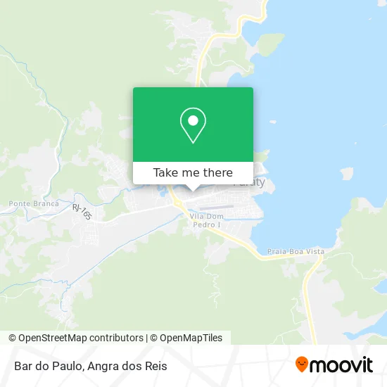
See Bar do Paulo, Parati, on the map
Public Transit to Bar do Paulo in Parati
Wondering how to get to Bar do Paulo in Parati? Moovit helps you find the best way to get to Bar do Paulo with step-by-step directions from the nearest public transit station.
Moovit provides free maps and live directions to help you navigate through your city. View schedules, routes, timetables, and find out how long does it take to get to Bar do Paulo in real time.
Looking for the nearest stop or station to Bar do Paulo? Check out this list of stops closest to your destination: Avenida Roberto Silveira; Avenida Roberto Silveira.
Bus: 25, 26, 38, L406, PARATY - PENHA, TRINDADE - PARATY, 11, 13, 14, 10.
Want to see if there’s another route that gets you there at an earlier time? Moovit helps you find alternative routes or times. Get directions from and directions to Bar do Paulo easily from the Moovit App or Website.
We make riding to Bar do Paulo easy, which is why over 1.5 million users, including users in Parati, trust Moovit as the best app for public transit. You don’t need to download an individual bus app or train app, Moovit is your all-in-one transit app that helps you find the best bus time or train time available.
For information on prices of bus, costs and ride fares to Bar do Paulo, please check the Moovit app.
Use the app to navigate to popular places including to the airport, hospital, stadium, grocery store, mall, coffee shop, school, college, and university.
Bar do Paulo Address: Rua Paulo Dias de Carvalho Mendonça, Portal de Parati Paraty-RJ 23970-000 street in Parati
- 167 Delegacia de Polícia Civil,
- Marques Lava Jato,
- Pousada Manacá - Paraty,
- Estrada Real,
- Pousada Lua Clara,
- Telecom Parat,
- Queijaria Santa Lola,
- Escola Municipal Pequenina Calixto,
- Loja Soares Paraty,
- Secretaria de Turismo de Paraty,
- Dani Lanches,
- Escuna Carpe Diem,
- Jrn Limpeza,
- Aura Estética Avancada,
- Studio Move,
- Kami Sama Sushi Paraty 2,
- Tempero de Mato Grosso 2,
- Pizza Show,
- Santé Medicina Integrada,
- Japa Food Service Paraty
Places Near Bar do Paulo (Parati)
- praia jabaquara - parati, Parati,
- Condominio Laranjeiras, Parati Mirim,
- Verolme, Jacuecanga,
- Avenida Antônio Bertholdo da Silva Jordão 7346, Jacuecanga,
- Rodovia BR 101, Km 533 s/n, Mambucaba,
- Avenida Almirante Jair Carneiro Toscano de Brito 110, Angra Dos Reis,
- Cachoeira do Tobogã, Parati,
- Vila Residencial De Mambucaba, Mambucaba,
- Rua Cônegos Bittencourt, Angra Dos Reis,
- Mambucaba, Mambucaba,
- Centro Histórico de Paraty, Parati,
- BR 101, Km 508 s/n, Cunhambebe,
- Vila Galé Eco Resort De Angra, Angra Dos Reis,
- Praia de Paraty Mirim, Parati,
- Garatucaia, Angra Dos Reis,
- Rodovia Procurador Haroldo Fernandes Duarte, Km 513,5 s / n, Cunhambebe,
- Rua Prefeito João Gregório Galindo, Cunhambebe,
- Praia do Laboratório, Angra Dos Reis,
- Rua Prefeito João Gregório Galindo 2487, Angra Dos Reis,
- Alambique Engenho D'Ouro, Parati
How to get to popular places in Angra dos Reis with public transit
Get around Parati by public transit!
Traveling around Parati has never been so easy. See step by step directions as you travel to any attraction, street or major public transit station. View bus and train schedules, arrival times, service alerts and detailed routes on a map, so you know exactly how to get to anywhere in Parati.
When traveling to any destination around Parati use Moovit's Live Directions with Get Off Notifications to know exactly where and how far to walk, how long to wait for your line, and how many stops are left. Moovit will alert you when it's time to get off — no need to constantly re-check whether yours is the next stop.
Wondering how to use public transit in Parati or how to pay for public transit in Parati? Moovit public transit app can help you navigate your way with public transit easily, and at minimum cost. It includes public transit fees, ticket prices, and costs. Looking for a map of Parati public transit lines? Moovit public transit app shows all public transit maps in Parati with all Bus and Ferry routes and stops on an interactive map.
Angra dos Reis has 2 transit type(s), including: Bus and Ferry, operated by several transit agencies, including Viação Senhor do Bonfim, Colitur Transportes Rodoviários, Cooparatyense (Vans), Costa Verde Transportes, Barcas Rio, Objetiva Tour, Vilanova Tour, Rodoviário Oceano, BusUFF and Colitur (Tarifa Zero - Paraty)