How to get to Barbara by bus?
Click on the bus route to see step by step directions with maps, line arrival times and updated time schedules.
From Campus Safran University Massy, Massy
82 minFrom Rue d'Avron, Paris
64 minFrom Hôpital Bichat, Paris
92 minFrom Rue Richer, Paris
77 minFrom Hôpital Robert Debré, Paris
94 minFrom Théâtre de la Michodière, Paris
52 minFrom Hôtel ibis budget Paris Porte de Bercy, Charenton-Le-Pont
67 minFrom Marché, Montreuil
92 minFrom Le Bataclan, Paris
67 minFrom Hôpital Bichat, Paris
92 min
How to get to Barbara by metro?
Click on the metro route to see step by step directions with maps, line arrival times and updated time schedules.
From Rue d'Avron, Paris
39 minFrom Hôpital Bichat, Paris
40 minFrom Rue Richer, Paris
42 minFrom Hôpital Robert Debré, Paris
47 minFrom Théâtre de la Michodière, Paris
36 minFrom Hôtel ibis budget Paris Porte de Bercy, Charenton-Le-Pont
55 minFrom Marché, Montreuil
48 minFrom Le Bataclan, Paris
42 minFrom Hôpital Bichat, Paris
42 min
RER station near Barbara in Paris
- Laplace, 18 min walk,VIEW
Bus lines to Barbara in Paris
What are the closest stations to Barbara?
The closest stations to Barbara are:
- Barbara is 61 meters away, 1 min walk.
- Boileau is 270 meters away, 4 min walk.
- Châtillon - Montrouge is 1206 meters away, 16 min walk.
- Laplace is 1299 meters away, 18 min walk.
Which bus lines stop near Barbara?
These bus lines stop near Barbara: 128, 323, 68.
Which metro line stops near Barbara?
4 (Porte de Clignancourt)
What’s the nearest metro station to Barbara in Paris?
The nearest metro station to Barbara in Paris is Barbara. It’s a 1 min walk away.
What’s the nearest bus station to Barbara in Paris?
The nearest bus station to Barbara in Paris is Barbara. It’s a 2 min walk away.
What’s the nearest RER station to Barbara in Paris?
The nearest RER station to Barbara in Paris is Laplace. It’s a 18 min walk away.
What time is the first light rail to Barbara in Paris?
The T6 is the first light rail that goes to Barbara in Paris. It stops nearby at 5:23 AM.
What time is the last light rail to Barbara in Paris?
The T6 is the last light rail that goes to Barbara in Paris. It stops nearby at 1:12 AM.
What time is the first metro to Barbara in Paris?
The 4 is the first metro that goes to Barbara in Paris. It stops nearby at 5:30 AM.
What time is the last metro to Barbara in Paris?
The 4 is the last metro that goes to Barbara in Paris. It stops nearby at 1:15 AM.
What time is the first bus to Barbara in Paris?
The 323 is the first bus that goes to Barbara in Paris. It stops nearby at 5:38 AM.
What time is the last bus to Barbara in Paris?
The 128 is the last bus that goes to Barbara in Paris. It stops nearby at 1:18 AM.
What time is the first RER to Barbara in Paris?
The B is the first RER that goes to Barbara in Paris. It stops nearby at 5:12 AM.
What time is the last RER to Barbara in Paris?
The B is the last RER that goes to Barbara in Paris. It stops nearby at 1:07 AM.
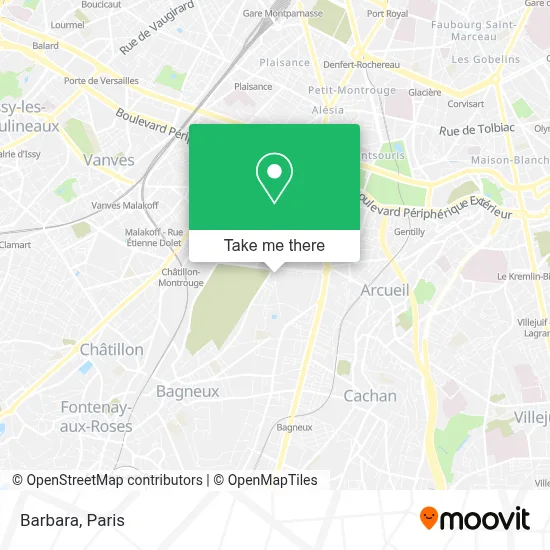
See Barbara, Paris, on the map
Public Transit to Barbara in Paris
Wondering how to get to Barbara in Paris? Moovit helps you find the best way to get to Barbara with step-by-step directions from the nearest public transit station.
Moovit provides free maps and live directions to help you navigate through your city. View schedules, routes, timetables, and find out how long does it take to get to Barbara in real time.
Looking for the nearest stop or station to Barbara? Check out this list of stops closest to your destination: Barbara; Boileau; Châtillon - Montrouge; Laplace.
Bus: 128, 323, 68, MONTBUS.Metro: 4, T6, 13.RER: B.
Want to see if there’s another route that gets you there at an earlier time? Moovit helps you find alternative routes or times. Get directions from and directions to Barbara easily from the Moovit App or Website.
We make riding to Barbara easy, which is why over 1.5 million users, including users in Paris, trust Moovit as the best app for public transit. You don’t need to download an individual bus app or train app, Moovit is your all-in-one transit app that helps you find the best bus time or train time available.
For information on prices of metro, bus and RER, costs and ride fares to Barbara, please check the Moovit app.
Use the app to navigate to popular places including to the airport, hospital, stadium, grocery store, mall, coffee shop, school, college, and university.
Barbara Address: Avenue de Stalingrad street in Paris
- Arrêt Cimetière Parisien [128],
- Avenue Henri Ginoux,
- Cimetière Parisien,
- 74 Avenue Marx Dormoy,
- Pole de Communication Graphique,
- 24 Avenue de Verdun,
- Mt Dormoy 100,
- Manonviller,
- Commune de Montrouge,
- Montrouge/Verdun/6,
- Quartier du Fort,
- Auchan,
- Auchan Supermarché MONTROUGE 2,
- Place Molière,
- Fort de Montrouge,
- Molière - République,
- Arrêt Boileau [128],
- Résidence Igesa Descartes,
- Place du 8 Mai 1945,
- Avenue de Stalingrad
Places Near Barbara (Paris)
- Hôpital Beaujon, Clichy,
- Hopital Lariboisière, Paris,
- 29 Rue Manin, Paris,
- Hôpital Saint-Joseph, Paris,
- Marché Saint-Pierre, Paris,
- Centre Hospitalier des 15/20, Paris,
- Hôpital Necker, Paris,
- Hôpital Henri Mondor, Creteil,
- Hôpital Pitié Salpêtrière, Paris,
- Hôpital de la Pitié-Salpêtrière, Paris,
- Gare Routière Flixbus, Paris,
- Fondation Louis Vuitton, Paris,
- Galeries Lafayette, Paris,
- Créteil Soleil, Creteil,
- Théâtre Mogador, Paris,
- Beaugrenelle, Paris,
- Hôpital Cochin, Paris,
- Hopital Foch, Suresnes,
- Atelier Des Lumieres, Paris,
- Galeries Lafayette Haussmann, Paris
How to get to popular places in Paris with public transit
Get around Paris by public transit!
Traveling around Paris has never been so easy. See step by step directions as you travel to any attraction, street or major public transit station. View bus and train schedules, arrival times, service alerts and detailed routes on a map, so you know exactly how to get to anywhere in Paris.
When traveling to any destination around Paris use Moovit's Live Directions with Get Off Notifications to know exactly where and how far to walk, how long to wait for your line, and how many stops are left. Moovit will alert you when it's time to get off — no need to constantly re-check whether yours is the next stop.
Wondering how to use public transit in Paris or how to pay for public transit in Paris? Moovit public transit app can help you navigate your way with public transit easily, and at minimum cost. It includes public transit fees, ticket prices, and costs. Looking for a map of Paris public transit lines? Moovit public transit app shows all public transit maps in Paris with all Bus, Train, Metro, Light Rail, RER, Funicular and Gondola routes and stops on an interactive map.
Paris has 7 transit type(s), including: Bus, Train, Metro, Light Rail, RER, Funicular and Gondola, operated by several transit agencies, including RATP, RER, RER Bus de remplacement, Train, Train Bus de remplacement, Tramway Bus de remplacement, TER, ADP, Magical Shuttle, Argenteuil - Boucles de Seine, Autocars Dominique, Bièvre, Brie et 2 Morin, Le Bus - C.C. du Clermontois and Cœur d’Essonne