Directions to Sant'Eustachio Basilica (Rome) with public transportation
The following transit lines have routes that pass near Sant'Eustachio Basilica
 Bus: 30, 46, 492, 628, 70.
- Train: FC2, FC3, FL3.
- Metro: A.
How to get to Sant'Eustachio Basilica by bus?
Click on the bus route to see step by step directions with maps, line arrival times and updated time schedules.
How to get to Sant'Eustachio Basilica by train?
Click on the train route to see step by step directions with maps, line arrival times and updated time schedules.
How to get to Sant'Eustachio Basilica by metro?
Click on the metro route to see step by step directions with maps, line arrival times and updated time schedules.
Bus stops near Sant'Eustachio Basilica in Rome
- Senate, 3 min walk,
- Zanardelli, 5 min walk,
- Argentina, 5 min walk,
- Torre Argentina Street, 6 min walk,
- Arenula/Cairoli, 7 min walk,
- Corso/Minghetti, 8 min walk,
Light Rail stations near Sant'Eustachio Basilica in Rome
- Arenula/Cairoli, 13 min walk,
Metro station near Sant'Eustachio Basilica in Rome
- Spain, 13 min walk,
Bus lines to Sant'Eustachio Basilica in Rome
- 30, Laurentina (Metro B),
- 70, Giolitti,
- N70, Termini (Metro A-Metro B-Railway),
- 81, Crescenzio/Risorgimento,
- 87, Giulio Cesare/Lepanto (Metro A),
- 492, Cipro Metro Station (Line A),
- 628, Baronio,
- N913, Tarsia,
- C3, Tiburtina Station (Metro B),
- G03, Zanardelli,
- N201, Piazza Venezia,
- 40, Termini (MA-MB-FS) - Castel Sant'Angelo,
- 46, Monte Mario (FS) - Piazza Venezia,
- N46, Monte Mario (FS-FL3) - Termini (MA-MB-FS),
- 62, Tiburtina (MB-FS) - Castel Sant'Angelo,
- 64, Termini (MA-MB-FS) - San Pietro (FS),
- N98, Mazzacurati - Termini (MA-MB-FS),
- 190F, Venice Square - Casalotti,
- N904, Selva Candida - Piazza Venezia,
- 916, Venezia Square - Primavalle,
What are the closest stations to Sant'Eustachio Basilica?
The closest stations to Sant'Eustachio Basilica are:
- Senate is 231 meters away, 3 min walk.
- Zanardelli is 309 meters away, 5 min walk.
- Argentina is 335 meters away, 5 min walk.
- Torre Argentina Street is 416 meters away, 6 min walk.
- Arenula/Cairoli is 532 meters away, 7 min walk.
- Corso/Minghetti is 572 meters away, 8 min walk.
- Spain is 962 meters away, 13 min walk.
Which bus lines stop near Sant'Eustachio Basilica?
These bus lines stop near Sant'Eustachio Basilica: 30, 46, 492, 628, 70, 83, 87.
Which train lines stop near Sant'Eustachio Basilica?
These train lines stop near Sant'Eustachio Basilica: FC2, FC3, FL3.
Which metro line stops near Sant'Eustachio Basilica?
A (Battistini)
What’s the nearest light rail station to Sant'Eustachio Basilica in Rome?
The nearest light rail station to Sant'Eustachio Basilica in Rome is Arenula/Cairoli. It’s a 13 min walk away.
What’s the nearest metro station to Sant'Eustachio Basilica in Rome?
The nearest metro station to Sant'Eustachio Basilica in Rome is Spain. It’s a 13 min walk away.
What’s the nearest bus station to Sant'Eustachio Basilica in Rome?
The nearest bus station to Sant'Eustachio Basilica in Rome is Senate. It’s a 3 min walk away.
What time is the first light rail to Sant'Eustachio Basilica in Rome?
The 8 is the first light rail that goes to Sant'Eustachio Basilica in Rome. It stops nearby at 5:27 AM.
What time is the last light rail to Sant'Eustachio Basilica in Rome?
The 8 is the last light rail that goes to Sant'Eustachio Basilica in Rome. It stops nearby at 12:33 AM.
What time is the first metro to Sant'Eustachio Basilica in Rome?
The A is the first metro that goes to Sant'Eustachio Basilica in Rome. It stops nearby at 5:45 AM.
What time is the last metro to Sant'Eustachio Basilica in Rome?
The A is the last metro that goes to Sant'Eustachio Basilica in Rome. It stops nearby at 11:56 PM.
What time is the first bus to Sant'Eustachio Basilica in Rome?
The N46 is the first bus that goes to Sant'Eustachio Basilica in Rome. It stops nearby at 3:00 AM.
What time is the last bus to Sant'Eustachio Basilica in Rome?
The N543 is the last bus that goes to Sant'Eustachio Basilica in Rome. It stops nearby at 3:44 AM.
See Sant'Eustachio Basilica, Rome, on the map
Public Transit to Sant'Eustachio Basilica in Rome
Wondering how to get to Sant'Eustachio Basilica in Rome? Moovit helps you find the best way to get to Sant'Eustachio Basilica with step-by-step directions from the nearest public transit station.
Moovit provides free maps and live directions to help you navigate through your city. View schedules, routes, timetables, and find out how long does it take to get to Sant'Eustachio Basilica in real time.
Looking for the nearest stop or station to Sant'Eustachio Basilica? Check out this list of stops closest to your destination: Senate; Zanardelli; Argentina; Torre Argentina Street; Arenula/Cairoli; Corso/Minghetti; Spain.
Bus: 30, 46, 492, 628, 70, 83, 87, N70, 81, C3, G03, N201, 40, N46, 62, 64, 8BUS, H, N8, 63.Train: FC2, FC3, FL3.Metro: A.
Want to see if there’s another route that gets you there at an earlier time? Moovit helps you find alternative routes or times. Get directions from and directions to Sant'Eustachio Basilica easily from the Moovit App or Website.
We make riding to Sant'Eustachio Basilica easy, which is why over 1.5 million users, including users in Rome, trust Moovit as the best app for public transit. You don’t need to download an individual bus app or train app, Moovit is your all-in-one transit app that helps you find the best bus time or train time available.
For information on prices of bus, metro and train, costs and ride fares to Sant'Eustachio Basilica, please check the Moovit app.
Use the app to navigate to popular places including to the airport, hospital, stadium, grocery store, mall, coffee shop, school, college, and university.
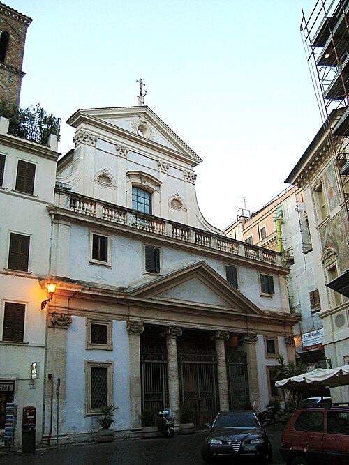
Sant'Eustachio Basilica Address: Piazza di Sant'Eustachio street in Rome
- Cenci Palace,
- Sant'Eustachio Cafe,
- Sant'Ivo at Sapienza,
- Ginger Flavors and Health Piazza Sant'Eustachio,
- Saint Eustace Square 54-55,
- Caprettari Square,
- Palazzo Della Sapienza,
- Mr. 100 Tiramisu,
- Aseq Bookstore,
- ASEQ,
- Navona Hotel,
- Eau Vive (The),
- Madama Palace,
- Navona Palace Hotel,
- Carpegna Palace in Sant'Eustachio,
- Carilli,
- Senate of the Republic,
- Sant'Ivo (Church of Sant'Ivo alla Sapienza),
- Santa Chiara Palace,
- Valle Theater
Places Near Sant'Eustachio Basilica (Rome)
- Scuderie Del Quirinale, Rome,
- Casilino Polyclinic, Rome,
- Olympic Stadium, Rome, Rome,
- Tiber Island, Rome,
- Villa Borghese, Rome,
- Trastevere Quarter, Rome,
- Coppedè Quarter, Rome,
- Auditorium Music Park, Rome,
- Tor Vergata, Rome,
- Paths, Rome,
- Foro Italico, Rome,
- IDI (Dermopatico Dell'Immacolata Institute), Rome,
- Gravity, Rome,
- Basilica of Santa Maria Maggiore, Rome,
- Cristo Re Hospital, Rome,
- Santa Maria Maggiore, Rome,
- Roma Est Shopping Center, Rome,
- The Wow Side, Fiumicino,
- Basilica of Saint Paul Outside the Walls, Rome,
- Sandro Pertini Hospital, Rome
How to get to popular places in Rome and Lazio with public transit
Get around Rome by public transit!
Traveling around Rome has never been so easy. See step by step directions as you travel to any attraction, street or major public transit station. View bus and train schedules, arrival times, service alerts and detailed routes on a map, so you know exactly how to get to anywhere in Rome.
When traveling to any destination around Rome use Moovit's Live Directions with Get Off Notifications to know exactly where and how far to walk, how long to wait for your line, and how many stops are left. Moovit will alert you when it's time to get off — no need to constantly re-check whether yours is the next stop.
Wondering how to use public transit in Rome or how to pay for public transit in Rome? Moovit public transit app can help you navigate your way with public transit easily, and at minimum cost. It includes public transit fees, ticket prices, and costs. Looking for a map of Rome public transit lines? Moovit public transit app shows all public transit maps in Rome with all Bus, Train, Metro, Light Rail, Ferry, Funicular and Gondola routes and stops on an interactive map.
Rome and Lazio has 7 transit type(s), including: Bus, Train, Metro, Light Rail, Ferry, Funicular and Gondola, operated by several transit agencies, including ATAC, Cotral, Trenitalia, Troiani Transportation Services, BIS, ATR Mobility, Tuscia, Shuttle, Seatour, Troiani Bus Lines, CSC Mobility, Terravision, ATRAL, Tambus and Sitbus