How to get to Battisti 6 by bus?
Click on the bus route to see step by step directions with maps, line arrival times and updated time schedules.
From Capannelle Racecourse, Roma
112 minFrom Casilino Polyclinic Paid Parking, Roma
110 minFrom Tor Vergata University, Roma
56 minFrom Torre Maura - Metro C, Roma
111 minFrom Prenestino Village, Roma
145 minFrom Casa Ufo Gallicano (Future House), Gallicano Nel Lazio
105 minFrom Prenestino Hill, Roma
105 minFrom Cassia Street, Roma
45 minFrom Borghesiana, Roma
110 minFrom Cinecittà Due (Cinecittadue Shopping Center), Roma
49 min
How to get to Battisti 6 by train?
Click on the train route to see step by step directions with maps, line arrival times and updated time schedules.
Bus stops near Battisti 6 in Frascati
Bus lines to Battisti 6 in Frascati
- 3, Macchia Dello Sterparo-Piazza Roma,VIEW
- 1, De Gasperi Square,VIEW
- 1, FRASCATI | Center - Cocciano,VIEW
- 4, Monte Porzio Catone | Piazza Borghese - Frascati,VIEW
- COTRAL, Frascati - Carchitti,VIEW
- COTRAL, Ariccia - Rocca Priora,VIEW
- COTRAL, Velletri - Rocca Priora,VIEW
- COTRAL, Frascati - Genazzano,VIEW
- COTRAL, Frascati - Rocca Priora,VIEW
- COTRAL, Ciampino - Rocca Priora,VIEW
- COTRAL, Frascati - Pantano Metro C,VIEW
- COTRAL, Grottaferrata - Pantano Metro C,VIEW
- COTRAL, Roma Anagnina - Rocca Priora,VIEW
- COTRAL, Frascati - Colonna,VIEW
- COTRAL, Grottaferrata - Carchitti,VIEW
- 3/, FRASCATI | Piazza Roma - Piazza Vanvitelli (-> Hospital),VIEW
- COTRAL, Colonna - Frascati,VIEW
- COTRAL, Carchitti - Frascati,VIEW
- COTRAL, Carchitti - Grottaferrata,VIEW
- COTRAL, Rocca Priora - Velletri,VIEW
What are the closest stations to Battisti 6?
The closest stations to Battisti 6 are:
- Pentini Square is 204 meters away, 3 min walk.
- Seghetti Street is 354 meters away, 5 min walk.
- Frascati | Manara Street (Railway Station) | Ugo Foscolo High School is 368 meters away, 5 min walk.
- Frascati | Manara Street (Railway Station) is 378 meters away, 5 min walk.
- Frascati | Rome Square is 419 meters away, 6 min walk.
- Frascati via Piazza Marconi is 494 meters away, 7 min walk.
- Frascati is 1966 meters away, 25 min walk.
- Tor Vergata is 2273 meters away, 29 min walk.
Which bus line stops near Battisti 6?
COTRAL (Rome | Anagnina (Metro A)→Marino Matteotti Square)
Which train line stops near Battisti 6?
FL4 (Frascati/Albano/Velletri)
What’s the nearest train station to Battisti 6 in Frascati?
The nearest train station to Battisti 6 in Frascati is Frascati. It’s a 25 min walk away.
What’s the nearest bus station to Battisti 6 in Frascati?
The nearest bus station to Battisti 6 in Frascati is Pentini Square. It’s a 3 min walk away.
What time is the first train to Battisti 6 in Frascati?
The FL4 is the first train that goes to Battisti 6 in Frascati. It stops nearby at 8:05 AM.
What time is the last train to Battisti 6 in Frascati?
The FL6 is the last train that goes to Battisti 6 in Frascati. It stops nearby at 9:26 PM.
What time is the first bus to Battisti 6 in Frascati?
The COTRAL is the first bus that goes to Battisti 6 in Frascati. It stops nearby at 5:55 AM.
What time is the last bus to Battisti 6 in Frascati?
The COTRAL is the last bus that goes to Battisti 6 in Frascati. It stops nearby at 10:30 PM.
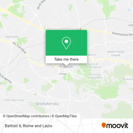
See Battisti 6, Frascati, on the map
Public Transit to Battisti 6 in Frascati
Wondering how to get to Battisti 6 in Frascati? Moovit helps you find the best way to get to Battisti 6 with step-by-step directions from the nearest public transit station.
Moovit provides free maps and live directions to help you navigate through your city. View schedules, routes, timetables, and find out how long does it take to get to Battisti 6 in real time.
Looking for the nearest stop or station to Battisti 6? Check out this list of stops closest to your destination: Pentini Square; Seghetti Street; Frascati | Manara Street (Railway Station) | Ugo Foscolo High School; Frascati | Manara Street (Railway Station); Frascati | Rome Square; Frascati via Piazza Marconi; Frascati; Tor Vergata.
Bus: COTRAL, 3, 1, 1, 4, 3/.Train: FL4, FL6.
Want to see if there’s another route that gets you there at an earlier time? Moovit helps you find alternative routes or times. Get directions from and directions to Battisti 6 easily from the Moovit App or Website.
We make riding to Battisti 6 easy, which is why over 1.5 million users, including users in Frascati, trust Moovit as the best app for public transit. You don’t need to download an individual bus app or train app, Moovit is your all-in-one transit app that helps you find the best bus time or train time available.
For information on prices of bus, train and metro, costs and ride fares to Battisti 6, please check the Moovit app.
Use the app to navigate to popular places including to the airport, hospital, stadium, grocery store, mall, coffee shop, school, college, and university.
Battisti 6 Address: Via dell'Olmo, 26 00044 Frascati street in Frascati
- Rossi Rita,
- Paradim Footwear Accessories,
- Chicco Store,
- Frascati Rome Pasta Courses, Handmade and Semi-Industrial, Advanced Training, Pasta Making Classes,
- Lo Scoglio Fish Market,
- Ancient Bakery Fratelli Senzacqua,
- At the Borough,
- Rossella Sabelli,
- Dr. Gloria Mii,
- De Sanctis Luigi,
- Massimo Daniele Ceruti,
- Sognatesori Romano,
- Tecno B Projects,
- Rigatelli Maria Giovanna,
- Reali Bruno,
- Aroundyou Banqueting,
- Guerrasio Pizza Shop,
- May and Ale Chioccia,
- Princi by Pausilli Enrico and Co.,
- Ataced
Places Near Battisti 6 (Frascati)
- Casilino Polyclinic, Roma,
- Santa Maria Maggiore, Roma,
- Trastevere Quarter, Roma,
- Paths, Roma,
- Cristo Re Hospital, Roma,
- Coppedè Quarter, Roma,
- Tor Vergata, Roma,
- Villa Borghese, Roma,
- Gemelli Polyclinic, Roma,
- Sandro Pertini Hospital, Roma,
- Tiber Island, Roma,
- Scuderie Del Quirinale, Roma,
- Olympic Stadium, Rome, Roma,
- Gravity, Roma,
- Termini Station, Roma,
- Roma Est Shopping Center, Roma,
- The Sail, Roma,
- IDI (Dermopatico Dell'Immacolata Institute), Roma,
- Auditorium Music Park, Roma,
- The Wow Side, Fiumicino
How to get to popular places in Rome and Lazio with public transit
Get around Frascati by public transit!
Traveling around Frascati has never been so easy. See step by step directions as you travel to any attraction, street or major public transit station. View bus and train schedules, arrival times, service alerts and detailed routes on a map, so you know exactly how to get to anywhere in Frascati.
When traveling to any destination around Frascati use Moovit's Live Directions with Get Off Notifications to know exactly where and how far to walk, how long to wait for your line, and how many stops are left. Moovit will alert you when it's time to get off — no need to constantly re-check whether yours is the next stop.
Wondering how to use public transit in Frascati or how to pay for public transit in Frascati? Moovit public transit app can help you navigate your way with public transit easily, and at minimum cost. It includes public transit fees, ticket prices, and costs. Looking for a map of Frascati public transit lines? Moovit public transit app shows all public transit maps in Frascati with all Bus, Train, Metro, Light Rail, Ferry, Funicular and Gondola routes and stops on an interactive map.
Rome and Lazio has 7 transit type(s), including: Bus, Train, Metro, Light Rail, Ferry, Funicular and Gondola, operated by several transit agencies, including ATAC, Cotral, Trenitalia, Troiani Transportation Services, BIS, ATR Mobility, Tuscia, Shuttle, Seatour, Troiani Bus Lines, CSC Mobility, Terravision, ATRAL, Tambus and Sitbus