How to get to Batu Projects by bus?
Click on the bus route to see step by step directions with maps, line arrival times and updated time schedules.
From 520 E 70th St, Manhattan
50 minFrom Elmhurst Hospital, Queens
62 minFrom Resorts World Shuttle Bus, Queens
56 minFrom Baruch College, Manhattan
70 minFrom 300 E 66th street, Manhattan
43 minFrom 47th St 7th Ave, Manhattan
40 minFrom Staten Island Ferry, Staten Island
73 minFrom Glendale, NY, Queens
73 minFrom Fifth Avenue, Manhattan
33 minFrom North Bergen, NJ, North Bergen
93 min
How to get to Batu Projects by train?
Click on the train route to see step by step directions with maps, line arrival times and updated time schedules.
How to get to Batu Projects by subway?
Click on the subway route to see step by step directions with maps, line arrival times and updated time schedules.
Bus stops near Batu Projects in Manhattan
Subway stations near Batu Projects in Manhattan
Bus lines to Batu Projects in Manhattan
What are the closest stations to Batu Projects?
The closest stations to Batu Projects are:
- East Broadway/Catherine St is 9 yards away, 1 min walk.
- Madison St/Catherine St is 219 yards away, 3 min walk.
- Madison St/Oliver St is 241 yards away, 4 min walk.
- Bowery/Bayard St is 432 yards away, 6 min walk.
- Canal St is 503 yards away, 7 min walk.
- Brooklyn Bridge-City Hall is 557 yards away, 7 min walk.
- East Broadway is 678 yards away, 9 min walk.
- Grand St is 821 yards away, 10 min walk.
Which bus lines stop near Batu Projects?
These bus lines stop near Batu Projects: BXM18, M103, M15-SBS, M9, QM11, QM25.
Which train lines stop near Batu Projects?
These train lines stop near Batu Projects: BLU, GRE, RED, YEL.
Which subway lines stop near Batu Projects?
These subway lines stop near Batu Projects: F, J, Q, R.
What’s the nearest subway station to Batu Projects in Manhattan?
The nearest subway stations to Batu Projects in Manhattan are Canal St and Brooklyn Bridge-City Hall. The closest one is a 7 min walk away.
What’s the nearest bus station to Batu Projects in Manhattan?
The nearest bus station to Batu Projects in Manhattan is East Broadway/Catherine St. It’s a 1 min walk away.
What time is the first subway to Batu Projects in Manhattan?
The J is the first subway that goes to Batu Projects in Manhattan. It stops nearby at 3:00 AM.
What time is the last subway to Batu Projects in Manhattan?
The 6 is the last subway that goes to Batu Projects in Manhattan. It stops nearby at 4:03 AM.
What time is the first bus to Batu Projects in Manhattan?
The M15 is the first bus that goes to Batu Projects in Manhattan. It stops nearby at 3:06 AM.
What time is the last bus to Batu Projects in Manhattan?
The M103 is the last bus that goes to Batu Projects in Manhattan. It stops nearby at 3:32 AM.
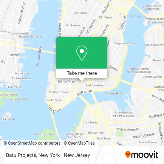
See Batu Projects, Manhattan, on the map
Public Transit to Batu Projects in Manhattan
Wondering how to get to Batu Projects in Manhattan? Moovit helps you find the best way to get to Batu Projects with step-by-step directions from the nearest public transit station.
Moovit provides free maps and live directions to help you navigate through your city. View schedules, routes, timetables, and find out how long does it take to get to Batu Projects in real time.
Looking for the nearest stop or station to Batu Projects? Check out this list of stops closest to your destination: East Broadway/Catherine St; Madison St/Catherine St; Madison St/Oliver St; Bowery/Bayard St; Canal St; Brooklyn Bridge-City Hall; East Broadway; Grand St.
Bus: BXM18, M103, M15-SBS, M9, QM11, QM25, M22.Train: BLU, GRE, RED, YEL.Subway: F, J, Q, R, M, N, 5, FX, B, D.
Want to see if there’s another route that gets you there at an earlier time? Moovit helps you find alternative routes or times. Get directions from and directions to Batu Projects easily from the Moovit App or Website.
We make riding to Batu Projects easy, which is why over 1.5 million users, including users in Manhattan, trust Moovit as the best app for public transit. You don’t need to download an individual bus app or train app, Moovit is your all-in-one transit app that helps you find the best bus time or train time available.
For information on prices of bus, subway, train and ferry, costs and ride fares to Batu Projects, please check the Moovit app.
Use the app to navigate to popular places including to the airport, hospital, stadium, grocery store, mall, coffee shop, school, college, and university.
Batu Projects Address: 2 E Broadway street in Manhattan
- Axis Mundi Interior Designers,
- Moving N Delivery Iker,
- NYC Dashing Electrician Service Electricians,
- E Broadway/Catherine St,
- E+I Studio Llc,
- MTA Bus - E Broadway & Catherine St (M9 / M22),
- Ukeep Insurance Brokerage,
- Sally,
- Allen Y. Hsu, Attorney at Law,
- E Noodle Chinatown,
- Libertyx Bitcoin Atm,
- Golden Unicorn Restaurant 麒麟金閣,
- Fok Noodles,
- Mi Island,
- T-Mobile,
- Century 21,
- Lubov,
- Dim Sum Go Go,
- Dr. Eddie Yang,
- Hsbc Bank
Places Near Batu Projects (Manhattan)
- 26 Federal Plaza, Manhattan,
- Chinatown, Manhattan,
- Times Square, Manhattan,
- Rockefeller Center, Manhattan,
- 1 Police Plaza, Manhattan,
- Hudson Yards, Manhattan,
- Bellevue Hospital, Manhattan,
- Katz's Deli, Manhattan,
- Mountainside Hospital, Glen Ridge,
- Wall Street, Manhattan,
- 66 John Street, Manhattan,
- SoHo, Manhattan,
- 911 Memorial, Manhattan,
- qqqq, Manhattan,
- 376 Hudson Street, Manhattan,
- Pier 83, Manhattan,
- 3 Stone St, Manhattan,
- Queens Center Mall, Queens,
- San Gennaro Feast, Manhattan,
- 111 Centre New York City Supreme Court, Manhattan
How to get to popular places in New York - New Jersey with public transit
Get around Manhattan by public transit!
Traveling around Manhattan has never been so easy. See step by step directions as you travel to any attraction, street or major public transit station. View bus and train schedules, arrival times, service alerts and detailed routes on a map, so you know exactly how to get to anywhere in Manhattan.
When traveling to any destination around Manhattan use Moovit's Live Directions with Get Off Notifications to know exactly where and how far to walk, how long to wait for your line, and how many stops are left. Moovit will alert you when it's time to get off — no need to constantly re-check whether yours is the next stop.
Wondering how to use public transit in Manhattan or how to pay for public transit in Manhattan? Moovit public transit app can help you navigate your way with public transit easily, and at minimum cost. It includes public transit fees, ticket prices, and costs. Looking for a map of Manhattan public transit lines? Moovit public transit app shows all public transit maps in Manhattan with all Bus, Train, Subway, Light Rail, Ferry and Cable Car routes and stops on an interactive map.
New York - New Jersey has 6 transit type(s), including: Bus, Train, Subway, Light Rail, Ferry and Cable Car, operated by several transit agencies, including MTA Subway, Metro-North Railroad, LIRR, PATH, MTA New York City Transit - Express routes, MTA Bus, NJ Transit, NYC Ferry, NICE bus, Bee-Line Bus, NJ Transit Rail, Norwalk Transit District, Hartford Line, River Valley Transit and HART