How to get to Bca, Inc. by bus?
Click on the bus route to see step by step directions with maps, line arrival times and updated time schedules.
From Holiday Inn Express Hotel & Suites-Miami Airport East, Miami
62 minFrom Department of Children and Families, Miami
69 minFrom Mt Sinai Medical Center, Miami
55 minFrom NW 62nd St / NW 27th Ave, Miami
79 minFrom Hyatt Place Miami Airport-East, Miami
53 minFrom NW 54th St / SE Le Jeune Rd, Hialeah
83 minFrom Amerant Bank, Miami
80 minFrom Amelia Earhart Park, Miami
86 minFrom Hialeah Hospital Emergency Room, Hialeah
71 minFrom Camillus House, Miami
93 min
Bus stops near Bca, Inc. in North Westside
Bus lines to Bca, Inc. in North Westside
What are the closest stations to Bca, Inc.?
The closest stations to Bca, Inc. are:
- Nw 36 St & Nw 87 Av is 115 yards away, 2 min walk.
- Nw 87 Av & Nw 36 St is 219 yards away, 3 min walk.
- Nw 36 St & 87 Av is 315 yards away, 5 min walk.
Which bus lines stop near Bca, Inc.?
These bus lines stop near Bca, Inc.: 132, 36, 87.
What’s the nearest bus station to Bca, Inc. in North Westside?
The nearest bus station to Bca, Inc. in North Westside is Nw 36 St & Nw 87 Av. It’s a 2 min walk away.
What time is the first bus to Bca, Inc. in North Westside?
The 87 is the first bus that goes to Bca, Inc. in North Westside. It stops nearby at 5:17 AM.
What time is the last bus to Bca, Inc. in North Westside?
The 87 is the last bus that goes to Bca, Inc. in North Westside. It stops nearby at 11:06 PM.
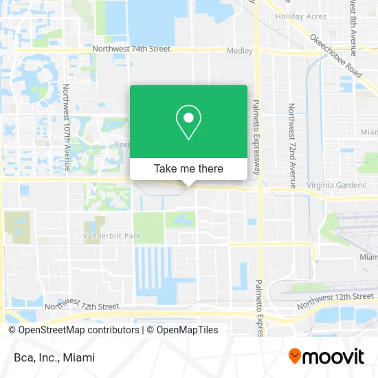
See Bca, Inc., North Westside, on the map
Public Transit to Bca, Inc. in North Westside
Wondering how to get to Bca, Inc. in North Westside? Moovit helps you find the best way to get to Bca, Inc. with step-by-step directions from the nearest public transit station.
Moovit provides free maps and live directions to help you navigate through your city. View schedules, routes, timetables, and find out how long does it take to get to Bca, Inc. in real time.
Looking for the nearest stop or station to Bca, Inc.? Check out this list of stops closest to your destination: Nw 36 St & Nw 87 Av; Nw 87 Av & Nw 36 St; Nw 36 St & 87 Av.
Bus: 132, 36, 87, 95, DLOOP1, DLOOP2.
Want to see if there’s another route that gets you there at an earlier time? Moovit helps you find alternative routes or times. Get directions from and directions to Bca, Inc. easily from the Moovit App or Website.
We make riding to Bca, Inc. easy, which is why over 1.5 million users, including users in North Westside, trust Moovit as the best app for public transit. You don’t need to download an individual bus app or train app, Moovit is your all-in-one transit app that helps you find the best bus time or train time available.
For information on prices of bus and train, costs and ride fares to Bca, Inc., please check the Moovit app.
Use the app to navigate to popular places including to the airport, hospital, stadium, grocery store, mall, coffee shop, school, college, and university.
Bca, Inc. Address: 8750 NW 36th St Miami, FL 33178 street in North Westside
- Alfaparf Milano Professional,
- Rivx Automation,
- Modern School of Real Estate,
- Terumo Medical Corporation Miami Sales Office,
- Mercury Americas,
- Florida Lemark Corporation,
- Omar Jimenez Cano - Realtor,
- Doral Cente Parking Lot,
- D&H Service Group,
- R Figueroa,
- Consulate General of Bolivia,
- Alsac St Jude's Children,
- Martin Lenta,
- Quest Workspaces Two Doral,
- Expriva,
- Akashic Records,
- Amli 8800 Intercom,
- Doral Blvd / NW 36th St,
- Ross Dress for Less 22,
- Homegoods - Coming Soon
Places Near Bca, Inc. (North Westside)
- Sawgrass mall ( FL ), Miami Beach,
- Bayside Marketplace, Miami,
- Aventura Mall, Miami Beach,
- Dolphin Mall Bus, Miami,
- Zoo Miami, Miami,
- Richard E. Gerstein Justice Building, Miami,
- Miami Design District, Miami,
- Keiser University Flagship Campus, West Palm Beach,
- Miami Freedom Park, Miami,
- Miami VA Hospital, Miami,
- Port of Miami Cruise Terminal, Miami,
- Marlins Park, Miami,
- Dolphin Mall, Miami,
- Hard Rock Stadium, Miami Gardens,
- Miami-Dade County Courthouse, Miami,
- Sawgrass Mall, Miami,
- Brickell City Centre, Miami,
- Little Havana, Miami,
- Aventura Mall, Miami,
- Wynwood, Miami
How to get to popular places in Miami with public transit
Get around North Westside by public transit!
Traveling around North Westside has never been so easy. See step by step directions as you travel to any attraction, street or major public transit station. View bus and train schedules, arrival times, service alerts and detailed routes on a map, so you know exactly how to get to anywhere in North Westside.
When traveling to any destination around North Westside use Moovit's Live Directions with Get Off Notifications to know exactly where and how far to walk, how long to wait for your line, and how many stops are left. Moovit will alert you when it's time to get off — no need to constantly re-check whether yours is the next stop.
Wondering how to use public transit in North Westside or how to pay for public transit in North Westside? Moovit public transit app can help you navigate your way with public transit easily, and at minimum cost. It includes public transit fees, ticket prices, and costs. Looking for a map of North Westside public transit lines? Moovit public transit app shows all public transit maps in North Westside with all Bus, Train, Light Rail and Ferry routes and stops on an interactive map.
Miami has 4 transit type(s), including: Bus, Train, Light Rail and Ferry, operated by several transit agencies, including Broward County Transit, Miami-Dade Transit, Metrorail, Palm Tran, Tri-Rail, Brightline, MARTY, City of Homestead Trolley, Key West Transit, Treasure Coast Connector, GoLine IRT, Amtrak, Greyhound-us, FlixBus-us and Aventura Express Shuttle Bus