How to get to Bcp by bus?
Click on the bus route to see step by step directions with maps, line arrival times and updated time schedules.
From Explanada de la Costa Verde, Magdalena
57 minFrom Av venezuela, Lima
26 minFrom Avenida Guillermo Prescott, San Isidro
45 minFrom Av Rivera Navarrete, San Isidro
47 minFrom Salaverry, Los Olivos
29 minFrom Puente Tingo María, Breña
30 minFrom Cafae-Se, San Isidro
44 minFrom Ministerio de Trabajo y Promoción del Empleo, Jesus Mari
24 minFrom Local Fuerza Popular, Lima
24 minFrom Universidad San Marcos Sjl, San Juan D
67 min
Bus stops near Bcp in San Martin
Bus lines to Bcp in San Martin
- 1199, Villarán (Surquillo) - Puente Camote (San Martin De Porres),VIEW
- 1203, Portón (San Juan De Lurigancho) - Plaza Norte (San Martin De Porres) - Portón (San Juan De Lurigancho),VIEW
- CR43, Ventanilla - Carabayllo,VIEW
- CR62, Carabayllo - Lima - Carabayllo,VIEW
- IM47, Km. 22 - Caquetá - Brasil - La Marina - Faucett - Km. 22,VIEW
- 1159, Callao - Jesús María [La 21],VIEW
- 1275, S.M.P - Surco [R],VIEW
- 1326, Puente Piedra - San Miguel [T],VIEW
- 2203, San Martín de Porres - San Martín de Porres,VIEW
- CR42, Independencia - La Perla,VIEW
- IM08, Independencia - Callao,VIEW
- IO45, Callao - Independencia,VIEW
- 1006, Carabayllo - Ate - Carabayllo,VIEW
- 1208, Pte. Piedra - S.M.P.,VIEW
- 1424, Oquendo (Callao) - Aeropuerto - A.Gamarra - Plaza Norte - Covida - Oquendo (Callao),VIEW
- 1005, Huánuco (La Victoria) - Punchauca (Carabayllo),VIEW
- 1010, Pte. Piedra - Magdalena - Pte. Piedra,VIEW
- 1016, La Florida (Ancon) - Aviación (La Victoria),VIEW
- 1017, Ancón - La Victoria,VIEW
- 1024, Los Sauces - Cerro Candela,VIEW
What are the closest stations to Bcp?
The closest stations to Bcp are:
- Tomás Valle is 266 meters away, 4 min walk.
- Marco Polo, 1694 is 310 meters away, 5 min walk.
- Fiori is 322 meters away, 5 min walk.
- Mercado Central is 372 meters away, 5 min walk.
- Plaza Norte is 401 meters away, 6 min walk.
Which bus lines stop near Bcp?
These bus lines stop near Bcp: 1024, 1168, 1180, 1260, 1261, 1262, 1287, 1326.
What’s the nearest bus station to Bcp in San Martin?
The nearest bus station to Bcp in San Martin is Tomás Valle. It’s a 4 min walk away.
What time is the first bus to Bcp in San Martin?
The 1180 is the first bus that goes to Bcp in San Martin. It stops nearby at 3:45 AM.
What time is the last bus to Bcp in San Martin?
The 1326 SX is the last bus that goes to Bcp in San Martin. It stops nearby at 2:24 AM.
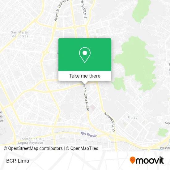
See Bcp, San Martin, on the map
Public Transit to Bcp in San Martin
Wondering how to get to Bcp in San Martin? Moovit helps you find the best way to get to Bcp with step-by-step directions from the nearest public transit station.
Moovit provides free maps and live directions to help you navigate through your city. View schedules, routes, timetables, and find out how long does it take to get to Bcp in real time.
Looking for the nearest stop or station to Bcp? Check out this list of stops closest to your destination: Tomás Valle; Marco Polo; Fiori; Mercado Central; Plaza Norte.
Bus: 1024, 1168, 1180, 1260, 1261, 1262, 1287, 1326, 1199, 1203, CR43, CR62, IM47, 1159, 1275, 2203, CR42, 1006, 1208, 1424, 1005, 1010, 1016, 1017, 1326 SX.
Want to see if there’s another route that gets you there at an earlier time? Moovit helps you find alternative routes or times. Get directions from and directions to Bcp easily from the Moovit App or Website.
We make riding to Bcp easy, which is why over 1.5 million users, including users in San Martin, trust Moovit as the best app for public transit. You don’t need to download an individual bus app or train app, Moovit is your all-in-one transit app that helps you find the best bus time or train time available.
For information on prices of bus, costs and ride fares to Bcp, please check the Moovit app.
Use the app to navigate to popular places including to the airport, hospital, stadium, grocery store, mall, coffee shop, school, college, and university.
Bcp Address: Avenida Tomás Valle street in San Martin
- Caja Piura Fiori,
- Sunat,
- Profuturo Afp,
- Centro Financiero,
- Compañía de Telefono Nextel-Nextel San Martin de Porres Lima,
- Kromasol Peru,
- SUNAT Agencia Fiori,
- Avenida Tomas valle,
- Kukyflor-Florería,
- Paradero de Taxis,
- Krispy Kreme,
- Avenida Alfredo Mendiola & Avenida Tomas Valle,
- Tercer Piso del Puente Av. Angelica Gamarra,
- Centro Comercial Fiori,
- Mangueras Hidráulicas Kami S.A.C.,
- Gamarra Plaza Norte,
- Lab Nutrition,
- Policlinico Fiori,
- parque tematico de dinosaurios,
- Western Union
Places Near Bcp (San Martin)
- Av. Abancay, Lima,
- Real Plaza Puruchuco, Ate,
- Paradero Av.Brasil,
- Aeropuerto Internacional Jorge Chávez, Ventanilla,
- Barranco, Barranco,
- Mall Del Sur,
- Circuito Mágico Del Agua, Lima,
- av arequipa, Lima,
- Av. Salaverry, Jesus Mari,
- Hospital Edgardo Rebagliati Martins, Jesus Mari,
- Pontificia Universidad Católica del Perú - PUCP, San Miguel,
- Miraflores, Miraflores,
- Larcomar, Miraflores,
- Parque de las Leyendas, San Miguel,
- Parque Kennedy, Miraflores,
- Jockey Plaza, Santiago D,
- Plaza San Miguel, San Miguel,
- Gamarra,
- Av. La Marina, San Miguel,
- Centro Comercial Plaza Norte, Independen
How to get to popular places in Lima with public transit
Get around San Martin by public transit!
Traveling around San Martin has never been so easy. See step by step directions as you travel to any attraction, street or major public transit station. View bus and train schedules, arrival times, service alerts and detailed routes on a map, so you know exactly how to get to anywhere in San Martin.
When traveling to any destination around San Martin use Moovit's Live Directions with Get Off Notifications to know exactly where and how far to walk, how long to wait for your line, and how many stops are left. Moovit will alert you when it's time to get off — no need to constantly re-check whether yours is the next stop.
Wondering how to use public transit in San Martin or how to pay for public transit in San Martin? Moovit public transit app can help you navigate your way with public transit easily, and at minimum cost. It includes public transit fees, ticket prices, and costs. Looking for a map of San Martin public transit lines? Moovit public transit app shows all public transit maps in San Martin with all Bus, Metro and Ferry routes and stops on an interactive map.
Lima has 3 transit type(s), including: Bus, Metro and Ferry, operated by several transit agencies, including Metro de Lima Línea 2 , Metro de Lima, Corredor Rojo, Metropolitano, Metropolitano - Alimentadores, Corredor Morado, Corredor Azul, Rutas Tradicionales, Transportes y Servicios La Esperanza S.A., Las Flores S.A., Virgen de la Asunción S.A., Consorcio HAM, Transportes y Service Canadá S.A., ETUL4SA and ETUCHISA