How to get to Beach Locks & Security by bus?
Click on the bus route to see step by step directions with maps, line arrival times and updated time schedules.
From Oakland Park Boulevard & State Road 7, Fort Lauderdale
67 minFrom City of Lauderdale Lakes, Fort Lauderdale
77 minFrom Intersection : N Andrews Ave & Sample Rd., Pompano Beach
60 minFrom Broward College North Campus Bldg. 48, Pompano Beach
50 minFrom Hotel Soap, Fort Lauderdale
37 minFrom Galleria Mall, Fort Lauderdale
53 minFrom W Commercial Blvd & 441 (SR 7), Fort Lauderdale
60 minFrom Galleria at Fort Lauderdale (Galleria Mall At Fort Lauderdale), Fort Lauderdale
52 minFrom I-95, Fort Lauderdale
74 minFrom Trapeze Swing Club, Fort Lauderdale
71 min
Bus stops near Beach Locks & Security in Pompano Beach
Bus lines to Beach Locks & Security in Pompano Beach
What are the closest stations to Beach Locks & Security?
The closest stations to Beach Locks & Security are:
- Atlantic Boulevard/Northeast 7th Avenue is 121 yards away, 2 min walk.
- Cypress Road/Atlantic Boulevard is 696 yards away, 9 min walk.
- Martin Luther King Boulevard & Dixie Highway Pompano is 1264 yards away, 15 min walk.
- Northeast Transit Center - (Martin Luther King Boulevard/Dixie Highway) is 1274 yards away, 15 min walk.
Which bus lines stop near Beach Locks & Security?
These bus lines stop near Beach Locks & Security: 20, 42, 50.
What’s the nearest bus station to Beach Locks & Security in Pompano Beach?
The nearest bus station to Beach Locks & Security in Pompano Beach is Atlantic Boulevard/Northeast 7th Avenue. It’s a 2 min walk away.
What time is the first bus to Beach Locks & Security in Pompano Beach?
The 20 is the first bus that goes to Beach Locks & Security in Pompano Beach. It stops nearby at 4:59 AM.
What time is the last bus to Beach Locks & Security in Pompano Beach?
The 50 is the last bus that goes to Beach Locks & Security in Pompano Beach. It stops nearby at 11:50 PM.
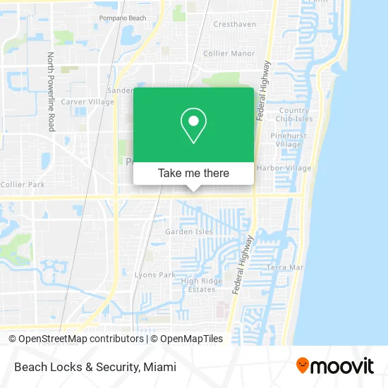
See Beach Locks & Security, Pompano Beach, on the map
Public Transit to Beach Locks & Security in Pompano Beach
Wondering how to get to Beach Locks & Security in Pompano Beach? Moovit helps you find the best way to get to Beach Locks & Security with step-by-step directions from the nearest public transit station.
Moovit provides free maps and live directions to help you navigate through your city. View schedules, routes, timetables, and find out how long does it take to get to Beach Locks & Security in real time.
Looking for the nearest stop or station to Beach Locks & Security? Check out this list of stops closest to your destination: Atlantic Boulevard/Northeast 7th Avenue; Cypress Road/Atlantic Boulevard; Martin Luther King Boulevard & Dixie Highway Pompano; Northeast Transit Center - (Martin Luther King Boulevard/Dixie Highway).
Bus: 20, 42, 50, 60.
Want to see if there’s another route that gets you there at an earlier time? Moovit helps you find alternative routes or times. Get directions from and directions to Beach Locks & Security easily from the Moovit App or Website.
We make riding to Beach Locks & Security easy, which is why over 1.5 million users, including users in Pompano Beach, trust Moovit as the best app for public transit. You don’t need to download an individual bus app or train app, Moovit is your all-in-one transit app that helps you find the best bus time or train time available.
For information on prices of bus, costs and ride fares to Beach Locks & Security, please check the Moovit app.
Use the app to navigate to popular places including to the airport, hospital, stadium, grocery store, mall, coffee shop, school, college, and university.
Beach Locks & Security Address: 601 E Atlantic Blvd Pompano Beach, FL 33060 street in Pompano Beach
- Your Wallpaper Installer,
- New Era Roofing Concept,
- T-Mobile,
- Tdi Processing of South Florida,
- Pat's Place,
- Pompano Locksmith,
- USPS Collection Box - Blue Box,
- bp,
- Thrifty and Nifty Consignment,
- Sabat Brothers III,
- Placement Counselors,
- MR. Squeaky Car Wash,
- Sousa Fernanda - Target Multi Service,
- Invesca Development Group,
- The Den,
- Boulder Bloc,
- Completeserenity-Mentalhealth,
- Koipompanobeach,
- Mycare Medical Group,
- Shanica Edwards, MSW
Places Near Beach Locks & Security (Pompano Beach)
- Miami VA Hospital, Miami,
- Hard Rock Stadium, Miami Gardens,
- Miami Freedom Park, Miami,
- Marlins Park, Miami,
- Miami Design District, Miami,
- Dolphin Mall, Miami,
- Brickell City Centre, Miami,
- Keiser University Flagship Campus, West Palm Beach,
- Richard E. Gerstein Justice Building, Miami,
- Wynwood, Miami,
- Sawgrass Mall, Miami,
- Sawgrass mall ( FL ), Miami Beach,
- Port of Miami Cruise Terminal, Miami,
- Aventura Mall, Miami Beach,
- Miami-Dade County Courthouse, Miami,
- Aventura Mall, Miami,
- Zoo Miami, Miami,
- Little Havana, Miami,
- Bayside Marketplace, Miami,
- Dolphin Mall Bus, Miami
How to get to popular places in Miami with public transit
Get around Pompano Beach by public transit!
Traveling around Pompano Beach has never been so easy. See step by step directions as you travel to any attraction, street or major public transit station. View bus and train schedules, arrival times, service alerts and detailed routes on a map, so you know exactly how to get to anywhere in Pompano Beach.
When traveling to any destination around Pompano Beach use Moovit's Live Directions with Get Off Notifications to know exactly where and how far to walk, how long to wait for your line, and how many stops are left. Moovit will alert you when it's time to get off — no need to constantly re-check whether yours is the next stop.
Wondering how to use public transit in Pompano Beach or how to pay for public transit in Pompano Beach? Moovit public transit app can help you navigate your way with public transit easily, and at minimum cost. It includes public transit fees, ticket prices, and costs. Looking for a map of Pompano Beach public transit lines? Moovit public transit app shows all public transit maps in Pompano Beach with all Bus, Train, Light Rail and Ferry routes and stops on an interactive map.
Miami has 4 transit type(s), including: Bus, Train, Light Rail and Ferry, operated by several transit agencies, including Broward County Transit, Miami-Dade Transit, Metrorail, Palm Tran, Tri-Rail, Brightline, MARTY, City of Homestead Trolley, Key West Transit, Treasure Coast Connector, GoLine IRT, Amtrak, Greyhound-us, FlixBus-us and Aventura Express Shuttle Bus