How to get to Becca Lilly Playground by bus?
Click on the bus route to see step by step directions with maps, line arrival times and updated time schedules.
From Pie Shop, Washington
69 minFrom Four Seasons Hotel Washington DC, Washington
86 minFrom Georgetown Flea Market, Washington
80 minFrom John A. Wilson Building - DC Government, Washington
80 minFrom Pennsylvania Ave NW (3rd st and pennsylvania), Washington
84 minFrom Dirksen Senate Building, Washington
78 minFrom The Westin Georgetown, Washington D.C., Washington
74 minFrom Beacon Hotel, Washington
72 minFrom Us Supreme Court, Washington
82 minFrom US Department of Veterans Affairs, Washington
81 min
How to get to Becca Lilly Playground by train?
Click on the train route to see step by step directions with maps, line arrival times and updated time schedules.
How to get to Becca Lilly Playground by metro?
Click on the metro route to see step by step directions with maps, line arrival times and updated time schedules.
From Pie Shop, Washington
69 minFrom Four Seasons Hotel Washington DC, Washington
73 minFrom John A. Wilson Building - DC Government, Washington
59 minFrom Pennsylvania Ave NW (3rd st and pennsylvania), Washington
56 minFrom Dirksen Senate Building, Washington
57 minFrom US Department of Veterans Affairs, Washington
63 minFrom The Westin Georgetown, Washington D.C., Washington
66 minFrom Beacon Hotel, Washington
61 minFrom Us Supreme Court, Washington
61 min
Bus stops near Becca Lilly Playground in Montgomery County
Metro station near Becca Lilly Playground in Montgomery County
- Fort Totten, 19 min walk,VIEW
Train station near Becca Lilly Playground in Montgomery County
- Silver Spring Marc Wb, 55 min walk,VIEW
Bus lines to Becca Lilly Playground in Montgomery County
- 16, 16-Silver Spring-Takoma,VIEW
- M6X, New Hampshire Av Limited,VIEW
- M60, New Hampshire Av,VIEW
- P30, West To Silver Spring,VIEW
- 12, 12-Silver Spring-Takoma,VIEW
- 13, 13-Silver Spring-Takoma,VIEW
- 17, 17-Silver Spring-Takoma Langley,VIEW
- 18, 18-Silver Spring -Takoma Langley,VIEW
- 25, 25-Takoma Station-Takoma Langley,VIEW
What are the closest stations to Becca Lilly Playground?
The closest stations to Becca Lilly Playground are:
- New Hampshire Ave & East-West Hwy is 410 yards away, 5 min walk.
- Ethan Allen Av & Elm Av is 573 yards away, 7 min walk.
- Carroll Ave & Sligo Creek Pkwy is 583 yards away, 7 min walk.
- Carroll Ave & Flower Ave is 717 yards away, 9 min walk.
- Fort Totten is 1612 yards away, 19 min walk.
- Silver Spring Marc Wb is 4697 yards away, 55 min walk.
Which bus lines stop near Becca Lilly Playground?
These bus lines stop near Becca Lilly Playground: 12, 16, M60, M6X, P30.
Which train line stops near Becca Lilly Playground?
MARC (Inbound - Brunswick)
Which metro line stops near Becca Lilly Playground?
RED (Glenmont)
What’s the nearest metro station to Becca Lilly Playground in Montgomery County?
The nearest metro station to Becca Lilly Playground in Montgomery County is Fort Totten. It’s a 19 min walk away.
What’s the nearest bus station to Becca Lilly Playground in Montgomery County?
The nearest bus station to Becca Lilly Playground in Montgomery County is New Hampshire Ave & East-West Hwy. It’s a 5 min walk away.
What time is the first metro to Becca Lilly Playground in Montgomery County?
The RED is the first metro that goes to Becca Lilly Playground in Montgomery County. It stops nearby at 5:10 AM.
What time is the last metro to Becca Lilly Playground in Montgomery County?
The GREEN is the last metro that goes to Becca Lilly Playground in Montgomery County. It stops nearby at 12:30 AM.
What time is the first train to Becca Lilly Playground in Montgomery County?
The MARC is the first train that goes to Becca Lilly Playground in Montgomery County. It stops nearby at 5:51 AM.
What time is the last train to Becca Lilly Playground in Montgomery County?
The MARC is the last train that goes to Becca Lilly Playground in Montgomery County. It stops nearby at 7:37 PM.
What time is the first bus to Becca Lilly Playground in Montgomery County?
The 16 is the first bus that goes to Becca Lilly Playground in Montgomery County. It stops nearby at 4:30 AM.
What time is the last bus to Becca Lilly Playground in Montgomery County?
The M60 is the last bus that goes to Becca Lilly Playground in Montgomery County. It stops nearby at 2:29 AM.
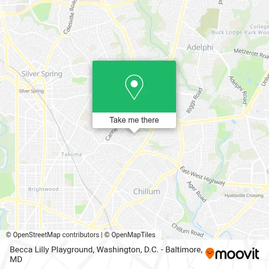
See Becca Lilly Playground, Montgomery County, on the map
Public Transit to Becca Lilly Playground in Montgomery County
Wondering how to get to Becca Lilly Playground in Montgomery County? Moovit helps you find the best way to get to Becca Lilly Playground with step-by-step directions from the nearest public transit station.
Moovit provides free maps and live directions to help you navigate through your city. View schedules, routes, timetables, and find out how long does it take to get to Becca Lilly Playground in real time.
Looking for the nearest stop or station to Becca Lilly Playground? Check out this list of stops closest to your destination: New Hampshire Ave & East-West Hwy; Ethan Allen Av & Elm Av; Carroll Ave & Sligo Creek Pkwy; Carroll Ave & Flower Ave; Fort Totten; Silver Spring Marc Wb.
Bus: 12, 16, M60, M6X, P30, 13, 17, 18, 25.Train: MARC.Metro: RED, GREEN, YELLOW.
Want to see if there’s another route that gets you there at an earlier time? Moovit helps you find alternative routes or times. Get directions from and directions to Becca Lilly Playground easily from the Moovit App or Website.
We make riding to Becca Lilly Playground easy, which is why over 1.7 million users, including users in Montgomery County, trust Moovit as the best app for public transit. You don’t need to download an individual bus app or train app, Moovit is your all-in-one transit app that helps you find the best bus time or train time available.
For information on prices of bus, metro and train, costs and ride fares to Becca Lilly Playground, please check the Moovit app.
Use the app to navigate to popular places including to the airport, hospital, stadium, grocery store, mall, coffee shop, school, college, and university.
Becca Lilly Playground Address: 7109 Central Ave street in Montgomery County
- Our Lady Of Sorrows Catholic Church,
- MD Lot Sunshine Ethio,
- Quest Diagnostics - Takoma Park - Employer Drug Testing Not Offered,
- Don Bosco Cristo Rey High School,
- Sligo Seventh-Day Adventist Church Offices,
- تاكوما بارك (ماريلاند),
- People's Republic Of Takoma Park,
- Adventist HealthCare Washington Adventist Hospital,
- The Skin Lab,
- Andrei Gursky, Md,
- Mrc Behavioral Health,
- Washington Adventist University,
- QUALITY INN,
- Admissions,
- Tom Dant,
- Wau Biology & Chemistry,
- Adventist HealthCare White Oak Medical Center,
- Asme at Wau Music Festival,
- Hôpital Adventiste De Washington,
- Washington Adventist Hospital-ER
Places Near Becca Lilly Playground (Montgomery County)
- Sibley Memorial Hospital, Washington,
- Camden Yards, Baltimore,
- Washington National Cathedral, Washington,
- Washington DC VA Medical Center, Washington,
- Amazon Hq2, Arlington County,
- Marriott Marquis Washington, DC, Washington,
- Museum Of The Bible, Washington,
- National Zoo, Washington,
- Basilica of the National Shrine, Washington,
- Georgetown, Washington,
- National Theatre, Washington,
- Westfield Montgomery Mall, Montgomery County,
- Rock Creek Tennis Center, Washington,
- Warner Theatre, Washington,
- M&T Bank Stadium, Baltimore,
- Capital One Arena, Washington,
- Pennsylvania Ave NW (3rd st and pennsylvania), Washington,
- The Anthem, Washington,
- National Museum of African American History and Culture, Washington,
- PG Mall, Prince George's County
How to get to popular places in Washington, D.C. - Baltimore, MD with public transit
Get around Montgomery County by public transit!
Traveling around Montgomery County has never been so easy. See step by step directions as you travel to any attraction, street or major public transit station. View bus and train schedules, arrival times, service alerts and detailed routes on a map, so you know exactly how to get to anywhere in Montgomery County.
When traveling to any destination around Montgomery County use Moovit's Live Directions with Get Off Notifications to know exactly where and how far to walk, how long to wait for your line, and how many stops are left. Moovit will alert you when it's time to get off — no need to constantly re-check whether yours is the next stop.
Wondering how to use public transit in Montgomery County or how to pay for public transit in Montgomery County? Moovit public transit app can help you navigate your way with public transit easily, and at minimum cost. It includes public transit fees, ticket prices, and costs. Looking for a map of Montgomery County public transit lines? Moovit public transit app shows all public transit maps in Montgomery County with all Bus, Train, Metro, Light Rail and Ferry routes and stops on an interactive map.
Washington, D.C. - Baltimore, MD has 5 transit type(s), including: Bus, Train, Metro, Light Rail and Ferry, operated by several transit agencies, including WMATA, Montgomery County Ride On, Fairfax Connector, TheBus, PRTC, DASH - Alexandria, Arlington Transit (ART), RTA of Central Maryland, MDOT MTA, MDOT MTA Light RailLink, MDOT MTA Commuter Bus, MDOT MTA Local Bus, FXBGO!, Virginia Railway Express (VRE) and MARC