How to get to Bee'Goddess Essentials by bus?
Click on the bus route to see step by step directions with maps, line arrival times and updated time schedules.
Bus stops near Bee'Goddess Essentials in Norfolk
Light Rail stations near Bee'Goddess Essentials in Norfolk
- York Street Freemason Station, 25 min walk,VIEW
What are the closest stations to Bee'Goddess Essentials?
The closest stations to Bee'Goddess Essentials are:
- Granby & 33rd is 377 yards away, 5 min walk.
- Colonial & 35th is 390 yards away, 5 min walk.
- Monticello & 25th is 778 yards away, 10 min walk.
- York Street Freemason Station is 2096 yards away, 25 min walk.
Which bus lines stop near Bee'Goddess Essentials?
These bus lines stop near Bee'Goddess Essentials: 001, 023, 961.
Which light rail line stops near Bee'Goddess Essentials?
800 (Evmc Fort Norfolk Station)
What’s the nearest light rail station to Bee'Goddess Essentials in Norfolk?
The nearest light rail station to Bee'Goddess Essentials in Norfolk is York Street Freemason Station. It’s a 25 min walk away.
What’s the nearest bus station to Bee'Goddess Essentials in Norfolk?
The nearest bus stations to Bee'Goddess Essentials in Norfolk are Granby & 33rd and Colonial & 35th. The closest one is a 5 min walk away.
What time is the first light rail to Bee'Goddess Essentials in Norfolk?
The 800 is the first light rail that goes to Bee'Goddess Essentials in Norfolk. It stops nearby at 5:27 AM.
What time is the last light rail to Bee'Goddess Essentials in Norfolk?
The 800 is the last light rail that goes to Bee'Goddess Essentials in Norfolk. It stops nearby at 11:40 PM.
What time is the first bus to Bee'Goddess Essentials in Norfolk?
The 001 is the first bus that goes to Bee'Goddess Essentials in Norfolk. It stops nearby at 4:48 AM.
What time is the last bus to Bee'Goddess Essentials in Norfolk?
The 003 is the last bus that goes to Bee'Goddess Essentials in Norfolk. It stops nearby at 1:00 AM.
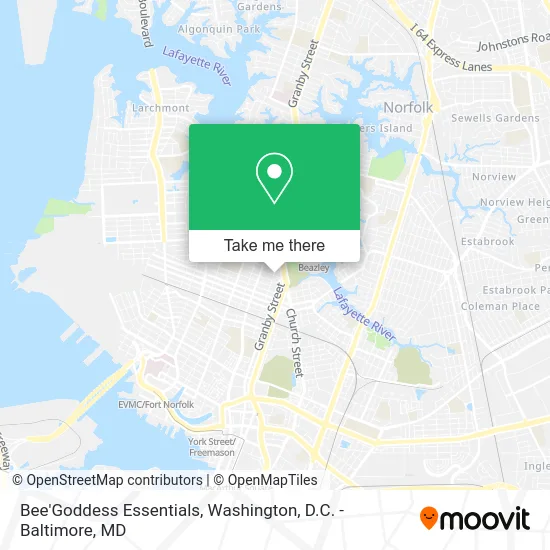
See Bee'Goddess Essentials, Norfolk, on the map
Public Transit to Bee'Goddess Essentials in Norfolk
Wondering how to get to Bee'Goddess Essentials in Norfolk? Moovit helps you find the best way to get to Bee'Goddess Essentials with step-by-step directions from the nearest public transit station.
Moovit provides free maps and live directions to help you navigate through your city. View schedules, routes, timetables, and find out how long does it take to get to Bee'Goddess Essentials in real time.
Looking for the nearest stop or station to Bee'Goddess Essentials? Check out this list of stops closest to your destination: Granby & 33rd; Colonial & 35th; Monticello & 25th; York Street Freemason Station.
Bus: 001, 023, 961, 011, 003.Light Rail: 800.
Want to see if there’s another route that gets you there at an earlier time? Moovit helps you find alternative routes or times. Get directions from and directions to Bee'Goddess Essentials easily from the Moovit App or Website.
We make riding to Bee'Goddess Essentials easy, which is why over 1.5 million users, including users in Norfolk, trust Moovit as the best app for public transit. You don’t need to download an individual bus app or train app, Moovit is your all-in-one transit app that helps you find the best bus time or train time available.
For information on prices of bus, train and light rail, costs and ride fares to Bee'Goddess Essentials, please check the Moovit app.
Use the app to navigate to popular places including to the airport, hospital, stadium, grocery store, mall, coffee shop, school, college, and university.
Bee'Goddess Essentials Address: 3100 Omohundro Ave Norfolk, VA 23504 street in Norfolk
- Downtown Church of Christ,
- Star Auto Body,
- FBL Small Business Loans Norfolk,
- Faith Community Church,
- Craig's Moving Services Inc.,
- New E3 School,
- YMCA,
- Y on Granby,
- Sentara Therapy Center - Granby YMCA,
- Prayer & Deliverance Center,
- The Virginia Landmarks Register,
- Godsey's Garage,
- Norfolk Discount Tires,
- Granby Tire,
- Golden Arm Auto Repair,
- Norfolk Evangelistic Church,
- Mekane Hiwot Abune Gebre Menfes Kidus Ethiopian Orthodox Tewahido Church,
- Faith Fellowship Christian Center,
- Luvisluv,
- Garden of Prayer No. 3 Cogic
Places Near Bee'Goddess Essentials (Norfolk)
- Camden Yards, Baltimore,
- Westfield Montgomery Mall, Montgomery County,
- PG Mall, Prince George's County,
- Basilica of the National Shrine, Washington,
- Washington National Cathedral, Washington,
- Warner Theatre, Washington,
- National Museum of African American History and Culture, Washington,
- M&T Bank Stadium, Baltimore,
- The Anthem, Washington,
- Georgetown, Washington,
- Marriott Marquis Washington, DC, Washington,
- National Zoo, Washington,
- Museum Of The Bible, Washington,
- Pennsylvania Ave NW (3rd st and pennsylvania), Washington,
- Rock Creek Tennis Center, Washington,
- Washington DC VA Medical Center, Washington,
- National Mall, Washington,
- Sibley Memorial Hospital, Washington,
- Capital One Arena, Washington,
- Amazon Hq2, Arlington County
How to get to popular places in Washington, D.C. - Baltimore, MD with public transit
Get around Norfolk by public transit!
Traveling around Norfolk has never been so easy. See step by step directions as you travel to any attraction, street or major public transit station. View bus and train schedules, arrival times, service alerts and detailed routes on a map, so you know exactly how to get to anywhere in Norfolk.
When traveling to any destination around Norfolk use Moovit's Live Directions with Get Off Notifications to know exactly where and how far to walk, how long to wait for your line, and how many stops are left. Moovit will alert you when it's time to get off — no need to constantly re-check whether yours is the next stop.
Wondering how to use public transit in Norfolk or how to pay for public transit in Norfolk? Moovit public transit app can help you navigate your way with public transit easily, and at minimum cost. It includes public transit fees, ticket prices, and costs. Looking for a map of Norfolk public transit lines? Moovit public transit app shows all public transit maps in Norfolk with all Bus, Train, Metro, Light Rail and Ferry routes and stops on an interactive map.
Washington, D.C. - Baltimore, MD has 5 transit type(s), including: Bus, Train, Metro, Light Rail and Ferry, operated by several transit agencies, including WMATA, Montgomery County Ride On, Fairfax Connector, TheBus, PRTC, DASH - Alexandria, Arlington Transit (ART), RTA of Central Maryland, MDOT MTA, MDOT MTA Light RailLink, MDOT MTA Commuter Bus, MDOT MTA Local Bus, FXBGO!, Virginia Railway Express (VRE) and MARC