Belford Roxo station - Thursday schedule
| Line | Direction | Time |
|---|---|---|
| EXTENSÃO PARACAMBI | Japeri | 4:48 AM |
| EXTENSÃO PARACAMBI | Japeri | 5:06 AM |
| EXTENSÃO PARACAMBI | Japeri | 5:21 AM |
| EXTENSÃO PARACAMBI | Japeri | 5:36 AM |
| EXTENSÃO PARACAMBI | Paracambi | 5:52 AM |
| EXTENSÃO PARACAMBI | Paracambi | 6:07 AM |
| EXTENSÃO PARACAMBI | Japeri | 6:09 AM |
| EXTENSÃO PARACAMBI | Paracambi | 6:22 AM |
| EXTENSÃO PARACAMBI | Japeri | 6:24 AM |
| EXTENSÃO PARACAMBI | Japeri | 6:39 AM |
| EXTENSÃO PARACAMBI | Paracambi | 6:42 AM |
| EXTENSÃO PARACAMBI | Paracambi | 7:06 AM |
| EXTENSÃO PARACAMBI | Japeri | 7:12 AM |
| EXTENSÃO PARACAMBI | Japeri | 7:27 AM |
| EXTENSÃO PARACAMBI | Paracambi | 7:30 AM |
| EXTENSÃO PARACAMBI | Japeri | 7:42 AM |
| EXTENSÃO PARACAMBI | Paracambi | 7:57 AM |
| EXTENSÃO PARACAMBI | Japeri | 8:02 AM |
| EXTENSÃO PARACAMBI | Paracambi | 8:29 AM |
| EXTENSÃO PARACAMBI | Japeri | 8:34 AM |
| EXTENSÃO PARACAMBI | Paracambi | 9:01 AM |
| EXTENSÃO PARACAMBI | Japeri | 9:05 AM |
| EXTENSÃO PARACAMBI | Paracambi | 9:31 AM |
| EXTENSÃO PARACAMBI | Japeri | 9:35 AM |
| EXTENSÃO PARACAMBI | Paracambi | 10:01 AM |
Directions to Belford Roxo station with public transit
The following transit lines have routes that pass near Belford Roxo
 Bus: 136I, 175I, 445I, 525I, 707I.
- Train: RAMAL BELFORD ROXO, RAMAL JAPERI.
How to get to Belford Roxo station by bus?
Click on the bus route to see step by step directions with maps, line arrival times and updated time schedules.
How to get to Belford Roxo station by train?
Click on the train route to see step by step directions with maps, line arrival times and updated time schedules.
Bus stops near Belford Roxo stop
- Avenida Florípes Da Rocha, 79, 2 min walk,
- Avenida Benjamin Pinto Dias, 865, 2 min walk,
- Avenida Benjamin Pinto Dias, 1495-1551, 6 min walk,
- Estação De Belford Roxo, 7 min walk,
- Ponto Final - Belford Roxo (Linha 7017), 8 min walk,
Train stations near Belford Roxo station
- Vila Rosali, 21 min walk,
- Presidente Juscelino, 37 min walk,
Bus lines to Belford Roxo station
- 451I, Nova Iguaçu,
- 522B, São Vicente,
- 523B, Central (Parador),
- RECANTUS - BELFORD ROXO (VIA JAMBUÍ), Recantus - Belford Roxo (Via Jambuí),
- TZ01, Jardim Glaúcia - Centro (via Bom Pastor / Gogó da Ema),
- TZ03, Cantão - Atacadão (via Centro),
- 115I, Caxias - Nova Iguaçu (Direto),
- 116I, Caxias - Nova Iguaçu (Via Vila Pauline),
- 120I, Nova Iguaçu - Belford Roxo (via Prata),
- 136I, Caxias - Nova Iguaçu (Via Vilar dos Teles),
- 175I, Queimados - Belford Roxo (via Dutra),
- 200I, Nova Iguaçu - Belford Roxo (Via Areia Branca),
- 201I, Nova Iguaçu - Belford Roxo (Via Engenho Pequeno),
- 205I, Nova Iguaçu - Belford Roxo (Via Piam),
- 206I, Nova Iguaçu - Belford Roxo (Via Estrada do Iguaçu),
- 400, Belford Roxo - Barra da Tijuca (Via Linha Amarela),
- 400T, Belford Roxo - Barra da Tijuca (Via Linha Amarela),
- 421I, Geneciano - Pavuna (Via Miguel Couto / Shangri-Lá),
- 422I, Geneciano - Pavuna (Via Grama / Itaipu),
- 423I, Tinguá - Pavuna,
What are the closest stations to Belford Roxo?
The closest stations to Belford Roxo are:
- Avenida Florípes Da Rocha, 79 stop is 42 meters away, 2 min walk.
- Avenida Benjamin Pinto Dias, 865 stop is 134 meters away, 2 min walk.
- Avenida Benjamin Pinto Dias, 1495-1551 stop is 467 meters away, 6 min walk.
- Estação De Belford Roxo stop is 513 meters away, 7 min walk.
- Ponto Final - Belford Roxo (Linha 7017) stop is 542 meters away, 8 min walk.
- Vila Rosali station is 1616 meters away, 21 min walk.
- Presidente Juscelino station is 2870 meters away, 37 min walk.
Which bus lines stop near Belford Roxo?
These bus lines stop near Belford Roxo: 136I, 175I, 445I, 525I, 707I, 729L, 800L.
Which train line stops near Belford Roxo?
RAMAL BELFORD ROXO (Belford Roxo)
What’s the nearest train station to Belford Roxo?
The nearest train station to Belford Roxo is Vila Rosali. It’s a 21 min walk away.
What’s the nearest bus station to Belford Roxo?
The nearest bus stations to Belford Roxo are Avenida Florípes Da Rocha, 79 and Avenida Benjamin Pinto Dias, 865. The closest one is a 2 min walk away.
What time is the first train to Belford Roxo?
The RAMAL JAPERI is the first train that goes to Belford Roxo. It stops nearby at 4:43 AM.
What time is the last train to Belford Roxo?
The RAMAL JAPERI is the last train that goes to Belford Roxo. It stops nearby at 11:22 PM.
What time is the first bus to Belford Roxo?
The 445I is the first bus that goes to Belford Roxo. It stops nearby at 3:20 AM.
What time is the last bus to Belford Roxo?
The 421I is the last bus that goes to Belford Roxo. It stops nearby at 2:49 AM.
Belford Roxo station
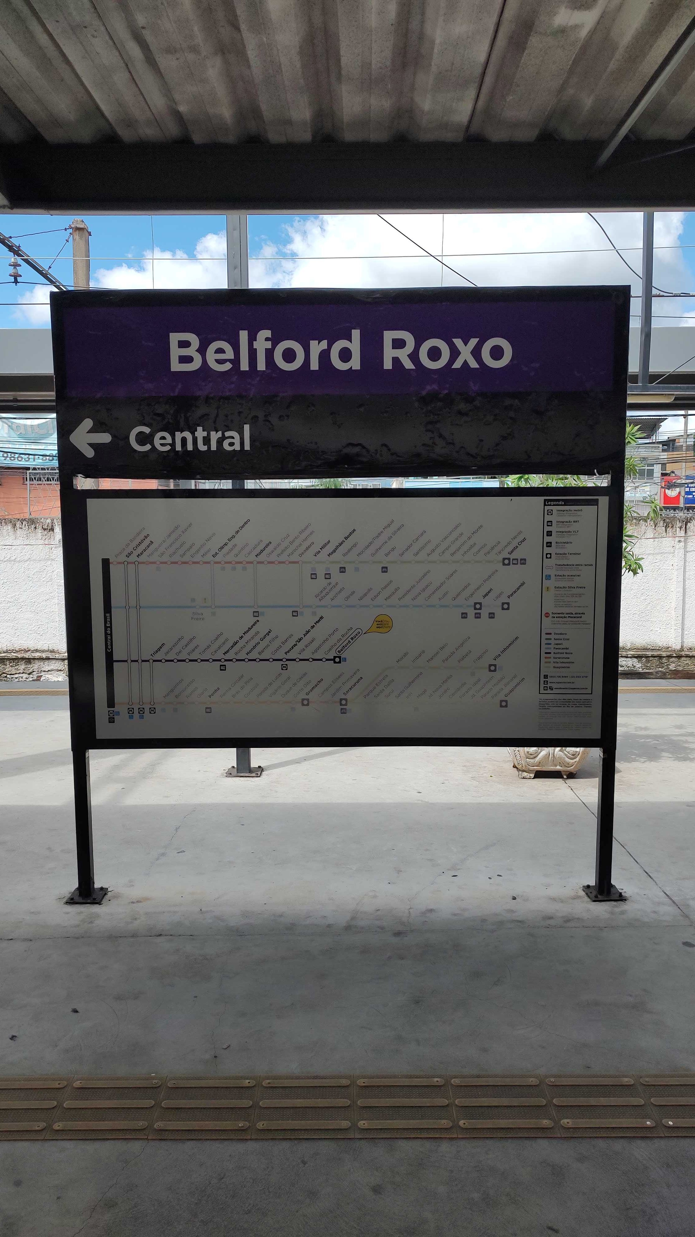 Taken by Anonymous
See Belford Roxo station on the map
Public transit to Belford Roxo station
Looking for directions to Belford Roxo in Belford Roxo, Brazil?
Download the Moovit App to find the current schedule and step-by-step directions for Bus or Train routes that pass through Belford Roxo.
Looking for the nearest stops closest to Belford Roxo ? Check out this list of closest stops to your destination: Avenida Florípes Da Rocha; Avenida Benjamin Pinto Dias; Avenida Benjamin Pinto Dias; Estação De Belford Roxo; Ponto Final - Belford Roxo (Linha 7017); Vila Rosali; Presidente Juscelino.
Bus: 136I, 175I, 445I, 525I, 707I, 729L, 800L, 451I, 522B, 523B, RECANTUS - BELFORD ROXO (VIA JAMBUÍ), TZ01, TZ03, 115I, 116I, 714I.Train: RAMAL BELFORD ROXO, RAMAL JAPERI.
We make riding on public transit to Belford Roxo easy, which is why over 1.7 billion users, including users in Belford Roxo trust Moovit as the best app for public transit.
Use the app to navigate to popular places including to the airport, hospital, stadium, grocery store, mall, coffee shop, school, college, and university.
The station has the following entrances: Av. Florípes Da Rocha and R. José Haddad
The first line to this station is EXTENSÃO PARACAMBI, at 4:48 AM, and the last line is EXTENSÃO PARACAMBI at 10:29 PM.
s/n Avenida Floripes da Rocha, Belford Roxo, Brazil
This station serves TrensRJ’s lines

Popular routes from Belford Roxo station
- Avenida Florípes Da Rocha, 79,
- Avenida Benjamin Pinto Dias, 865,
- Avenida Benjamin Pinto Dias, 1495-1551,
- Estação De Belford Roxo,
- Ponto Final - Belford Roxo (Linha 7017)
Bus stops near Belford Roxo stop
- Vila Rosali,
- Presidente Juscelino
Train stations near Belford Roxo station
- Praça Antero De Quental,
- Estr. Engenho D'Água | Parkjacarepaguá (Acesso 2),
- Rua João Vicente | Estação De Trem,
- Rua Francisca Haiden,
- Terminal Do Recreio,
- Ponto Final - Sargento Roncalli,
- Terminal De Irajá (Rua Hipócrates - Linha 905),
- Rua Barão De Mesquita, 159,
- Tomás Coelho,
- Rodovia Presidente Dutra (Andina Coca-Cola),
- Rodovia Washington Luiz (Sentido Petrópolis) | Viaduto Do Maracanã,
- Centro Universitário Celso Lisboa (Sentido Méier),
- Saara,
- Ponto Final - Praia Da Barra De Guaratiba,
- Estr. Do Portela | Madureira Shopping,
- Jacarezinho,
- Praça Varnhagen,
- 4° Batalhão Da Polícia Militar,
- Ponto Final - Maria Paula,
- Posto De Saúde Do Rio Do Ouro
Popular public transit stations in Belford Roxo
Get around Belford Roxo by public transit!
Traveling around Belford Roxo has never been so easy. See step by step directions as you travel to any attraction, street or major public transit station. View bus and train schedules, arrival times, service alerts and detailed routes on a map, so you know exactly how to get to anywhere in Belford Roxo.
When traveling to any destination around Belford Roxo use Moovit's Live Directions with Get Off Notifications to know exactly where and how far to walk, how long to wait for your line, and how many stops are left. Moovit will alert you when it's time to get off — no need to constantly re-check whether yours is the next stop.
Wondering how to use public transit in Belford Roxo or how to pay for public transit in Belford Roxo? Moovit public transit app can help you navigate your way with public transit easily, and at minimum cost. It includes public transit fees, ticket prices, and costs. Looking for a map of Belford Roxo public transit lines? Moovit public transit app shows all public transit maps in Belford Roxo with all Bus, Train, Metro, Light Rail, Ferry, Cable Car, Gondola and Funicular routes and stops on an interactive map.
Rio de Janeiro Region has 8 transit type(s), including: Bus, Train, Metro, Light Rail, Ferry, Cable Car, Gondola and Funicular, operated by several transit agencies, including TrensRJ, Metrô Rio, VLT Carioca, Barcas Rio, BRT MOBI-Rio, Auto Viação Alpha, Auto Viação Tijuca, Gire Transportes, Transurb, Viação Nossa Senhora das Graças, Consórcio INTERSUL, Braso Lisboa, Caprichosa Auto Ônibus, Auto Viação Três Amigos and Rodoviária Âncora Matias