How to get to Bell Designs by bus?
Click on the bus route to see step by step directions with maps, line arrival times and updated time schedules.
From I-695 @ Exit 27 (Dulaney Valley Road/MD 146), Baltimore County
56 minFrom Baltimore Museum Of Art, Baltimore
61 minFrom Johns Hopkins Bayview Medical Center, Baltimore
60 minFrom Johns Hopkins University, Baltimore
62 minFrom I-695 Exit 29 (Loch Raven Blvd (MD 542)/Cromwell Bridge Rd), Baltimore County
50 minFrom Canton, Baltimore
61 minFrom I-695 @ Exit 26 (York Rd/MD 45), Baltimore County
52 minFrom Patterson Park, Baltimore
53 minFrom Bwi2 Employee Shuttles, Baltimore
89 minFrom Harford Road, Baltimore
43 min
Bus stops near Bell Designs in Baltimore County
Bus lines to Bell Designs in Baltimore County
What are the closest stations to Bell Designs?
The closest stations to Bell Designs are:
- Kenwood Ave & Sipple Ave Opp Eb is 886 yards away, 11 min walk.
- Belair Rd & Thorncliff Rd Nb is 1229 yards away, 15 min walk.
Which bus lines stop near Bell Designs?
These bus lines stop near Bell Designs: 33, 36.
What’s the nearest bus station to Bell Designs in Baltimore County?
The nearest bus station to Bell Designs in Baltimore County is Kenwood Ave & Sipple Ave Opp Eb. It’s a 11 min walk away.
What time is the first bus to Bell Designs in Baltimore County?
The 36 is the first bus that goes to Bell Designs in Baltimore County. It stops nearby at 5:15 AM.
What time is the last bus to Bell Designs in Baltimore County?
The 33 is the last bus that goes to Bell Designs in Baltimore County. It stops nearby at 12:11 AM.
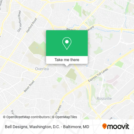
See Bell Designs, Baltimore County, on the map
Public Transit to Bell Designs in Baltimore County
Wondering how to get to Bell Designs in Baltimore County? Moovit helps you find the best way to get to Bell Designs with step-by-step directions from the nearest public transit station.
Moovit provides free maps and live directions to help you navigate through your city. View schedules, routes, timetables, and find out how long does it take to get to Bell Designs in real time.
Looking for the nearest stop or station to Bell Designs? Check out this list of stops closest to your destination: Kenwood Ave & Sipple Ave Opp Eb; Belair Rd & Thorncliff Rd Nb.
Bus: 33, 36, 115.
Want to see if there’s another route that gets you there at an earlier time? Moovit helps you find alternative routes or times. Get directions from and directions to Bell Designs easily from the Moovit App or Website.
We make riding to Bell Designs easy, which is why over 1.5 million users, including users in Baltimore County, trust Moovit as the best app for public transit. You don’t need to download an individual bus app or train app, Moovit is your all-in-one transit app that helps you find the best bus time or train time available.
For information on prices of bus, costs and ride fares to Bell Designs, please check the Moovit app.
Use the app to navigate to popular places including to the airport, hospital, stadium, grocery store, mall, coffee shop, school, college, and university.
Bell Designs Address: 5153 Terrace Dr Nottingham, MD 21236 street in Baltimore County
- McKoy & Sons Electricians,
- Terrace Tavern,
- Birdland Bowtique,
- Baltimore County Gop,
- Shea's Pop,
- Ziebart,
- Direct Home Nurturing,
- Mercy & Grace,
- Ebenezer Ame Church,
- Kenwood Avenue,
- GOODYEAR,
- Rev Andre Godsey,
- The Man Cave,
- Overlea, Maryland,
- VIP Bail Bonds,
- Romero, Frank J,
- Vision Wrecker Service,
- U-Haul,
- Cricket Wireless Authorized Retailer,
- Yamaha Motorcycle Promotions
Places Near Bell Designs (Baltimore County)
- Museum Of The Bible, Washington,
- The Anthem, Washington,
- Basilica of the National Shrine, Washington,
- Georgetown, Washington,
- M&T Bank Stadium, Baltimore,
- Amazon Hq2, Arlington County,
- Rock Creek Tennis Center, Washington,
- National Museum of African American History and Culture, Washington,
- Pennsylvania Ave NW (3rd st and pennsylvania), Washington,
- National Mall, Washington,
- Sibley Memorial Hospital, Washington,
- Capital One Arena, Washington,
- Marriott Marquis Washington, DC, Washington,
- Westfield Montgomery Mall, Montgomery County,
- Washington National Cathedral, Washington,
- PG Mall, Prince George's County,
- Warner Theatre, Washington,
- Camden Yards, Baltimore,
- National Zoo, Washington,
- Washington DC VA Medical Center, Washington
How to get to popular places in Washington, D.C. - Baltimore, MD with public transit
Get around Baltimore County by public transit!
Traveling around Baltimore County has never been so easy. See step by step directions as you travel to any attraction, street or major public transit station. View bus and train schedules, arrival times, service alerts and detailed routes on a map, so you know exactly how to get to anywhere in Baltimore County.
When traveling to any destination around Baltimore County use Moovit's Live Directions with Get Off Notifications to know exactly where and how far to walk, how long to wait for your line, and how many stops are left. Moovit will alert you when it's time to get off — no need to constantly re-check whether yours is the next stop.
Wondering how to use public transit in Baltimore County or how to pay for public transit in Baltimore County? Moovit public transit app can help you navigate your way with public transit easily, and at minimum cost. It includes public transit fees, ticket prices, and costs. Looking for a map of Baltimore County public transit lines? Moovit public transit app shows all public transit maps in Baltimore County with all Bus, Train, Metro, Light Rail and Ferry routes and stops on an interactive map.
Washington, D.C. - Baltimore, MD has 5 transit type(s), including: Bus, Train, Metro, Light Rail and Ferry, operated by several transit agencies, including WMATA, Montgomery County Ride On, Fairfax Connector, TheBus, PRTC, DASH - Alexandria, Arlington Transit (ART), RTA of Central Maryland, MDOT MTA, MDOT MTA Light RailLink, MDOT MTA Commuter Bus, MDOT MTA Local Bus, FXBGO!, Virginia Railway Express (VRE) and MARC