How to get to Bells United Methodist Church by bus?
Click on the bus route to see step by step directions with maps, line arrival times and updated time schedules.
From Saint Elizabeth's West Campus (DHS/USCG), Washington
61 minFrom U.S. Naval Research Laboratory - NRL, Washington
63 minFrom Naval Research Lab, Washington
63 minFrom Ballou High School, Washington
62 minFrom St Elizabeths Hospital, Washington
64 minFrom The Capital Wheel at the National Harbor, Prince George's County
49 minFrom THEARC, Washington
61 minFrom Headquarters - U.S. Coast Guard, Washington
84 minFrom Navy Lodge, Washington
67 minFrom Washington Nationals Youth Baseball Academy, Washington
88 min
How to get to Bells United Methodist Church by metro?
Click on the metro route to see step by step directions with maps, line arrival times and updated time schedules.
Bus stops near Bells United Methodist Church in Prince George's County
Metro station near Bells United Methodist Church in Prince George's County
- Branch Avenue, 45 min walk,VIEW
Bus lines to Bells United Methodist Church in Prince George's County
What are the closest stations to Bells United Methodist Church?
The closest stations to Bells United Methodist Church are:
- Allentown Road at Perrie Lane is 92 yards away, 2 min walk.
- Allentown Rd + Perrie Lane is 92 yards away, 2 min walk.
- Allentown Rd & Old Branch Ave is 615 yards away, 8 min walk.
- Old Branch Avenue at Pgcc Skilled Trade Center is 862 yards away, 11 min walk.
- Branch Avenue is 3775 yards away, 45 min walk.
Which bus lines stop near Bells United Methodist Church?
These bus lines stop near Bells United Methodist Church: P86, P87, P88.
Which metro line stops near Bells United Methodist Church?
GREEN (Branch Av)
What’s the nearest bus station to Bells United Methodist Church in Prince George's County?
The nearest bus stations to Bells United Methodist Church in Prince George's County are Allentown Road at Perrie Lane and Allentown Rd + Perrie Lane. The closest one is a 2 min walk away.
What time is the first metro to Bells United Methodist Church in Prince George's County?
The GREEN is the first metro that goes to Bells United Methodist Church in Prince George's County. It stops nearby at 5:00 AM.
What time is the last metro to Bells United Methodist Church in Prince George's County?
The GREEN is the last metro that goes to Bells United Methodist Church in Prince George's County. It stops nearby at 12:34 AM.
What time is the first bus to Bells United Methodist Church in Prince George's County?
The P87 is the first bus that goes to Bells United Methodist Church in Prince George's County. It stops nearby at 5:32 AM.
What time is the last bus to Bells United Methodist Church in Prince George's County?
The P87 is the last bus that goes to Bells United Methodist Church in Prince George's County. It stops nearby at 12:03 AM.
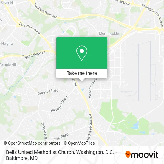
See Bells United Methodist Church, Prince George's County, on the map
Public Transit to Bells United Methodist Church in Prince George's County
Wondering how to get to Bells United Methodist Church in Prince George's County? Moovit helps you find the best way to get to Bells United Methodist Church with step-by-step directions from the nearest public transit station.
Moovit provides free maps and live directions to help you navigate through your city. View schedules, routes, timetables, and find out how long does it take to get to Bells United Methodist Church in real time.
Looking for the nearest stop or station to Bells United Methodist Church? Check out this list of stops closest to your destination: Allentown Road at Perrie Lane; Allentown Rd + Perrie Lane; Allentown Rd & Old Branch Ave; Old Branch Avenue at Pgcc Skilled Trade Center; Branch Avenue.
Bus: P86, P87, P88, P85, P84.Metro: GREEN.
Want to see if there’s another route that gets you there at an earlier time? Moovit helps you find alternative routes or times. Get directions from and directions to Bells United Methodist Church easily from the Moovit App or Website.
We make riding to Bells United Methodist Church easy, which is why over 1.5 million users, including users in Prince George's County, trust Moovit as the best app for public transit. You don’t need to download an individual bus app or train app, Moovit is your all-in-one transit app that helps you find the best bus time or train time available.
For information on prices of bus and metro, costs and ride fares to Bells United Methodist Church, please check the Moovit app.
Use the app to navigate to popular places including to the airport, hospital, stadium, grocery store, mall, coffee shop, school, college, and university.
Bells United Methodist Church Address: Allentown Road street in Prince George's County
- Leon St MD-337,
- Social Security Administration,
- Mecmo Pharmacy,
- Costello & Edwards, LLC,
- Royal Farms,
- Dr Eunice Shakir, MD (Dr Monica Riley, MD),
- Kaiser Permanente,
- Emerson L Coronel,
- FedEx,
- Weight Height Bmi Blood Pressure Waist Measurement,
- VA Clinic Andrews,
- Topolino Italian Cuisine & Buffet,
- 2nd Ave Thrift Superstore,
- Bontica Gardens (Botanica Gardens),
- New Look African Hair Brading,
- Andrews Federal Credit Union,
- Emerald Spa - Asian Massage Spa,
- Transformation Fellowship Church,
- Camp Springs Allentown Rd,
- Emergency Room
Places Near Bells United Methodist Church (Prince George's County)
- National Mall, Washington,
- Georgetown, Washington,
- Museum Of The Bible, Washington,
- Washington National Cathedral, Washington,
- Westfield Montgomery Mall, Montgomery County,
- The Anthem, Washington,
- Sibley Memorial Hospital, Washington,
- Camden Yards, Baltimore,
- M&T Bank Stadium, Baltimore,
- Pennsylvania Ave NW (3rd st and pennsylvania), Washington,
- Basilica of the National Shrine, Washington,
- Washington DC VA Medical Center, Washington,
- National Zoo, Washington,
- Capital One Arena, Washington,
- PG Mall, Prince George's County,
- National Museum of African American History and Culture, Washington,
- Warner Theatre, Washington,
- Amazon Hq2, Arlington County,
- Marriott Marquis Washington, DC, Washington,
- Rock Creek Tennis Center, Washington
How to get to popular places in Washington, D.C. - Baltimore, MD with public transit
Get around Prince George's County by public transit!
Traveling around Prince George's County has never been so easy. See step by step directions as you travel to any attraction, street or major public transit station. View bus and train schedules, arrival times, service alerts and detailed routes on a map, so you know exactly how to get to anywhere in Prince George's County.
When traveling to any destination around Prince George's County use Moovit's Live Directions with Get Off Notifications to know exactly where and how far to walk, how long to wait for your line, and how many stops are left. Moovit will alert you when it's time to get off — no need to constantly re-check whether yours is the next stop.
Wondering how to use public transit in Prince George's County or how to pay for public transit in Prince George's County? Moovit public transit app can help you navigate your way with public transit easily, and at minimum cost. It includes public transit fees, ticket prices, and costs. Looking for a map of Prince George's County public transit lines? Moovit public transit app shows all public transit maps in Prince George's County with all Bus, Train, Metro, Light Rail and Ferry routes and stops on an interactive map.
Washington, D.C. - Baltimore, MD has 5 transit type(s), including: Bus, Train, Metro, Light Rail and Ferry, operated by several transit agencies, including WMATA, Montgomery County Ride On, Fairfax Connector, TheBus, PRTC, DASH - Alexandria, Arlington Transit (ART), RTA of Central Maryland, MDOT MTA, MDOT MTA Light RailLink, MDOT MTA Commuter Bus, MDOT MTA Local Bus, FXBGO!, Virginia Railway Express (VRE) and MARC