Directions to Belt Tech (Tazewell County) with public transportation
The following transit lines have routes that pass near Belt Tech
Bus stops near Belt Tech in Tazewell County
Bus lines to Belt Tech in Tazewell County
- Centre Stage Hair Design,
- Rodriguez Funeral Homes,
- Kovach David A Dr DDS,
- Misty Cline DDS,
- First Methodist Church,
- First United Methodist Church,
- Presbyterian Church,
- Plaster Adam C DDS PC,
- James Dyer - Pt-Clinic,
- Classic Auto and Machine,
- Four Seasons Rehab,
- First Century Bank,
- Summit Community Bank,
- Premier Realty,
- Graham Presbyterian Church,
- Nationwide Insurance: the Blankenship Agency,
- Brinegar Thomas E,
- Bluefield Insurance Agency,
- Identity America,
- Evan's Sweets
Places Near Belt Tech (Tazewell County)
- Museum Of The Bible, Washington,
- The Anthem, Washington,
- Basilica of the National Shrine, Washington,
- Georgetown, Washington,
- M&T Bank Stadium, Baltimore,
- Amazon Hq2, Arlington County,
- Rock Creek Tennis Center, Washington,
- National Museum of African American History and Culture, Washington,
- Pennsylvania Ave NW (3rd st and pennsylvania), Washington,
- National Mall, Washington,
- Sibley Memorial Hospital, Washington,
- Capital One Arena, Washington,
- Marriott Marquis Washington, DC, Washington,
- Westfield Montgomery Mall, Montgomery County,
- Washington National Cathedral, Washington,
- PG Mall, Prince George's County,
- Warner Theatre, Washington,
- Camden Yards, Baltimore,
- National Zoo, Washington,
- Washington DC VA Medical Center, Washington
How to get to popular places in Washington, D.C. - Baltimore, MD with public transit
What are the closest stations to Belt Tech?
The closest stations to Belt Tech are:
- 427 Virginia Ave at Treasury Office is 713 yards away, 9 min walk.
- Hardee'S, Bluefield is 1223 yards away, 15 min walk.
- Bluefield-Underpass Near Crescentview Apts is 1313 yards away, 16 min walk.
Which bus line stops near Belt Tech?
GREYHOUND US0140 (Detroit Bus Station)
What’s the nearest bus station to Belt Tech in Tazewell County?
The nearest bus station to Belt Tech in Tazewell County is 427 Virginia Ave at Treasury Office. It’s a 9 min walk away.
What time is the first bus to Belt Tech in Tazewell County?
The SWVCC EAGLE EXPRESS TAZEWELL COUNTY is the first bus that goes to Belt Tech in Tazewell County. It stops nearby at 6:00 AM.
What time is the last bus to Belt Tech in Tazewell County?
The SWVCC EAGLE EXPRESS TAZEWELL COUNTY is the last bus that goes to Belt Tech in Tazewell County. It stops nearby at 6:15 PM.
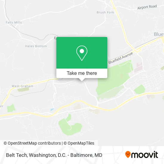
See Belt Tech, Tazewell County, on the map
Public Transit to Belt Tech in Tazewell County
Wondering how to get to Belt Tech in Tazewell County? Moovit helps you find the best way to get to Belt Tech with step-by-step directions from the nearest public transit station.
Moovit provides free maps and live directions to help you navigate through your city. View schedules, routes, timetables, and find out how long does it take to get to Belt Tech in real time.
Looking for the nearest stop or station to Belt Tech? Check out this list of stops closest to your destination: 427 Virginia Ave at Treasury Office; Hardee'S; Bluefield-Underpass Near Crescentview Apts.
Bus: GREYHOUND US0140, GOLD, MAIN, POCAHONTAS, SWVCC EAGLE EXPRESS TAZEWELL COUNTY.
Want to see if there’s another route that gets you there at an earlier time? Moovit helps you find alternative routes or times. Get directions from and directions to Belt Tech easily from the Moovit App or Website.
We make riding to Belt Tech easy, which is why over 1.5 million users, including users in Tazewell County, trust Moovit as the best app for public transit. You don’t need to download an individual bus app or train app, Moovit is your all-in-one transit app that helps you find the best bus time or train time available.
For information on prices of bus and train, costs and ride fares to Belt Tech, please check the Moovit app.
Use the app to navigate to popular places including to the airport, hospital, stadium, grocery store, mall, coffee shop, school, college, and university.
Belt Tech Address: 307 Skyline Dr Bluefield, VA 24605 street in Tazewell County
Get around Tazewell County by public transit!
Traveling around Tazewell County has never been so easy. See step by step directions as you travel to any attraction, street or major public transit station. View bus and train schedules, arrival times, service alerts and detailed routes on a map, so you know exactly how to get to anywhere in Tazewell County.
When traveling to any destination around Tazewell County use Moovit's Live Directions with Get Off Notifications to know exactly where and how far to walk, how long to wait for your line, and how many stops are left. Moovit will alert you when it's time to get off — no need to constantly re-check whether yours is the next stop.
Wondering how to use public transit in Tazewell County or how to pay for public transit in Tazewell County? Moovit public transit app can help you navigate your way with public transit easily, and at minimum cost. It includes public transit fees, ticket prices, and costs. Looking for a map of Tazewell County public transit lines? Moovit public transit app shows all public transit maps in Tazewell County with all Bus, Train, Metro, Light Rail and Ferry routes and stops on an interactive map.
Washington, D.C. - Baltimore, MD has 5 transit type(s), including: Bus, Train, Metro, Light Rail and Ferry, operated by several transit agencies, including WMATA, Montgomery County Ride On, Fairfax Connector, TheBus, PRTC, DASH - Alexandria, Arlington Transit (ART), RTA of Central Maryland, MDOT MTA, MDOT MTA Light RailLink, MDOT MTA Commuter Bus, MDOT MTA Local Bus, FXBGO!, Virginia Railway Express (VRE) and MARC