How to get to Besson by bus?
Click on the bus route to see step by step directions with maps, line arrival times and updated time schedules.
From Chennevières-Sur-Marne, Chennevières-Sur-Marne
108 minFrom Ormesson-Sur-Marne, Ormesson-Sur-Marne
121 minFrom Domus, Rosny-Sous-Bois
78 minFrom Villeparisis, Villeparisis
43 minFrom Consulat d'Algerie, Bobigny
72 minFrom Centre Commercial Pontault-Combault, Pontault-Combault
91 minFrom Ofpra, Fontenay-Sous-Bois
53 minFrom Rosny 2, Rosny-Sous-Bois
74 minFrom IKEA, Villiers-Sur-Marne
77 minFrom Claye-Souilly, Claye-Souilly
33 min
Bus stops near Besson in Torcy
RER station near Besson in Torcy
- Chelles - Gournay, 9 min walk,VIEW
Bus lines to Besson in Torcy
- 2, Paul Algis - Gare De Chelles - Gournay,VIEW
- 3, Gare De Chelles - Gournay - Gare De Villeparisis - Mitry-Le-Neuf,VIEW
- 4, Gare De Chelles - Gournay - Mairie,VIEW
- 6, Gare De Chelles - Gournay - Gare De Vaires - Torcy (nord),VIEW
- 7, Désiré Lefèvre - Gare De Chelles - Gournay,VIEW
- 9, Gare De Chelles - Gournay - Gare De Chelles - Gournay,VIEW
- 113, Mairie - Nogent-Sur-Marne Rer,VIEW
- 613, Gare De Chelles - Gournay - Gare D'aulnay-Sous-Bois,VIEW
- 8S, Mairie - Vieux Moulin,VIEW
- 9S, Cité Scolaire - Bois Madame,VIEW
- 1, Hôpital de Montfermeil,VIEW
- EX 19, Roissypole - Aéroport Cdg1 (G2),VIEW
What are the closest stations to Besson?
The closest stations to Besson are:
- Mairie is 110 meters away, 2 min walk.
- Aulnoy is 390 meters away, 6 min walk.
- Carrefour Des Déportés is 425 meters away, 6 min walk.
- Chelles - Gournay is 645 meters away, 9 min walk.
Which bus lines stop near Besson?
These bus lines stop near Besson: 113, 213, 3, 4, 613.
Which RER line stops near Besson?
E (Tournan/ Chelles - Gournay)
What’s the nearest bus station to Besson in Torcy?
The nearest bus station to Besson in Torcy is Mairie. It’s a 2 min walk away.
What’s the nearest RER station to Besson in Torcy?
The nearest RER station to Besson in Torcy is Chelles - Gournay. It’s a 9 min walk away.
What time is the first train to Besson in Torcy?
The P is the first train that goes to Besson in Torcy. It stops nearby at 5:14 AM.
What time is the last train to Besson in Torcy?
The P is the last train that goes to Besson in Torcy. It stops nearby at 10:15 PM.
What time is the first bus to Besson in Torcy?
The 613 is the first bus that goes to Besson in Torcy. It stops nearby at 4:30 AM.
What time is the last bus to Besson in Torcy?
The 613 is the last bus that goes to Besson in Torcy. It stops nearby at 2:01 AM.
What time is the first RER to Besson in Torcy?
The E is the first RER that goes to Besson in Torcy. It stops nearby at 5:03 AM.
What time is the last RER to Besson in Torcy?
The E is the last RER that goes to Besson in Torcy. It stops nearby at 11:29 PM.
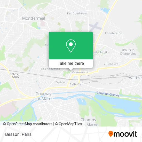
See Besson, Torcy, on the map
Public Transit to Besson in Torcy
Wondering how to get to Besson in Torcy? Moovit helps you find the best way to get to Besson with step-by-step directions from the nearest public transit station.
Moovit provides free maps and live directions to help you navigate through your city. View schedules, routes, timetables, and find out how long does it take to get to Besson in real time.
Looking for the nearest stop or station to Besson? Check out this list of stops closest to your destination: Mairie; Aulnoy; Carrefour Des Déportés; Chelles - Gournay.
Bus: 113, 213, 3, 4, 613, 2, 6, 7, 1, EX 19.RER: E, P.
Want to see if there’s another route that gets you there at an earlier time? Moovit helps you find alternative routes or times. Get directions from and directions to Besson easily from the Moovit App or Website.
We make riding to Besson easy, which is why over 1.5 million users, including users in Torcy, trust Moovit as the best app for public transit. You don’t need to download an individual bus app or train app, Moovit is your all-in-one transit app that helps you find the best bus time or train time available.
For information on prices of bus, RER and metro, costs and ride fares to Besson, please check the Moovit app.
Use the app to navigate to popular places including to the airport, hospital, stadium, grocery store, mall, coffee shop, school, college, and university.
Besson Address: Rue Adolphe Besson street in Torcy
- Mairie de Chelles,
- Place de la République,
- Parc du souvenir Emile Fouchard,
- Rue Gambetta,
- Arrêt Mairie de Chelles [113],
- Médiathèque Jean-Pierre Vernant de Chelles,
- Parc du Souvenir,
- 20 Avenue François Mitterrand,
- R.A.S Intérim,
- 2 Rue des Tilleuls,
- Etoile Cosmos,
- Allianz,
- Centre Culturel de Chelles,
- 11 Rue Saint-Hubert,
- 25 Rue du Docteur Roux,
- Chelles Médical,
- Avenue François Mitterrand,
- Centre commercial Chelles 2,
- Bus 113 Gare De Chelles Gournay,
- Marché de Chelles
Places Near Besson (Torcy)
- Galeries Lafayette, Paris,
- Hopital Foch, Suresnes,
- Atelier Des Lumieres, Paris,
- Hôpital Saint-Joseph, Paris,
- Hôpital Cochin, Paris,
- Créteil Soleil, Creteil,
- Fondation Louis Vuitton, Paris,
- 29 Rue Manin, Paris,
- Hôpital Beaujon, Clichy,
- Hôpital de la Pitié-Salpêtrière, Paris,
- Hôpital Necker, Paris,
- Théâtre Mogador, Paris,
- Marché Saint-Pierre, Paris,
- Hôpital Henri Mondor, Creteil,
- Centre Hospitalier des 15/20, Paris,
- Galeries Lafayette Haussmann, Paris,
- Hôpital Pitié Salpêtrière, Paris,
- Beaugrenelle, Paris,
- Hopital Lariboisière, Paris,
- Gare Routière Flixbus, Paris
How to get to popular places in Paris with public transit
Get around Torcy by public transit!
Traveling around Torcy has never been so easy. See step by step directions as you travel to any attraction, street or major public transit station. View bus and train schedules, arrival times, service alerts and detailed routes on a map, so you know exactly how to get to anywhere in Torcy.
When traveling to any destination around Torcy use Moovit's Live Directions with Get Off Notifications to know exactly where and how far to walk, how long to wait for your line, and how many stops are left. Moovit will alert you when it's time to get off — no need to constantly re-check whether yours is the next stop.
Wondering how to use public transit in Torcy or how to pay for public transit in Torcy? Moovit public transit app can help you navigate your way with public transit easily, and at minimum cost. It includes public transit fees, ticket prices, and costs. Looking for a map of Torcy public transit lines? Moovit public transit app shows all public transit maps in Torcy with all Bus, Train, Metro, Light Rail, RER, Funicular and Gondola routes and stops on an interactive map.
Paris has 7 transit type(s), including: Bus, Train, Metro, Light Rail, RER, Funicular and Gondola, operated by several transit agencies, including RATP, RER, RER Bus de remplacement, Train, Train Bus de remplacement, Tramway Bus de remplacement, TER, ADP, Magical Shuttle, Argenteuil - Boucles de Seine, Autocars Dominique, Bièvre, Brie et 2 Morin, Le Bus - C.C. du Clermontois and Cœur d’Essonne