Directions to Best Chiropractic Adjustment (Baltimore County) with public transportation
The following transit lines have routes that pass near Best Chiropractic Adjustment
 Bus: 51, CITYLINK RED, LAKE AVE, 53, GOLD ROUTE.
How to get to Best Chiropractic Adjustment by bus?
Click on the bus route to see step by step directions with maps, line arrival times and updated time schedules.
From Mercy Medical Center, Baltimore
36 minFrom Hippodrome Theatre, Baltimore
51 minFrom Mondawmin Mall, Baltimore
56 minFrom City Hall Fields, Baltimore
45 minFrom Baltimore City Circuit Court, Baltimore
37 minFrom Pimlico Race Course, Baltimore
53 minFrom Lord Baltimore Hotel, Baltimore
36 minFrom I-83 Exit 16 (Timonium Road), Baltimore County
45 minFrom Harford Road, Baltimore
43 minFrom Clarence M. Mitchell, Jr. Courthouse, Baltimore
36 min
Bus stops near Best Chiropractic Adjustment in Baltimore County
Light Rail stations near Best Chiropractic Adjustment in Baltimore County
- Mt. Washington, 37 min walk,VIEW
Bus lines to Best Chiropractic Adjustment in Baltimore County
What are the closest stations to Best Chiropractic Adjustment?
The closest stations to Best Chiropractic Adjustment are:
- Stevenson Ln & Stanmore Rd Eb is 300 yards away, 4 min walk.
- #138 Stevenson La. at Heathfield Rd. is 991 yards away, 12 min walk.
- Stevenson Ln & Heathfield FS Wb is 996 yards away, 12 min walk.
- #26 Lot 8b Child Care Center is 1351 yards away, 16 min walk.
- Mt. Washington is 3121 yards away, 37 min walk.
Which bus lines stop near Best Chiropractic Adjustment?
These bus lines stop near Best Chiropractic Adjustment: 51, CITYLINK RED.
What’s the nearest bus station to Best Chiropractic Adjustment in Baltimore County?
The nearest bus station to Best Chiropractic Adjustment in Baltimore County is Stevenson Ln & Stanmore Rd Eb. It’s a 4 min walk away.
What time is the first light rail to Best Chiropractic Adjustment in Baltimore County?
The LIGHT RAILLINK is the first light rail that goes to Best Chiropractic Adjustment in Baltimore County. It stops nearby at 4:32 AM.
What time is the last light rail to Best Chiropractic Adjustment in Baltimore County?
The LIGHT RAILLINK is the last light rail that goes to Best Chiropractic Adjustment in Baltimore County. It stops nearby at 1:09 AM.
What time is the first bus to Best Chiropractic Adjustment in Baltimore County?
The 53 is the first bus that goes to Best Chiropractic Adjustment in Baltimore County. It stops nearby at 3:44 AM.
What time is the last bus to Best Chiropractic Adjustment in Baltimore County?
The GOLD ROUTE is the last bus that goes to Best Chiropractic Adjustment in Baltimore County. It stops nearby at 1:36 AM.
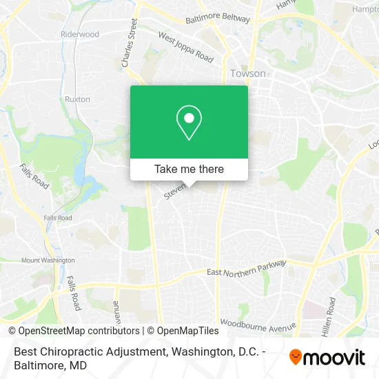
See Best Chiropractic Adjustment, Baltimore County, on the map
Public Transit to Best Chiropractic Adjustment in Baltimore County
Wondering how to get to Best Chiropractic Adjustment in Baltimore County? Moovit helps you find the best way to get to Best Chiropractic Adjustment with step-by-step directions from the nearest public transit station.
Moovit provides free maps and live directions to help you navigate through your city. View schedules, routes, timetables, and find out how long does it take to get to Best Chiropractic Adjustment in real time.
Looking for the nearest stop or station to Best Chiropractic Adjustment? Check out this list of stops closest to your destination: Stevenson Ln & Stanmore Rd Eb; #138 Stevenson La. at Heathfield Rd.; Stevenson Ln & Heathfield FS Wb; #26 Lot 8b Child Care Center; Mt. Washington.
Bus: 51, CITYLINK RED, LAKE AVE, 53, GOLD ROUTE.
Want to see if there’s another route that gets you there at an earlier time? Moovit helps you find alternative routes or times. Get directions from and directions to Best Chiropractic Adjustment easily from the Moovit App or Website.
We make riding to Best Chiropractic Adjustment easy, which is why over 1.5 million users, including users in Baltimore County, trust Moovit as the best app for public transit. You don’t need to download an individual bus app or train app, Moovit is your all-in-one transit app that helps you find the best bus time or train time available.
For information on prices of bus, costs and ride fares to Best Chiropractic Adjustment, please check the Moovit app.
Use the app to navigate to popular places including to the airport, hospital, stadium, grocery store, mall, coffee shop, school, college, and university.
Best Chiropractic Adjustment Address: 263 Rodgers Forge Rd Baltimore, MD 21212 street in Baltimore County
- Rodgers Forge,
- Service Master by Singer-MD,
- Maryland Government State Attorney's Office Information,
- Baltimore Change House Locks,
- Baltimore Eden Korean School,
- F13 Design Studio,
- Glyndon Travel,
- Dumbarton Rd Car Key Extraction Locksmith,
- Automotive Locksmith 25 Baltimore,
- Lacy Foundries,
- South Campus Pavilion,
- Nicholas J Belitsos MD,
- Diaz Alberto Dr,
- STARBUCKS,
- Rosedale Federal Savings & Loan Association,
- Music Together of Charm City,
- Jesuits of Jamshedpur India,
- Chef Bobby D Restaurant,
- General Risk Analytics,
- Express Way Medical Laboratories
Places Near Best Chiropractic Adjustment (Baltimore County)
- National Museum of African American History and Culture, Washington,
- Westfield Montgomery Mall, Montgomery County,
- Sibley Memorial Hospital, Washington,
- National Zoo, Washington,
- Capital One Arena, Washington,
- Washington DC VA Medical Center, Washington,
- Basilica of the National Shrine, Washington,
- Marriott Marquis Washington, DC, Washington,
- Museum Of The Bible, Washington,
- Amazon Hq2, Arlington County,
- Pennsylvania Ave NW (3rd st and pennsylvania), Washington,
- Camden Yards, Baltimore,
- Warner Theatre, Washington,
- The Anthem, Washington,
- PG Mall, Prince George's County,
- Washington National Cathedral, Washington,
- Rock Creek Tennis Center, Washington,
- Georgetown, Washington,
- National Mall, Washington,
- M&T Bank Stadium, Baltimore
How to get to popular places in Washington, D.C. - Baltimore, MD with public transit
Get around Baltimore County by public transit!
Traveling around Baltimore County has never been so easy. See step by step directions as you travel to any attraction, street or major public transit station. View bus and train schedules, arrival times, service alerts and detailed routes on a map, so you know exactly how to get to anywhere in Baltimore County.
When traveling to any destination around Baltimore County use Moovit's Live Directions with Get Off Notifications to know exactly where and how far to walk, how long to wait for your line, and how many stops are left. Moovit will alert you when it's time to get off — no need to constantly re-check whether yours is the next stop.
Wondering how to use public transit in Baltimore County or how to pay for public transit in Baltimore County? Moovit public transit app can help you navigate your way with public transit easily, and at minimum cost. It includes public transit fees, ticket prices, and costs. Looking for a map of Baltimore County public transit lines? Moovit public transit app shows all public transit maps in Baltimore County with all Bus, Train, Metro, Light Rail and Ferry routes and stops on an interactive map.
Washington, D.C. - Baltimore, MD has 5 transit type(s), including: Bus, Train, Metro, Light Rail and Ferry, operated by several transit agencies, including WMATA, Montgomery County Ride On, Fairfax Connector, TheBus, PRTC, DASH - Alexandria, Arlington Transit (ART), RTA of Central Maryland, MDOT MTA, MDOT MTA Light RailLink, MDOT MTA Commuter Bus, MDOT MTA Local Bus, FXBGO!, Virginia Railway Express (VRE) and MARC