How to get to Betheny Multimedia by bus?
Click on the bus route to see step by step directions with maps, line arrival times and updated time schedules.
From Girardin, Prunay
73 minFrom Rue Pierre Bérégovoy, Reims
42 minFrom Champfleury, Champfleury
53 minFrom Le Ludoval, Reims
40 minFrom Bergelyne, Prunay
70 minFrom Bistrot de la Gare, Prunay
74 minFrom Aquamoovprunay, Prunay
78 minFrom Annick, Tinqueux
38 minFrom Parclor, Bezannes
50 minFrom Renovjantes, Tinqueux
40 min
Bus stops near Betheny Multimedia in Reims
Light Rail stations near Betheny Multimedia in Reims
- St Thomas, 20 min walk,VIEW
Bus lines to Betheny Multimedia in Reims
What are the closest stations to Betheny Multimedia?
The closest stations to Betheny Multimedia are:
- Epinettes is 537 meters away, 7 min walk.
- Divry is 652 meters away, 9 min walk.
- C.C. Cernay is 761 meters away, 11 min walk.
- St Thomas is 1548 meters away, 20 min walk.
Which bus line stops near Betheny Multimedia?
U2 (Route De Witry)
What’s the nearest light rail station to Betheny Multimedia in Reims?
The nearest light rail station to Betheny Multimedia in Reims is St Thomas. It’s a 20 min walk away.
What’s the nearest bus station to Betheny Multimedia in Reims?
The nearest bus station to Betheny Multimedia in Reims is Epinettes. It’s a 7 min walk away.
What time is the first light rail to Betheny Multimedia in Reims?
The TRAM is the first light rail that goes to Betheny Multimedia in Reims. It stops nearby at 5:22 AM.
What time is the last light rail to Betheny Multimedia in Reims?
The TRAM is the last light rail that goes to Betheny Multimedia in Reims. It stops nearby at 12:49 AM.
What time is the first bus to Betheny Multimedia in Reims?
The U1 is the first bus that goes to Betheny Multimedia in Reims. It stops nearby at 5:15 AM.
What time is the last bus to Betheny Multimedia in Reims?
The U2 is the last bus that goes to Betheny Multimedia in Reims. It stops nearby at 12:56 AM.
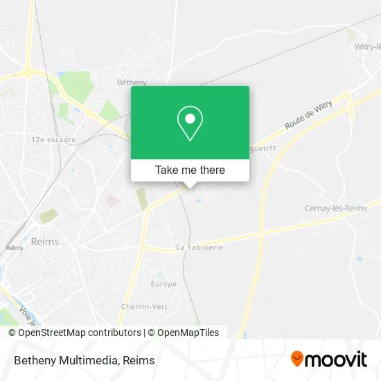
See Betheny Multimedia, Reims, on the map
Public Transit to Betheny Multimedia in Reims
Wondering how to get to Betheny Multimedia in Reims? Moovit helps you find the best way to get to Betheny Multimedia with step-by-step directions from the nearest public transit station.
Moovit provides free maps and live directions to help you navigate through your city. View schedules, routes, timetables, and find out how long does it take to get to Betheny Multimedia in real time.
Looking for the nearest stop or station to Betheny Multimedia? Check out this list of stops closest to your destination: Epinettes; Divry; C.C. Cernay; St Thomas.
Bus: U2, E3, 20, U1, U3.
Want to see if there’s another route that gets you there at an earlier time? Moovit helps you find alternative routes or times. Get directions from and directions to Betheny Multimedia easily from the Moovit App or Website.
We make riding to Betheny Multimedia easy, which is why over 1.5 million users, including users in Reims, trust Moovit as the best app for public transit. You don’t need to download an individual bus app or train app, Moovit is your all-in-one transit app that helps you find the best bus time or train time available.
For information on prices of bus and light rail, costs and ride fares to Betheny Multimedia, please check the Moovit app.
Use the app to navigate to popular places including to the airport, hospital, stadium, grocery store, mall, coffee shop, school, college, and university.
Betheny Multimedia Address: 5 Rue du Canada 51100 Reims street in Reims
- École Élémentaire Paul Bert,
- Espace Aubade Somatem Reims,
- Espace Aubade Somatem,
- Plurial Novilia,
- Mq Épinettes,
- 29 Rte de Witry,
- Pharmacie Dellemme,
- Chez Océane,
- Le Foyer Rémois,
- Absolut Propreté,
- Saolobarber,
- Basic-Fit Reims Route de Witry,
- 33 35,
- Seoul Reims,
- Blanchefle Chicoine,
- Eloy Sébastien,
- Afpa,
- Espace Rencontre Le Creuset,
- Bernonville,
- Pub Inter Route
Places Near Betheny Multimedia (Reims)
- Parc Des Expositions, Reims,
- Bétheny, Bétheny,
- Centre Commercial Cernay, Reims,
- Hôpital Debré, Reims,
- Croix Blandin, Reims,
- Polyclinique Reims Bezannes, Bezannes,
- St Remi, Reims,
- La Neuvillette, Reims,
- Hôpital Maison Blanche, Reims,
- Campus Croix Rouge, Reims,
- Parc de Champagne, Reims,
- Ikea, Thillois,
- Carrefour, Tinqueux,
- Leclerc, Saint-Brice-Courcelles,
- CHU, Reims,
- Gare Tgv, Bezannes,
- E. Leclerc Champfleury, Champfleury,
- Cormontreuil, Reims,
- Tinqueux, Tinqueux,
- Bezannes, Bezannes
How to get to popular places in Reims with public transit
Get around Reims by public transit!
Traveling around Reims has never been so easy. See step by step directions as you travel to any attraction, street or major public transit station. View bus and train schedules, arrival times, service alerts and detailed routes on a map, so you know exactly how to get to anywhere in Reims.
When traveling to any destination around Reims use Moovit's Live Directions with Get Off Notifications to know exactly where and how far to walk, how long to wait for your line, and how many stops are left. Moovit will alert you when it's time to get off — no need to constantly re-check whether yours is the next stop.
Wondering how to use public transit in Reims or how to pay for public transit in Reims? Moovit public transit app can help you navigate your way with public transit easily, and at minimum cost. It includes public transit fees, ticket prices, and costs. Looking for a map of Reims public transit lines? Moovit public transit app shows all public transit maps in Reims with all Bus and Light Rail routes and stops on an interactive map.
Reims has 2 transit type(s), including: Bus and Light Rail, operated by several transit agencies, including Transdev Reims