How to get to Bethesda Auto Repair Courtesy Check by bus?
Click on the bus route to see step by step directions with maps, line arrival times and updated time schedules.
From Cia Headquarters, Fairfax County
78 minFrom Washington Hebrew Congregation, Washington
57 minFrom Cathedral Heights, Washington
56 minFrom The Cheesecake Factory, Washington
51 minFrom Wheaton High School, Montgomery County
59 minFrom McLean, Virginia, Fairfax County
78 minFrom Rock Creek Park, Washington
75 minFrom Fannie Mae, Washington
53 minFrom Embassy Suites at the Chevy Chase Pavilion, Washington
51 min
How to get to Bethesda Auto Repair Courtesy Check by metro?
Click on the metro route to see step by step directions with maps, line arrival times and updated time schedules.
Bus stops near Bethesda Auto Repair Courtesy Check in Montgomery County
Bus lines to Bethesda Auto Repair Courtesy Check in Montgomery County
What are the closest stations to Bethesda Auto Repair Courtesy Check?
The closest stations to Bethesda Auto Repair Courtesy Check are:
- Fernwood Rd & Stoneham Rd is 279 yards away, 4 min walk.
- Old Georgetown Rd+Kingswood Rd is 755 yards away, 10 min walk.
- Singleton Dr & Kingford Rd is 1851 yards away, 22 min walk.
Which bus lines stop near Bethesda Auto Repair Courtesy Check?
These bus lines stop near Bethesda Auto Repair Courtesy Check: 47, M70.
Which metro line stops near Bethesda Auto Repair Courtesy Check?
RED (Shady Grove)
What’s the nearest bus station to Bethesda Auto Repair Courtesy Check in Montgomery County?
The nearest bus station to Bethesda Auto Repair Courtesy Check in Montgomery County is Fernwood Rd & Stoneham Rd. It’s a 4 min walk away.
What time is the first bus to Bethesda Auto Repair Courtesy Check in Montgomery County?
The M70 is the first bus that goes to Bethesda Auto Repair Courtesy Check in Montgomery County. It stops nearby at 5:06 AM.
What time is the last bus to Bethesda Auto Repair Courtesy Check in Montgomery County?
The M70 is the last bus that goes to Bethesda Auto Repair Courtesy Check in Montgomery County. It stops nearby at 2:10 AM.
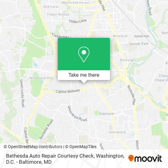
See Bethesda Auto Repair Courtesy Check, Montgomery County, on the map
Public Transit to Bethesda Auto Repair Courtesy Check in Montgomery County
Wondering how to get to Bethesda Auto Repair Courtesy Check in Montgomery County? Moovit helps you find the best way to get to Bethesda Auto Repair Courtesy Check with step-by-step directions from the nearest public transit station.
Moovit provides free maps and live directions to help you navigate through your city. View schedules, routes, timetables, and find out how long does it take to get to Bethesda Auto Repair Courtesy Check in real time.
Looking for the nearest stop or station to Bethesda Auto Repair Courtesy Check? Check out this list of stops closest to your destination: Fernwood Rd & Stoneham Rd; Old Georgetown Rd+Kingswood Rd; Singleton Dr & Kingford Rd.
Bus: 47, M70, 30.Metro: RED.
Want to see if there’s another route that gets you there at an earlier time? Moovit helps you find alternative routes or times. Get directions from and directions to Bethesda Auto Repair Courtesy Check easily from the Moovit App or Website.
We make riding to Bethesda Auto Repair Courtesy Check easy, which is why over 1.5 million users, including users in Montgomery County, trust Moovit as the best app for public transit. You don’t need to download an individual bus app or train app, Moovit is your all-in-one transit app that helps you find the best bus time or train time available.
For information on prices of bus and metro, costs and ride fares to Bethesda Auto Repair Courtesy Check, please check the Moovit app.
Use the app to navigate to popular places including to the airport, hospital, stadium, grocery store, mall, coffee shop, school, college, and university.
Bethesda Auto Repair Courtesy Check Address: 6213 Stoneham Rd Bethesda, MD 20817 street in Montgomery County
- Romana,
- Ashburton Pta,
- Jill's Harbor,
- KJB Associates,
- USPS Collection Box - Blue Box,
- Child Care Center,
- China English Teaching Initiative,
- Farm,
- Pooch Portrait Studio,
- Belhaven Lone Dr,
- Musical Instruction,
- Oxford House-Bethesda,
- Bulls Run Parkway Median,
- Bethesda Travel Guide,
- US Roofing Restoration,
- Bethesda, MD,
- 360 Painting of DC,
- Jaho Home Improvement,
- Exit 36 - MD 187 (Old Georgetown Road) / Rockville, Bethesda,
- North Star Games
Places Near Bethesda Auto Repair Courtesy Check (Montgomery County)
- Basilica of the National Shrine, Washington,
- National Zoo, Washington,
- Camden Yards, Baltimore,
- Washington DC VA Medical Center, Washington,
- Washington National Cathedral, Washington,
- Amazon Hq2, Arlington County,
- Westfield Montgomery Mall, Montgomery County,
- The Anthem, Washington,
- Georgetown, Washington,
- Capital One Arena, Washington,
- Pennsylvania Ave NW (3rd st and pennsylvania), Washington,
- PG Mall, Prince George's County,
- National Theatre, Washington,
- Museum Of The Bible, Washington,
- National Museum of African American History and Culture, Washington,
- Marriott Marquis Washington, DC, Washington,
- M&T Bank Stadium, Baltimore,
- Rock Creek Tennis Center, Washington,
- Warner Theatre, Washington,
- Sibley Memorial Hospital, Washington
How to get to popular places in Washington, D.C. - Baltimore, MD with public transit
Get around Montgomery County by public transit!
Traveling around Montgomery County has never been so easy. See step by step directions as you travel to any attraction, street or major public transit station. View bus and train schedules, arrival times, service alerts and detailed routes on a map, so you know exactly how to get to anywhere in Montgomery County.
When traveling to any destination around Montgomery County use Moovit's Live Directions with Get Off Notifications to know exactly where and how far to walk, how long to wait for your line, and how many stops are left. Moovit will alert you when it's time to get off — no need to constantly re-check whether yours is the next stop.
Wondering how to use public transit in Montgomery County or how to pay for public transit in Montgomery County? Moovit public transit app can help you navigate your way with public transit easily, and at minimum cost. It includes public transit fees, ticket prices, and costs. Looking for a map of Montgomery County public transit lines? Moovit public transit app shows all public transit maps in Montgomery County with all Bus, Train, Metro, Light Rail and Ferry routes and stops on an interactive map.
Washington, D.C. - Baltimore, MD has 5 transit type(s), including: Bus, Train, Metro, Light Rail and Ferry, operated by several transit agencies, including WMATA, Montgomery County Ride On, Fairfax Connector, TheBus, PRTC, DASH - Alexandria, Arlington Transit (ART), RTA of Central Maryland, MDOT MTA, MDOT MTA Light RailLink, MDOT MTA Commuter Bus, MDOT MTA Local Bus, FXBGO!, Virginia Railway Express (VRE) and MARC