Beverly Shores station - Thursday schedule
| Line | Direction | Time |
|---|---|---|
| LAKESHORE | Millennium Station | 5:15 AM |
| LAKESHORE | Millennium Station | 6:03 AM |
| LAKESHORE | Millennium Station | 6:38 AM |
| LAKESHORE | Millennium Station | 7:30 AM |
| LAKESHORE | Millennium Station | 8:19 AM |
| LAKESHORE | Carroll Ave. (Michigan City) | 9:01 AM |
| LAKESHORE | Millennium Station | 9:28 AM |
| LAKESHORE | South Bend Airport | 10:03 AM |
| LAKESHORE | Millennium Station | 11:05 AM |
| LAKESHORE | 11th St. (Michigan City) | 11:47 AM |
| LAKESHORE | Millennium Station | 12:28 PM |
| LAKESHORE | South Bend Airport | 1:51 PM |
| LAKESHORE | Millennium Station | 2:28 PM |
| LAKESHORE | Carroll Ave. (Michigan City) | 2:56 PM |
| LAKESHORE | Carroll Ave. (Michigan City) | 4:01 PM |
| LAKESHORE | Millennium Station | 4:41 PM |
| LAKESHORE | Carroll Ave. (Michigan City) | 4:57 PM |
| LAKESHORE | Millennium Station | 5:49 PM |
| LAKESHORE | Carroll Ave. (Michigan City) | 5:49 PM |
| LAKESHORE | Carroll Ave. (Michigan City) | 6:25 PM |
| LAKESHORE | South Bend Airport | 6:40 PM |
| LAKESHORE | Carroll Ave. (Michigan City) | 7:13 PM |
| LAKESHORE | Carroll Ave. (Michigan City) | 7:37 PM |
| LAKESHORE | 11th St. (Michigan City) | 8:29 PM |
| LAKESHORE | Millennium Station | 8:49 PM |
Directions to Beverly Shores station (Chicago) with public transit
The following transit lines have routes that pass near Beverly Shores
 Train: LAKESHORE.
How to get to Beverly Shores station by train?
Click on the train route to see step by step directions with maps, line arrival times and updated time schedules.
Which train line stops near Beverly Shores?
LAKESHORE (Millennium Station)
See Beverly Shores station, Chicago, on the map
Public transit to Beverly Shores station in Chicago
Looking for directions to Beverly Shores in Chicago, United States?
Download the Moovit App to find the current schedule and step-by-step directions for Train or Bus routes that pass through Beverly Shores.
Train: LAKESHORE.
We make riding on public transit to Beverly Shores easy, which is why over 1.7 billion users, including users in Chicago trust Moovit as the best app for public transit.
Use the app to navigate to popular places including to the airport, hospital, stadium, grocery store, mall, coffee shop, school, college, and university.
The station has the following entrances: Calumet Trl and Broadway
The first line to this station is LAKESHORE, at 5:15 AM, and the last line is LAKESHORE at 4:18 AM.
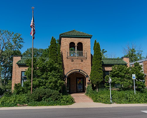
2 E Dunes Hwy, Beverly Shores, IN, USA
This station serves Northern Indiana Commuter Transportation District’s lines
Beverly Shores is a town in Pine Township, Porter County, Indiana, United States, about 36 miles (58 km) east of downtown Chicago. The population was 597 as of the 2023 5-year ACS census.Wiki
Popular routes from Beverly Shores station, Chicago
- Michigan & 121st Street (South),
- Fullerton & Sheffield (Red/Brown/Purple Line) (East),
- Rand Rd & Central Rd,
- Davis Purple Line Station (South),
- Rte 53 & Remington Blvd,
- North Ave & 76th Ave,
- Sedgwick,
- Pulaski & Harrison (Blue Line) (North),
- Narragansett & Diversey (South),
- Taylor & Paulina (West),
- Division & Damen (East),
- Grand Ave & N Greenleaf St/Old Grand Ave,
- Northfield Square Mall,
- Touhy Ave & Mt. Prospect Rd,
- Western & Bryn Mawr (North),
- O'Hare Mmf Bay 9,
- 159th St & Crawford Ave/Pulaski Ave,
- 18th,
- Van Buren St.,
- 127th/Pulaski
Popular public transit stations in Chicago
Get around Chicago by public transit!
Traveling around Chicago has never been so easy. See step by step directions as you travel to any attraction, street or major public transit station. View bus and train schedules, arrival times, service alerts and detailed routes on a map, so you know exactly how to get to anywhere in Chicago.
When traveling to any destination around Chicago use Moovit's Live Directions with Get Off Notifications to know exactly where and how far to walk, how long to wait for your line, and how many stops are left. Moovit will alert you when it's time to get off — no need to constantly re-check whether yours is the next stop.
Wondering how to use public transit in Chicago or how to pay for public transit in Chicago? Moovit public transit app can help you navigate your way with public transit easily, and at minimum cost. It includes public transit fees, ticket prices, and costs. Looking for a map of Chicago public transit lines? Moovit public transit app shows all public transit maps in Chicago with all Bus, Train and Chicago 'L' routes and stops on an interactive map.
Chicago has 3 transit type(s), including: Bus, Train and Chicago 'L', operated by several transit agencies, including CTA 'L', Metra, Northern Indiana Commuter Transportation District, CTA, PACE, O'Hare International Airport Shuttle Bus, Gary Public Transit, Amtrak, River Valley Metro, Valpo Transit, DeKalb Public Transit, FlixBus-us, Greyhound-us, Van Galder (Coach USA) and Wisconsin Coach Lines