Directions to Bezno (Mladá Boleslav) with public transportation
The following transit lines have routes that pass near Bezno
 Bus: 431, 467, 767, 699, 769.
- Train: T10, R21, S30, R43.
How to get to Bezno by bus?
Click on the bus route to see step by step directions with maps, line arrival times and updated time schedules.
Bus stops near Bezno in Mladá Boleslav
- Sovínky, 5 min walk,
- Bezno, 10 min walk,
Train stations near Bezno in Mladá Boleslav
- Km 62, 900, 54 min walk,
- Chotětov, 57 min walk,
Bus lines to Bezno in Mladá Boleslav
- 431, Předměřice N.Jiz.,U Kostela,
- 467, Roudnice N.L.,Purkyňovo Nám.,
- 699, Bezno,
- 767, Kropáčova Vrutice,Krpy,
- 769, Chotětov,
What are the closest stations to Bezno?
The closest stations to Bezno are:
- Sovínky is 263 meters away, 5 min walk.
- Bezno is 670 meters away, 10 min walk.
- Km 62, 900 is 3911 meters away, 54 min walk.
- Chotětov is 4389 meters away, 57 min walk.
Which bus lines stop near Bezno?
These bus lines stop near Bezno: 431, 467, 767.
What’s the nearest bus station to Bezno in Mladá Boleslav?
The nearest bus station to Bezno in Mladá Boleslav is Sovínky. It’s a 5 min walk away.
What time is the first train to Bezno in Mladá Boleslav?
The S30 is the first train that goes to Bezno in Mladá Boleslav. It stops nearby at 4:53 AM.
What time is the last train to Bezno in Mladá Boleslav?
The S30 is the last train that goes to Bezno in Mladá Boleslav. It stops nearby at 10:53 PM.
What time is the first bus to Bezno in Mladá Boleslav?
The 431 is the first bus that goes to Bezno in Mladá Boleslav. It stops nearby at 4:41 AM.
What time is the last bus to Bezno in Mladá Boleslav?
The 767 is the last bus that goes to Bezno in Mladá Boleslav. It stops nearby at 10:53 PM.
See Bezno, Mladá Boleslav, on the map
Public Transit to Bezno in Mladá Boleslav
Wondering how to get to Bezno in Mladá Boleslav? Moovit helps you find the best way to get to Bezno with step-by-step directions from the nearest public transit station.
Moovit provides free maps and live directions to help you navigate through your city. View schedules, routes, timetables, and find out how long does it take to get to Bezno in real time.
Looking for the nearest stop or station to Bezno? Check out this list of stops closest to your destination: Sovínky; Bezno; Km 62; Chotětov.
Bus: 431, 467, 767, 699, 769.Train: T10, R21, S30, R43.
Want to see if there’s another route that gets you there at an earlier time? Moovit helps you find alternative routes or times. Get directions from and directions to Bezno easily from the Moovit App or Website.
We make riding to Bezno easy, which is why over 1.5 million users, including users in Mladá Boleslav, trust Moovit as the best app for public transit. You don’t need to download an individual bus app or train app, Moovit is your all-in-one transit app that helps you find the best bus time or train time available.
For information on prices of bus, costs and ride fares to Bezno, please check the Moovit app.
Use the app to navigate to popular places including to the airport, hospital, stadium, grocery store, mall, coffee shop, school, college, and university.
Location: Mladá Boleslav, Prague
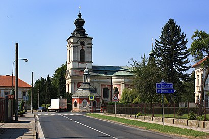
Bezno (Czech pronunciation: [ˈbɛzno]) is a market town in Mladá Boleslav District in the Central Bohemian Region of the Czech Republic. It has about 1,000 inhabitants.Wiki
- Princezniny šaty,
- Základní škola Václava Vaňka Bezno,
- Hostinec U Veze,
- Chotětov,
- Themowhite Service, s.r.o.,
- Malé Všelisy,
- Zámek Velké Všelisy,
- Pivovar Podkováň,
- Velké Všelisy,
- Horní Cetno,
- Kominík Chotetov s.r.o.,
- Drevoobchod Dolezal,
- Klub Krátkosrstých Ohařů Jizerní Vtelno,
- Jizerka a.s.,
- SK,
- Detsky domov Krnsko,Horni Krnsko 180,
- Krnsko,
- Hřbitov Řehnice,
- Hendrych Craft,
- Usira
Places Near Bezno (Mladá Boleslav)
- Výstaviště Holešovice, Praha 7,
- Nemocnice Na Bulovce, Praha 8,
- Karlův Most, Praha 1,
- Hudební Divadlo Karlín, Praha 8,
- Žižkovská Televizní Věž, Praha 3,
- O2 arena, Praha 9,
- Obchodní centrum Letňany, Praha 18,
- Stadion Eden, Praha 10,
- Staroměstské Náměstí, Praha 1,
- Fashion Arena Outlet Center, Praha-Štěrboholy,
- Planetárium Praha, Praha 7,
- Olympia, Plzeň,
- Arkády Pankrác, Praha 4,
- Grébovka, Praha 2,
- Fakultní nemocnice Královské Vinohrady, Praha 10,
- Michelská 1552/58, Praha 4,
- SAPA, Praha-Libuš,
- Centrum Chodov, Praha 11,
- Petřín, Praha 1,
- Westfield Chodov, Praha 11
How to get to popular places in Prague with public transit
Get around Mladá Boleslav by public transit!
Traveling around Mladá Boleslav has never been so easy. See step by step directions as you travel to any attraction, street or major public transit station. View bus and train schedules, arrival times, service alerts and detailed routes on a map, so you know exactly how to get to anywhere in Mladá Boleslav.
When traveling to any destination around Mladá Boleslav use Moovit's Live Directions with Get Off Notifications to know exactly where and how far to walk, how long to wait for your line, and how many stops are left. Moovit will alert you when it's time to get off — no need to constantly re-check whether yours is the next stop.
Wondering how to use public transit in Mladá Boleslav or how to pay for public transit in Mladá Boleslav? Moovit public transit app can help you navigate your way with public transit easily, and at minimum cost. It includes public transit fees, ticket prices, and costs. Looking for a map of Mladá Boleslav public transit lines? Moovit public transit app shows all public transit maps in Mladá Boleslav with all Bus, Train, Subway, Light Rail, Ferry, Trolleybus and Gondola routes and stops on an interactive map.
Prague has 7 transit type(s), including: Bus, Train, Subway, Light Rail, Ferry, Trolleybus and Gondola, operated by several transit agencies, including Dopravní podnik měst Liberce a Jablonce nad Nisou, a.s., České dráhy - nabídka, Dopravní společnost Ústeckého kraje, příspěvková organizace, Railway Capital a.s., DPP, České dráhy a.s., RegioJet a.s., Dopravní podnik Karlovy Vary, a.s., Dopravní podnik města Ústí nad Labem a.s., Dopravní podnik města Děčína, a.s., CityRail, a.s., BusLine MAD Česká Lípa s.r.o., GW Train Regio a.s., Regiojet ÚK a.s. and AŽD Praha, s.r.o.