How to get to Bezos Grill by bus?
Click on the bus route to see step by step directions with maps, line arrival times and updated time schedules.
From POCO Einrichtungsmärkte, Pforzheim
130 minFrom Waldbronn Eistreff, Waldbronn
31 minFrom Epplesee, Rheinstetten
79 minFrom Hopfenschlingel, Vereinbarte Verwaltungsgemeinschaft Rastatt
87 minFrom Mercedes-Benz Werk Rastatt, Vereinbarte Verwaltungsgemeinschaft Rastatt
84 minFrom Arcus Klinik, Pforzheim
108 minFrom Karlsruher Straße, Pforzheim
129 min
How to get to Bezos Grill by train?
Click on the train route to see step by step directions with maps, line arrival times and updated time schedules.
From POCO Einrichtungsmärkte, Pforzheim
80 minFrom Waldbronn Eistreff, Waldbronn
50 minFrom Epplesee, Rheinstetten
19 minFrom Rkh Kliniken, Verwaltungsgemeinschaft Bretten
44 minFrom Hopfenschlingel, Vereinbarte Verwaltungsgemeinschaft Rastatt
43 minFrom Schloss Neuenbürg, Verwaltungsgemeinschaft Neuenbürg
79 minFrom Arcus Klinik, Pforzheim
76 minFrom Karlsruher Straße, Pforzheim
79 min
Train stations near Bezos Grill in Stuttgart
- Karlsruhe Albtalbahnhof, 1 min walk,VIEW
Light Rail stations near Bezos Grill in Stuttgart
- Karlsruhe Albtalbahnhof, 1 min walk,VIEW
Bus stops near Bezos Grill in Stuttgart
Bus lines to Bezos Grill in Stuttgart
- 52, Karlsruhe Dammerstock,VIEW
- ALT52, Karlsruhe Albtalbahnhof,VIEW
- 50, Oberreut Eugen-Geck-Straße - KA Hauptbahnhof (Vorplatz),VIEW
- 51, KA Hauptbahnhof (Vorplatz) - Oberreut Eugen-Geck-Straße,VIEW
- 55, KA Hauptbahnhof (Vorplatz) - Karlsruhe Kühler Krug,VIEW
- 62, Karlsruhe Entenfang - KA Hauptbahnhof (Vorplatz),VIEW
- ALT50, Oberreut Eugen-Geck-Straße - KA Hauptbahnhof (Vorplatz),VIEW
- ALT62, Karlsruhe St. Josef Kirche - KA Hauptbahnhof (Vorplatz),VIEW
- M, Karlsruhe Messe - KA Hauptbahnhof (Vorplatz),VIEW
- SEV S31/S32, Karlsruhe Hauptbahnhof (Vorplatz) - Bruchsal Bahnhof/ZOB,VIEW
- SEV S7/S8, Karlsruhe Hauptbahnhof (Vorplatz) - Kuppenheim Bahnhof,VIEW
- 44, Hohenwettersbach Rathaus,VIEW
- 47, Stupferich Rathaus,VIEW
- NL14, Karlsruhe Windeckstraße,VIEW
What are the closest stations to Bezos Grill?
The closest stations to Bezos Grill are:
- Karlsruhe Albtalbahnhof is 27 meters away, 1 min walk.
- Karlsruhe Ebertstraße is 122 meters away, 2 min walk.
- Karlsruhe Albtalbahnhof (Ersatzhalt) is 243 meters away, 4 min walk.
- Ka Hauptbahnhof (Vorplatz) is 263 meters away, 4 min walk.
Which train lines stop near Bezos Grill?
These train lines stop near Bezos Grill: RE 1, RE 2, RE 45, RE1, S11, S7, S8.
Which bus lines stop near Bezos Grill?
These bus lines stop near Bezos Grill: 44, 47, 62.
What’s the nearest light rail station to Bezos Grill in Stuttgart?
The nearest light rail station to Bezos Grill in Stuttgart is Karlsruhe Albtalbahnhof. It’s a 1 min walk away.
What’s the nearest train station to Bezos Grill in Stuttgart?
The nearest train station to Bezos Grill in Stuttgart is Karlsruhe Albtalbahnhof. It’s a 1 min walk away.
What’s the nearest bus station to Bezos Grill in Stuttgart?
The nearest bus station to Bezos Grill in Stuttgart is Karlsruhe Albtalbahnhof. It’s a 1 min walk away.
What time is the first light rail to Bezos Grill in Stuttgart?
The S4 is the first light rail that goes to Bezos Grill in Stuttgart. It stops nearby at 3:55 AM.
What time is the last light rail to Bezos Grill in Stuttgart?
The S4 is the last light rail that goes to Bezos Grill in Stuttgart. It stops nearby at 1:42 AM.
What time is the first train to Bezos Grill in Stuttgart?
The S4 is the first train that goes to Bezos Grill in Stuttgart. It stops nearby at 3:55 AM.
What time is the last train to Bezos Grill in Stuttgart?
The S4 is the last train that goes to Bezos Grill in Stuttgart. It stops nearby at 1:40 AM.
What time is the first bus to Bezos Grill in Stuttgart?
The ALT50 is the first bus that goes to Bezos Grill in Stuttgart. It stops nearby at 4:23 AM.
What time is the last bus to Bezos Grill in Stuttgart?
The ALT52 is the last bus that goes to Bezos Grill in Stuttgart. It stops nearby at 12:59 AM.
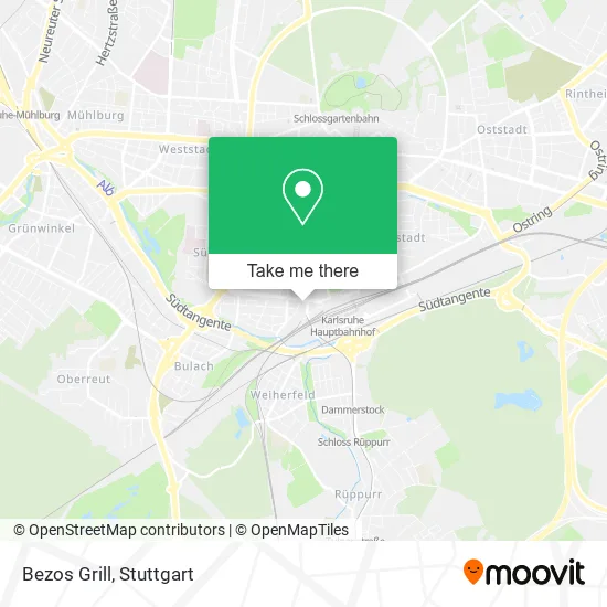
See Bezos Grill, Stuttgart, on the map
Public Transit to Bezos Grill in Stuttgart
Wondering how to get to Bezos Grill in Stuttgart? Moovit helps you find the best way to get to Bezos Grill with step-by-step directions from the nearest public transit station.
Moovit provides free maps and live directions to help you navigate through your city. View schedules, routes, timetables, and find out how long does it take to get to Bezos Grill in real time.
Looking for the nearest stop or station to Bezos Grill? Check out this list of stops closest to your destination: Karlsruhe Albtalbahnhof; Karlsruhe Ebertstraße; Karlsruhe Albtalbahnhof (Ersatzhalt); Ka Hauptbahnhof (Vorplatz).
Train: RE 1, RE 2, RE 45, RE1, S11, S7, S8, E, S4, S5, S1, S12, E, E.Bus: 44, 47, 62, 52, ALT52, 50, 51, 55, ALT50, ALT62, M.
Want to see if there’s another route that gets you there at an earlier time? Moovit helps you find alternative routes or times. Get directions from and directions to Bezos Grill easily from the Moovit App or Website.
We make riding to Bezos Grill easy, which is why over 1.5 million users, including users in Stuttgart, trust Moovit as the best app for public transit. You don’t need to download an individual bus app or train app, Moovit is your all-in-one transit app that helps you find the best bus time or train time available.
For information on prices of bus and train, costs and ride fares to Bezos Grill, please check the Moovit app.
Use the app to navigate to popular places including to the airport, hospital, stadium, grocery store, mall, coffee shop, school, college, and university.
Bezos Grill Address: Ebertstraße 9 Beiertheim-Bulach, 76135 Karlsruhe street in Stuttgart
- Stadtbahn Albtalbahnhof,
- Personalraum,
- Brunnenanlage am Albtalbahnhof,
- Albtalbahnhof,
- Fotofix,
- Markomannen,
- Generalagentur Paul Pfirmann,
- Freundeskreis Karlsruhe- Halle E. V,
- S! Markomannen,
- Dr. med. Michael Born,
- Schmidt Küchen Und Wohnwelten,
- Hausarztzentrum am Albtalbahnhof,
- Fahrschule am Albtalbahnhof,
- Solarpotenzialanalyse,
- Energieleitplan Stadt Bruchsal,
- Zollernalbkreis,
- smart Geomatics,
- Regionalen Energieagentur Ulm,
- Mq Neuland Management,
- Paccard Wolfsburg 1
Places Near Bezos Grill (Stuttgart)
- Gasometer Pforzheim, Pforzheim,
- Klinikum Stuttgart - Katharinenhospital, Stuttgart-Mitte,
- Gleis 101/102 (tief), Stuttgart-Mitte,
- Im Wizemann (Halle), Bad Cannstatt,
- Pariser Platz Stuttgart, Stuttgart-Mitte,
- Hauptbahnhof Stuttgart, Stuttgart-Mitte,
- Schleyerhalle, Bad Cannstatt,
- Hanns-Martin-Schleyer-Halle (Stuttgart Hans-Martin-Schleyerhalle), Bad Cannstatt,
- Mercedes-Benz Museum (Mercedes Museum Stuttgart), Bad Cannstatt,
- Marmorsaal Im Weissenburgpark, Stuttgart-Süd,
- SI-Centrum, Möhringen,
- Hanns-Martin-Schleyer-Halle, Bad Cannstatt,
- Mettingen Eros-Center Puff Laufhaus, Esslingen Am Neckar,
- Geilhaus Haus 33a, Reutlingen-Betzingen,
- Waldfriedhof, Degerloch,
- Mercedes-Benz Museum, Bad Cannstatt,
- Porsche Museum, Zuffenhausen,
- FlixBus Haltestelle, Stuttgart,
- Wilhelma (U-Bahn Wilhelma), Bad Cannstatt,
- Porsche-Arena, Bad Cannstatt
How to get to popular places in Stuttgart with public transit
Get around Stuttgart by public transit!
Traveling around Stuttgart has never been so easy. See step by step directions as you travel to any attraction, street or major public transit station. View bus and train schedules, arrival times, service alerts and detailed routes on a map, so you know exactly how to get to anywhere in Stuttgart.
When traveling to any destination around Stuttgart use Moovit's Live Directions with Get Off Notifications to know exactly where and how far to walk, how long to wait for your line, and how many stops are left. Moovit will alert you when it's time to get off — no need to constantly re-check whether yours is the next stop.
Wondering how to use public transit in Stuttgart or how to pay for public transit in Stuttgart? Moovit public transit app can help you navigate your way with public transit easily, and at minimum cost. It includes public transit fees, ticket prices, and costs. Looking for a map of Stuttgart public transit lines? Moovit public transit app shows all public transit maps in Stuttgart with all Bus, Train, Subway, Light Rail, Ferry, S-Bahn and Funicular routes and stops on an interactive map.
Stuttgart has 7 transit type(s), including: Bus, Train, Subway, Light Rail, Ferry, S-Bahn and Funicular, operated by several transit agencies, including SSB - Stadtbahn, SSB, SSB - Seilbahn / Zacke, S-Bahn Stuttgart, Rhein-Neckar-Verkehr GmbH (rnv), Karlsruher Verkehrsverbund, DB AG, DB Regiobus BW, Arverio Baden-Württemberg GmbH, DB RegioNetz Verkehrs GmbH Westfrankenbahn, DB Regio AG Baden-Württemberg, Südwestdeutsche Verkehrs-AG, DB Regio AG Mitte Region Hessen, DB and Bodensee-Oberschwaben-Bahn