Directions to Bfn Express (Araucária) with public transportation
The following transit lines have routes that pass near Bfn Express
How to get to Bfn Express by bus?
Click on the bus route to see step by step directions with maps, line arrival times and updated time schedules.
From Vitoria Regia, Cic
52 minFrom Posigraf, Cic
43 minFrom Volvo, Cic
35 minFrom Colônia Cristina, Araucária
115 minFrom 11º Distrito Policial, Cic
48 minFrom Sesi/Senai - CIC, Cic
44 minFrom Rua João Bettega, Cic
35 minFrom Rua Senador Accioly Filho, 298 - Cidade Industrial, Cic
42 minFrom Mondelez Brasil, Cic
70 minFrom Avenida das Industrias 1974, Cic
38 min
Bus stops near Bfn Express in Araucária
Bus lines to Bfn Express in Araucária
- 14 IPÊS / JATOBÁ, Terminal Central Araucária → Terminal Vila Angélica,VIEW
- 36 CTI / ANGÉLICA, Sentido Anti-horário,VIEW
- 34 LINHA 04, Sentido Horário,VIEW
- 01 LINHÃO 01 (ANGÉLICA / TUPY), Tupy → Terminal Vila Angélica,VIEW
- 33 CALIFÓRNIA / IPÊS, Terminal Vila Angélica ↺ Califórnia / Ipês (Circular),VIEW
- 38 FAZENDA VELHA, Colégio Fazenda Velha → Itaipu,VIEW
What are the closest stations to Bfn Express?
The closest stations to Bfn Express are:
- Rua Dos Eucalíptos, 290-424 is 7 meters away, 1 min walk.
- Avenida Dos Pinheirais, 1245 is 226 meters away, 4 min walk.
- Rua Uirapuru, 110 is 517 meters away, 7 min walk.
- Rua Arapongas, 425 is 532 meters away, 7 min walk.
Which bus lines stop near Bfn Express?
These bus lines stop near Bfn Express: 01 LINHÃO 01 (ANGÉLICA / TUPY), 14 IPÊS / JATOBÁ.
What’s the nearest bus station to Bfn Express in Araucária?
The nearest bus station to Bfn Express in Araucária is Rua Dos Eucalíptos, 290-424. It’s a 1 min walk away.
What time is the first bus to Bfn Express in Araucária?
The 14 IPÊS / JATOBÁ is the first bus that goes to Bfn Express in Araucária. It stops nearby at 4:23 AM.
What time is the last bus to Bfn Express in Araucária?
The 14 IPÊS / JATOBÁ is the last bus that goes to Bfn Express in Araucária. It stops nearby at 1:00 AM.
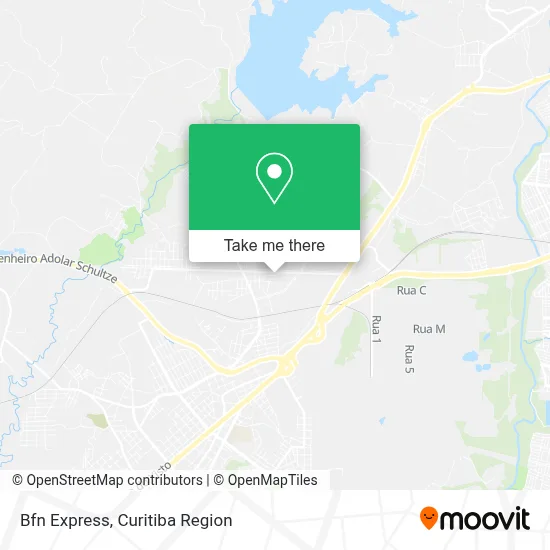
See Bfn Express, Araucária, on the map
Public Transit to Bfn Express in Araucária
Wondering how to get to Bfn Express in Araucária? Moovit helps you find the best way to get to Bfn Express with step-by-step directions from the nearest public transit station.
Moovit provides free maps and live directions to help you navigate through your city. View schedules, routes, timetables, and find out how long does it take to get to Bfn Express in real time.
Looking for the nearest stop or station to Bfn Express? Check out this list of stops closest to your destination: Rua Dos Eucalíptos; Avenida Dos Pinheirais; Rua Uirapuru; Rua Arapongas.
Bus: 01 LINHÃO 01 (ANGÉLICA / TUPY), 14 IPÊS / JATOBÁ, 36 CTI / ANGÉLICA, 34 LINHA 04, 33 CALIFÓRNIA / IPÊS, 38 FAZENDA VELHA.
Want to see if there’s another route that gets you there at an earlier time? Moovit helps you find alternative routes or times. Get directions from and directions to Bfn Express easily from the Moovit App or Website.
We make riding to Bfn Express easy, which is why over 1.5 million users, including users in Araucária, trust Moovit as the best app for public transit. You don’t need to download an individual bus app or train app, Moovit is your all-in-one transit app that helps you find the best bus time or train time available.
For information on prices of bus, costs and ride fares to Bfn Express, please check the Moovit app.
Use the app to navigate to popular places including to the airport, hospital, stadium, grocery store, mall, coffee shop, school, college, and university.
Bfn Express Address: Rua José Maria dos Anjos, 141 Capela Velha Araucária-PR 83705-325 street in Araucária
- Guma Coletas e Entregas,
- Torcamp,
- Steelcamp Usinagem,
- Lalor Coldres Kydex,
- Le Fontine - Scp,
- Prodiet Nutricao Clínica,
- Salão Marly,
- Dragon Smoke Distribuidora de Bebidas e Tabacaria,
- D e S Suspensões,
- Norma von Muller Berneck C M e I,
- Signa - Sinalizacao,
- Fresal Embalagens,
- Placlux,
- Vg Transportes Rodoviarios,
- Pastelaria e Doceria Reis,
- De Laras,
- Escava Maquinas e Pecas,
- Transportes Stall,
- Arkson,
- Orvic
Places Near Bfn Express (Araucária)
- Jockey Plaza Shopping Center, Tarumã,
- Hospital Da Cruz Vermelha, Batel,
- Jardim Botânico de Curitiba PR, Centro,
- Arena Da Baixada - Curitiba,
- Parque Barigui, Mercês,
- Hospital Universitário Evangélico de Curitiba, Bigorrilho,
- Shopping Palladium, Portão,
- Park Shopping Barigüi, Mossunguê,
- Rua Martim Afonso 558, Mercês,
- Shopping Estação, Rebouças,
- Hospital Angelina Caron, Campina Grande Do Sul,
- Hospital de Clínicas (HC - UFPR), Centro,
- Hospital Erasto Gaertner, Jardim Das Américas,
- Hospital Madalena Sofia, Bairro Alto,
- Campo Largo, Campo,
- Pontifícia Universidade Católica do Paraná (PUCPR), Prado Velho,
- Rua General Mário Tourinho, Campina Do Siqueira,
- Hospital Nossa Senhora Das Graças, Mercês,
- Hhhhh, Fazendinha,
- Hospital do Rocio, Campo
How to get to popular places in Curitiba Region with public transit
Get around Araucária by public transit!
Traveling around Araucária has never been so easy. See step by step directions as you travel to any attraction, street or major public transit station. View bus and train schedules, arrival times, service alerts and detailed routes on a map, so you know exactly how to get to anywhere in Araucária.
When traveling to any destination around Araucária use Moovit's Live Directions with Get Off Notifications to know exactly where and how far to walk, how long to wait for your line, and how many stops are left. Moovit will alert you when it's time to get off — no need to constantly re-check whether yours is the next stop.
Wondering how to use public transit in Araucária or how to pay for public transit in Araucária? Moovit public transit app can help you navigate your way with public transit easily, and at minimum cost. It includes public transit fees, ticket prices, and costs. Looking for a map of Araucária public transit lines? Moovit public transit app shows all public transit maps in Araucária with all Bus and Cable Car routes and stops on an interactive map.
Curitiba Region has 2 transit type(s), including: Bus and Cable Car, operated by several transit agencies, including Sistema Integrado de Mobilidade (URBS), Sistema Integrado de Mobilidade (AMEP), URBS (Cartões bancários e Dinheiro), URBS (Cartões bancários / Cartão URBS), AMEP (Cartões bancários / Cartão MetroCard), AMEP (Cartões bancários / Cartão MetroCard / Dinheiro), Viação Colombo (Dinheiro), TRIAR (Cartão TRIAR / Dinheiro), Empresa Curitiba Cerro Azul (Dinheiro), Expresso Nossa Senhora da Penha (Dinheiro), Empresa Campo Alto Tijucas (Dinheiro), Auto Viação São José (Cartão VEM / Dinheiro), BRT S/A (Cartão VEM / Dinheiro), TransPiedade (Cartão Cidadão / Dinheiro) and Oceânica Sul (Cartão Transporte / Dinheiro)