How to get to Bhujn by bus?
Click on the bus route to see step by step directions with maps, line arrival times and updated time schedules.
From Silver Spring, Maryland, Montgomery County
43 minFrom Pentagon City Mall, Arlington County
65 minFrom Joint Base Myer – Henderson Hall (JBMHH) | Fort Myer area, Arlington County
53 minFrom THEARC, Washington
85 minFrom The Pentagon, Hall Of Heroes, Arlington County
46 minFrom National Institutes of Health (NIH), Montgomery County
74 minFrom Suburban Hospital, Montgomery County
77 minFrom Riverdale, MD, Prince George's County
79 minFrom DoubleTree by Hilton Hotel Washington DC-Crystal City, Arlington County
63 min
How to get to Bhujn by metro?
Click on the metro route to see step by step directions with maps, line arrival times and updated time schedules.
From Silver Spring, Maryland, Montgomery County
47 minFrom Pentagon City Mall, Arlington County
40 minFrom THEARC, Washington
53 minFrom The Pentagon, Hall Of Heroes, Arlington County
39 minFrom National Institutes of Health (NIH), Montgomery County
39 minFrom Suburban Hospital, Montgomery County
53 minFrom DoubleTree by Hilton Hotel Washington DC-Crystal City, Arlington County
45 min
Bus stops near Bhujn in Washington
Metro stations near Bhujn in Washington
Bus lines to Bhujn in Washington
What are the closest stations to Bhujn?
The closest stations to Bhujn are:
- 18 St Nw+California St NW is 84 yards away, 2 min walk.
- Columbia Rd Nw+19 St NW is 362 yards away, 5 min walk.
- Columbia Heights is 772 yards away, 10 min walk.
- 16 St Nw+Belmont St NW is 779 yards away, 10 min walk.
- Dupont Circle Metro Station is 963 yards away, 12 min walk.
Which bus lines stop near Bhujn?
These bus lines stop near Bhujn: C51, C53, D6X, D72.
Which metro lines stop near Bhujn?
These metro lines stop near Bhujn: GREEN, RED, YELLOW.
What’s the nearest metro station to Bhujn in Washington?
The nearest metro station to Bhujn in Washington is Columbia Heights. It’s a 10 min walk away.
What’s the nearest bus station to Bhujn in Washington?
The nearest bus station to Bhujn in Washington is 18 St Nw+California St NW. It’s a 2 min walk away.
What time is the first metro to Bhujn in Washington?
The GREEN is the first metro that goes to Bhujn in Washington. It stops nearby at 5:16 AM.
What time is the last metro to Bhujn in Washington?
The GREEN is the last metro that goes to Bhujn in Washington. It stops nearby at 12:25 AM.
What time is the first bus to Bhujn in Washington?
The D60 is the first bus that goes to Bhujn in Washington. It stops nearby at 3:02 AM.
What time is the last bus to Bhujn in Washington?
The C53 is the last bus that goes to Bhujn in Washington. It stops nearby at 3:26 AM.
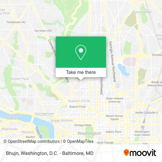
See Bhujn, Washington, on the map
Public Transit to Bhujn in Washington
Wondering how to get to Bhujn in Washington? Moovit helps you find the best way to get to Bhujn with step-by-step directions from the nearest public transit station.
Moovit provides free maps and live directions to help you navigate through your city. View schedules, routes, timetables, and find out how long does it take to get to Bhujn in real time.
Looking for the nearest stop or station to Bhujn? Check out this list of stops closest to your destination: 18 St Nw+California St NW; Columbia Rd Nw+19 St NW; Columbia Heights; 16 St Nw+Belmont St NW; Dupont Circle Metro Station.
Bus: C51, C53, D6X, D72, D74, D60.Metro: GREEN, RED, YELLOW.
Want to see if there’s another route that gets you there at an earlier time? Moovit helps you find alternative routes or times. Get directions from and directions to Bhujn easily from the Moovit App or Website.
We make riding to Bhujn easy, which is why over 1.5 million users, including users in Washington, trust Moovit as the best app for public transit. You don’t need to download an individual bus app or train app, Moovit is your all-in-one transit app that helps you find the best bus time or train time available.
For information on prices of bus and metro, costs and ride fares to Bhujn, please check the Moovit app.
Use the app to navigate to popular places including to the airport, hospital, stadium, grocery store, mall, coffee shop, school, college, and university.
Bhujn Address: 2305 18th St NW street in Washington
- Muzette Karaoke Studio & Korean Restaurant,
- Pitchers Cafe,
- A League of Her Own,
- Smash Records,
- Johnny Pistolas,
- Highroad Hostel DC,
- Rise Bakery (Rise Gluten Free Bakery),
- Marie Reed Elementary School,
- Sakuramen,
- 4645 Reservoir Road Northwest,
- Adams Morgan,
- Tattoo Paradise,
- Bukom Cafe,
- Madam's Organ Blues Bar,
- Madam's Organ (Madams Organ),
- Tryst,
- Shenanigan's Irish Pub,
- Bossa,
- Andy's Pizza,
- Lost City Books
Places Near Bhujn (Washington)
- Basilica of the National Shrine, Washington,
- Warner Theatre, Washington,
- National Zoo, Washington,
- Amazon Hq2, Arlington County,
- Georgetown, Washington,
- Camden Yards, Baltimore,
- PG Mall, Prince George's County,
- Museum Of The Bible, Washington,
- Washington National Cathedral, Washington,
- Marriott Marquis Washington, DC, Washington,
- Washington DC VA Medical Center, Washington,
- M&T Bank Stadium, Baltimore,
- Westfield Montgomery Mall, Montgomery County,
- Rock Creek Tennis Center, Washington,
- National Museum of African American History and Culture, Washington,
- The Anthem, Washington,
- Sibley Memorial Hospital, Washington,
- Capital One Arena, Washington,
- Pennsylvania Ave NW (3rd st and pennsylvania), Washington,
- National Theatre, Washington
How to get to popular places in Washington, D.C. - Baltimore, MD with public transit
Get around Washington by public transit!
Traveling around Washington has never been so easy. See step by step directions as you travel to any attraction, street or major public transit station. View bus and train schedules, arrival times, service alerts and detailed routes on a map, so you know exactly how to get to anywhere in Washington.
When traveling to any destination around Washington use Moovit's Live Directions with Get Off Notifications to know exactly where and how far to walk, how long to wait for your line, and how many stops are left. Moovit will alert you when it's time to get off — no need to constantly re-check whether yours is the next stop.
Wondering how to use public transit in Washington or how to pay for public transit in Washington? Moovit public transit app can help you navigate your way with public transit easily, and at minimum cost. It includes public transit fees, ticket prices, and costs. Looking for a map of Washington public transit lines? Moovit public transit app shows all public transit maps in Washington with all Bus, Train, Metro, Light Rail and Ferry routes and stops on an interactive map.
Washington, D.C. - Baltimore, MD has 5 transit type(s), including: Bus, Train, Metro, Light Rail and Ferry, operated by several transit agencies, including WMATA, Montgomery County Ride On, Fairfax Connector, TheBus, PRTC, DASH - Alexandria, Arlington Transit (ART), RTA of Central Maryland, MDOT MTA, MDOT MTA Light RailLink, MDOT MTA Commuter Bus, MDOT MTA Local Bus, FXBGO!, Virginia Railway Express (VRE) and MARC