Directions to Bi.Mo. (Casole D'Elsa) with public transportation
The following transit lines have routes that pass near Bi.Mo.
 Bus: 126.
How to get to Bi.Mo. by bus?
Click on the bus route to see step by step directions with maps, line arrival times and updated time schedules.
From Rugani Hospital, Monteriggioni
149 minFrom Piazza del Campo, Siena
119 minFrom Sarrocchi Technical Institute and Lyceum - Siena, Siena
109 minFrom New Maltraverso Sports Center, Colle Di Val D'Elsa
64 minFrom Massetana Romana, Siena
124 minFrom Siena Eye Laser, Poggibonsi
74 minFrom Massimo Bertoni Soccer Field, Siena
111 minFrom Colle Di Val D'Elsa, Colle Di Val D'Elsa
52 minFrom Alta Val d'Elsa River Park, Colle Di Val D'Elsa
49 minFrom Rugani Care Home, Monteriggioni
148 min
Bus stop near Bi.Mo. in Casole D'Elsa
- San Severo Estate, 7 min walk,VIEW
Bus lines to Bi.Mo. in Casole D'Elsa
- 126, Casole Consortium,VIEW
What are the closest stations to Bi.Mo.?
The closest stations to Bi.Mo. are:
- San Severo Estate is 457 meters away, 7 min walk.
Which bus line stops near Bi.Mo.?
126 (Casole Consortium)
What’s the nearest bus station to Bi.Mo. in Casole D'Elsa?
The nearest bus station to Bi.Mo. in Casole D'Elsa is San Severo Estate. It’s a 7 min walk away.
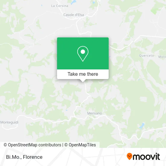
See Bi.Mo., Casole D'Elsa, on the map
Public Transit to Bi.Mo. in Casole D'Elsa
Wondering how to get to Bi.Mo. in Casole D'Elsa? Moovit helps you find the best way to get to Bi.Mo. with step-by-step directions from the nearest public transit station.
Moovit provides free maps and live directions to help you navigate through your city. View schedules, routes, timetables, and find out how long does it take to get to Bi.Mo. in real time.
Looking for the nearest stop or station to Bi.Mo.? Check out this list of stops closest to your destination: San Severo Estate.
Bus: 126.
Want to see if there’s another route that gets you there at an earlier time? Moovit helps you find alternative routes or times. Get directions from and directions to Bi.Mo. easily from the Moovit App or Website.
We make riding to Bi.Mo. easy, which is why over 1.5 million users, including users in Casole D'Elsa, trust Moovit as the best app for public transit. You don’t need to download an individual bus app or train app, Moovit is your all-in-one transit app that helps you find the best bus time or train time available.
For information on prices of bus, costs and ride fares to Bi.Mo., please check the Moovit app.
Use the app to navigate to popular places including to the airport, hospital, stadium, grocery store, mall, coffee shop, school, college, and university.
Bi.Mo. Address: Località Casciano, 53031 Casole d'Elsa street in Casole D'Elsa
- Isa Agricultural Development Increment,
- Bellaria Agricultural Farm by Burchianti Maimiliano,
- Alba,
- Podere Agresto 26,
- Btech Biemme,
- Paratex Italia,
- Cielsereno Agricultural Farm,
- Cielsereno,
- Tenuta Cantona,
- Michele Cocchiola,
- Rocche Square,
- Mensano,
- Cipriano Incoronata,
- Our Place,
- Paolo Pietroni,
- Il Merlo,
- Casole Road Omo Intersection,
- Chilean House,
- Casa Baronciole,
- Ferrini Primo
Places Near Bi.Mo. (Casole D'Elsa)
- Field of Mars, Florence,
- Tobacco Manufacture, Florence,
- Cascine Park, Florence,
- Nelson Mandela Forum, Florence,
- Visarno Arena, Florence,
- Santa Maria Nuova Hospital, Florence,
- Michelangelo Square, Florence,
- Visarno Hippodrome, Florence,
- Verdi Theater, Florence,
- Torregalli Hospital Scandicci *, Scandicci,
- I Gigli, Campi Bisenzio,
- Mandela Forum (Nelson Mandela Forum), Florence,
- OOO, Florence,
- Michelangelo Square, Florence,
- IKEA Florence, Sesto Fiorentino,
- Santa Maria Novella Station, Florence,
- Campi Bisenzio, Campi Bisenzio,
- Artemio Franchi Municipal Stadium, Florence,
- Asmana, Campi Bisenzio,
- Piero Palagi Hospital Facility-Florence, Florence
How to get to popular places in Florence with public transit
Get around Casole D'Elsa by public transit!
Traveling around Casole D'Elsa has never been so easy. See step by step directions as you travel to any attraction, street or major public transit station. View bus and train schedules, arrival times, service alerts and detailed routes on a map, so you know exactly how to get to anywhere in Casole D'Elsa.
When traveling to any destination around Casole D'Elsa use Moovit's Live Directions with Get Off Notifications to know exactly where and how far to walk, how long to wait for your line, and how many stops are left. Moovit will alert you when it's time to get off — no need to constantly re-check whether yours is the next stop.
Wondering how to use public transit in Casole D'Elsa or how to pay for public transit in Casole D'Elsa? Moovit public transit app can help you navigate your way with public transit easily, and at minimum cost. It includes public transit fees, ticket prices, and costs. Looking for a map of Casole D'Elsa public transit lines? Moovit public transit app shows all public transit maps in Casole D'Elsa with all Bus, Train, Light Rail, Ferry and Funicular routes and stops on an interactive map.
Florence has 5 transit type(s), including: Bus, Train, Light Rail, Ferry and Funicular, operated by several transit agencies, including Florence Urban - Tuscan Bus Lines, GEST, Livorno and Province - Tuscan Bus Lines, Arezzo, Florence and Provinces - Tuscan Bus Lines, Prato and Province - Tuscan Bus Lines, Lucca and Province - Tuscan Bus Lines, Massa, Carrara and Province - Tuscan Bus Lines, Pisa and Province - Tuscan Bus Lines, Grosseto, Siena and Provinces - Tuscan Bus Lines, Arezzo, Siena and Provinces - Tuscan Bus Lines, Florence and Province - Tuscan Bus Lines, Pistoia and Province - Tuscan Bus Lines, Siena and Province - Tuscan Bus Lines, Arezzo and Province - Tuscan Bus Lines and Trenitalia