How to get to Biggercode by bus?
Click on the bus route to see step by step directions with maps, line arrival times and updated time schedules.
From Elmhurst Hospital, Queens
69 minFrom LaGuardia High School, Manhattan
47 minFrom Costco, Manhattan
80 minFrom Naumburg Bandshell, Central Park, Manhattan
45 minFrom Costco Wholesale, Manhattan
79 minFrom Middle Village, NY, Queens
66 minFrom Astoria, Queens
86 minFrom Newport Mall Bus, Jersey City
73 minFrom Walmart, North Bergen
83 minFrom NJ 440, Jersey City
80 min
How to get to Biggercode by train?
Click on the train route to see step by step directions with maps, line arrival times and updated time schedules.
How to get to Biggercode by subway?
Click on the subway route to see step by step directions with maps, line arrival times and updated time schedules.
Bus stops near Biggercode in Manhattan
Subway stations near Biggercode in Manhattan
Bus lines to Biggercode in Manhattan
- X27, Bay Ridge - Manhattan Express,VIEW
- X28, Sea Gate / Bensonhurst - Manhattan Express,VIEW
- SIM1, Eltingville - Lower Manhattan Express,VIEW
- SIM1C, Eltingville - Manhattan Express,VIEW
- SIM3C, Pt. Richmond - Manhattan Express,VIEW
- SIM4C, Huguenot - Manhattan Express,VIEW
- SIM33C, Mariners Harbor - Greenwich Village Express,VIEW
- SIM34, Mariners Harbor - Lower Manhattan Express,VIEW
- M1, Soho Centre St Via 5 Av/ Via Broadway,VIEW
- M55, South Ferry,VIEW
- SHORTLINE HUDSON, 500 - Monroe - Chester - Goshen,VIEW
- SHORTLINE HUDSON, 200 - Northern District – Nanuet,VIEW
- SHORTLINE HUDSON, 800 - Pennsylvania,VIEW
- SHORTLINE HUDSON, 700 - Newburgh - Poughkeepsie,VIEW
- SHORTLINE HUDSON, 300 - NYC - Middletown,VIEW
- M21, 6 Av- Spring St,VIEW
- BXM18, Riverdale 263 St Via Madison Av Via H. Hudson Pky,VIEW
What are the closest stations to Biggercode?
The closest stations to Biggercode are:
- Broadway/Broome St is 115 yards away, 2 min walk.
- Broadway/Spring St is 260 yards away, 4 min walk.
- Spring St is 267 yards away, 4 min walk.
- Broadway & Spring St is 304 yards away, 4 min walk.
- Canal St is 439 yards away, 6 min walk.
- Prince St is 470 yards away, 6 min walk.
- 6 Av/Spring St is 504 yards away, 7 min walk.
- 6 Av/W Broadway is 513 yards away, 7 min walk.
Which bus lines stop near Biggercode?
These bus lines stop near Biggercode: 120, M1, M116, M55.
Which train lines stop near Biggercode?
These train lines stop near Biggercode: BLU, RED, YEL.
Which subway lines stop near Biggercode?
These subway lines stop near Biggercode: 1, 6, 6X, A, C, E, M, N.
What’s the nearest subway station to Biggercode in Manhattan?
The nearest subway station to Biggercode in Manhattan is Spring St. It’s a 4 min walk away.
What’s the nearest bus station to Biggercode in Manhattan?
The nearest bus station to Biggercode in Manhattan is Broadway/Broome St. It’s a 2 min walk away.
What time is the first subway to Biggercode in Manhattan?
The N is the first subway that goes to Biggercode in Manhattan. It stops nearby at 3:00 AM.
What time is the last subway to Biggercode in Manhattan?
The 2 is the last subway that goes to Biggercode in Manhattan. It stops nearby at 4:05 AM.
What time is the first bus to Biggercode in Manhattan?
The SIM1C is the first bus that goes to Biggercode in Manhattan. It stops nearby at 3:49 AM.
What time is the last bus to Biggercode in Manhattan?
The SIM1C is the last bus that goes to Biggercode in Manhattan. It stops nearby at 2:51 AM.
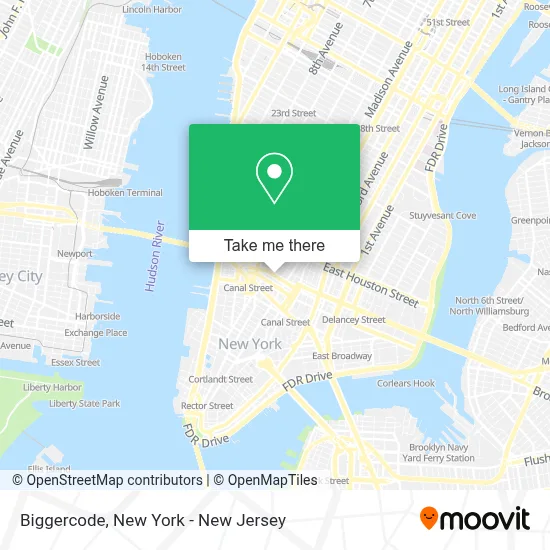
See Biggercode, Manhattan, on the map
Public Transit to Biggercode in Manhattan
Wondering how to get to Biggercode in Manhattan? Moovit helps you find the best way to get to Biggercode with step-by-step directions from the nearest public transit station.
Moovit provides free maps and live directions to help you navigate through your city. View schedules, routes, timetables, and find out how long does it take to get to Biggercode in real time.
Looking for the nearest stop or station to Biggercode? Check out this list of stops closest to your destination: Broadway/Broome St; Broadway/Spring St; Spring St; Broadway & Spring St; Canal St; Prince St; 6 Av/Spring St; 6 Av/W Broadway.
Bus: 120, M1, M116, M55, X27, X28, SIM1, SIM1C, SIM3C, SIM4C, SIM33C.Train: BLU, RED, YEL.Subway: 1, 6, 6X, A, C, E, M, N, 4, Q, R, W, 2.
Want to see if there’s another route that gets you there at an earlier time? Moovit helps you find alternative routes or times. Get directions from and directions to Biggercode easily from the Moovit App or Website.
We make riding to Biggercode easy, which is why over 1.5 million users, including users in Manhattan, trust Moovit as the best app for public transit. You don’t need to download an individual bus app or train app, Moovit is your all-in-one transit app that helps you find the best bus time or train time available.
For information on prices of bus, subway and train, costs and ride fares to Biggercode, please check the Moovit app.
Use the app to navigate to popular places including to the airport, hospital, stadium, grocery store, mall, coffee shop, school, college, and university.
Biggercode Address: 472 Broome St street in Manhattan
- Sicis,
- ফেব্রিক্স,
- Eden (Eden Gallery) - Soho,
- Dr Smood,
- Tigi Advanced Hairdressing Academy Salon,
- Arcadia Gallery,
- Cult Gaia,
- Moose Knuckles Soho,
- Rudy's Music Soho,
- Rails,
- Halston Heritage Soho,
- Lafayette 148 New York,
- Health Justice Initiative,
- Integrative Dermatology Nyc,
- 64 Wooster,
- Pascal Mathieu Eyewear,
- Afa | Nyc,
- Alexander and Bonin,
- Made by Many,
- Rudy's Music
Places Near Biggercode (Manhattan)
- Katz's Deli, Manhattan,
- Wall Street, Manhattan,
- San Gennaro Feast, Manhattan,
- 911 Memorial, Manhattan,
- 1 Police Plaza, Manhattan,
- 66 John Street, Manhattan,
- Queens Center Mall, Queens,
- Times Square, Manhattan,
- 3 Stone St, Manhattan,
- Pier 83, Manhattan,
- 376 Hudson Street, Manhattan,
- 26 Federal Plaza, Manhattan,
- 111 Centre New York City Supreme Court, Manhattan,
- Mountainside Hospital, Glen Ridge,
- Chinatown, Manhattan,
- Hudson Yards, Manhattan,
- SoHo, Manhattan,
- qqqq, Manhattan,
- Bellevue Hospital, Manhattan,
- Rockefeller Center, Manhattan
How to get to popular places in New York - New Jersey with public transit
Get around Manhattan by public transit!
Traveling around Manhattan has never been so easy. See step by step directions as you travel to any attraction, street or major public transit station. View bus and train schedules, arrival times, service alerts and detailed routes on a map, so you know exactly how to get to anywhere in Manhattan.
When traveling to any destination around Manhattan use Moovit's Live Directions with Get Off Notifications to know exactly where and how far to walk, how long to wait for your line, and how many stops are left. Moovit will alert you when it's time to get off — no need to constantly re-check whether yours is the next stop.
Wondering how to use public transit in Manhattan or how to pay for public transit in Manhattan? Moovit public transit app can help you navigate your way with public transit easily, and at minimum cost. It includes public transit fees, ticket prices, and costs. Looking for a map of Manhattan public transit lines? Moovit public transit app shows all public transit maps in Manhattan with all Bus, Train, Subway, Light Rail, Ferry and Cable Car routes and stops on an interactive map.
New York - New Jersey has 6 transit type(s), including: Bus, Train, Subway, Light Rail, Ferry and Cable Car, operated by several transit agencies, including MTA Subway, Metro-North Railroad, LIRR, PATH, MTA New York City Transit - Express routes, MTA Bus, NJ Transit, NYC Ferry, NICE bus, Bee-Line Bus, NJ Transit Rail, Norwalk Transit District, Hartford Line, River Valley Transit and HART