How to get to Beeline by bus?
Click on the bus route to see step by step directions with maps, line arrival times and updated time schedules.
From 16/1 Patsaeva, Oktyabrsky District
64 minFrom 23rd Line, Proletarsky District
43 minFrom Northern Babylon, Voroshilovsky District
50 minFrom Forum Shopping Center, Voroshilovsky District
60 minFrom Nakhichevan Market, Proletarsky District
40 minFrom City of Volos Street 11/81, Kirovsky District
33 minFrom Officers' House, Leninsky District
23 min
Shuttle stations near Beeline in Rostov-on-Don
- Zorge Street, 2 min walk,VIEW
Bus lines to Beeline in Rostov-on-Don
- 16, Emerald,VIEW
- 16, Stachki Avenue,VIEW
- 64, Peskov Street,VIEW
- 34, Central Market (Temernitskaya St) - GPZ-10,VIEW
- 34, GPZ-10 - Central Market,VIEW
- 41, European Complex (Three Squares District) - Central Market,VIEW
- 44, GPZ-10 - Mercury Shopping Center,VIEW
- 57, Kumzhensky Village - Central Market,VIEW
- 98, GPZ-10 - Selmash,VIEW
- 98, GPZ-10 - Karl Marx Square,VIEW
- 34A, GPZ-10 - Central Market,VIEW
- 12, Stanislavskogo Street,VIEW
What are the closest stations to Beeline?
The closest stations to Beeline are:
- Zorge Street is 72 meters away, 2 min walk.
- Stachki Avenue is 76 meters away, 2 min walk.
- Workers St. is 813 meters away, 11 min walk.
Which bus lines stop near Beeline?
These bus lines stop near Beeline: 26, 67, 94, 96.
Which shuttle lines stop near Beeline?
These shuttle lines stop near Beeline: 40, 59, 71.
What’s the nearest bus station to Beeline in Rostov-on-Don?
The nearest bus station to Beeline in Rostov-on-Don is Stachki Avenue. It’s a 2 min walk away.
What’s the nearest shuttle station to Beeline in Rostov-on-Don?
The nearest shuttle station to Beeline in Rostov-on-Don is Zorge Street. It’s a 2 min walk away.
What time is the first bus to Beeline in Rostov-on-Don?
The 34 is the first bus that goes to Beeline in Rostov-on-Don. It stops nearby at 5:08 AM.
What time is the last bus to Beeline in Rostov-on-Don?
The 71 is the last bus that goes to Beeline in Rostov-on-Don. It stops nearby at 11:56 PM.
What time is the first Trolleybus to Beeline in Rostov-on-Don?
The 8 is the first Trolleybus that goes to Beeline in Rostov-on-Don. It stops nearby at 5:54 AM.
What time is the last Trolleybus to Beeline in Rostov-on-Don?
The 12 is the last Trolleybus that goes to Beeline in Rostov-on-Don. It stops nearby at 7:33 PM.
What time is the first shuttle to Beeline in Rostov-on-Don?
The 59 is the first shuttle that goes to Beeline in Rostov-on-Don. It stops nearby at 5:10 AM.
What time is the last shuttle to Beeline in Rostov-on-Don?
The 67 is the last shuttle that goes to Beeline in Rostov-on-Don. It stops nearby at 12:00 AM.
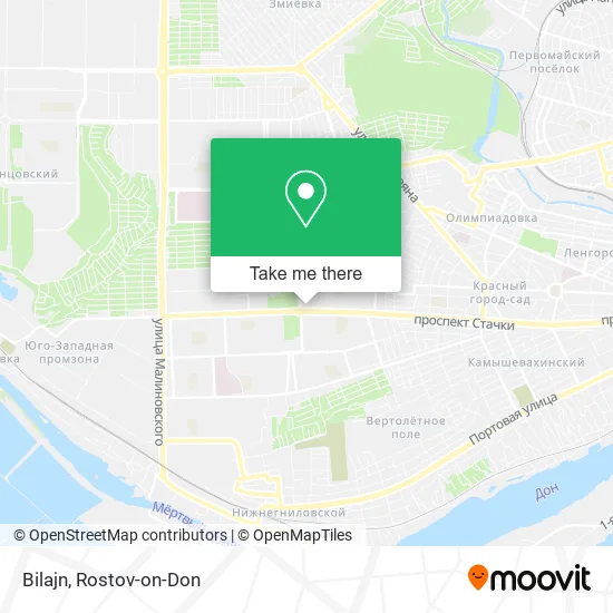
See Beeline, Rostov-on-Don, on the map
Public Transit to Beeline in Rostov-on-Don
Wondering how to get to Beeline in Rostov-on-Don? Moovit helps you find the best way to get to Beeline with step-by-step directions from the nearest public transit station.
Moovit provides free maps and live directions to help you navigate through your city. View schedules, routes, timetables, and find out how long does it take to get to Beeline in real time.
Looking for the nearest stop or station to Beeline? Check out this list of stops closest to your destination: Zorge Street; Stachki Avenue; Workers St..
Bus: 26, 67, 94, 96, 16, 16, 64, 34, 34, 41, 44, 57, 12.Shuttle: 40, 59, 71, 10, 20, 25, 26, 8.
Want to see if there’s another route that gets you there at an earlier time? Moovit helps you find alternative routes or times. Get directions from and directions to Beeline easily from the Moovit App or Website.
We make riding to Beeline easy, which is why over 1.5 million users, including users in Rostov-on-Don, trust Moovit as the best app for public transit. You don’t need to download an individual bus app or train app, Moovit is your all-in-one transit app that helps you find the best bus time or train time available.
For information on prices of bus, shuttle and light rail, costs and ride fares to Beeline, please check the Moovit app.
Use the app to navigate to popular places including to the airport, hospital, stadium, grocery store, mall, coffee shop, school, college, and university.
Beeline Address: Bilajn, улица Зорге, Ростов-на-Дону, Россия, 344090 street in Rostov-on-Don
- Charitable Foundation I Am Without a Mother,
- Strikes Avenue 190/16,
- Ozon,
- Knyazev Showroom,
- Katerins Market,
- Samotsvет Jewelry Store on Stachki Avenue,
- Stachki Ave/Zorge St,
- Farmatseft,
- Stachki Avenue & Sorge Street,
- Malibu,
- Zorge Street/Stachki Avenue,
- Pier,
- Fast Food Products Kiosk,
- Social Pharmacy,
- Malynovka,
- Zorge Street/Stachki Avenue,
- Shawarma Market,
- Dentistry,
- Zapadny Microdistrict,
- Zorge Street, 22/91
Places Near Beeline (Rostov-on-Don)
- CDC "Health", Pervomaisky District,
- Rostov Research Oncology Institute, Proletarsky District,
- Shopping Center "Horizon", Voroshilovsky District,
- 14 Line Street 63, Proletarsky District,
- Rostov Regional Clinical Hospital, Sovetsky District,
- Regional Clinical Hospital #2, Pervomaisky District,
- Sailors Hospital, Pervomaisky District,
- Blagodatnaya Street 170, Sovetsky District,
- Gaidara Street, Leninsky District,
- UFPS Military Unit 71609, Pervomaisky District,
- City Clinical Hospital #20, Sovetsky District,
- Temernik Market, Pervomaisky District,
- Regional Hospital #2,
- Rostov-on-Don Embankment,
- Pushkinskaya Street, 174, Kirovsky District,
- BSMP-2, Voroshilovsky District,
- Central Market,
- Sholokhov Avenue,
- Rostov Zoo, Oktyabrsky District,
- Pervomayskaya Station, Sovetsky District
How to get to popular places in Rostov-on-Don with public transit
Get around Rostov-on-Don by public transit!
Traveling around Rostov-on-Don has never been so easy. See step by step directions as you travel to any attraction, street or major public transit station. View bus and train schedules, arrival times, service alerts and detailed routes on a map, so you know exactly how to get to anywhere in Rostov-on-Don.
When traveling to any destination around Rostov-on-Don use Moovit's Live Directions with Get Off Notifications to know exactly where and how far to walk, how long to wait for your line, and how many stops are left. Moovit will alert you when it's time to get off — no need to constantly re-check whether yours is the next stop.
Wondering how to use public transit in Rostov-on-Don or how to pay for public transit in Rostov-on-Don? Moovit public transit app can help you navigate your way with public transit easily, and at minimum cost. It includes public transit fees, ticket prices, and costs. Looking for a map of Rostov-on-Don public transit lines? Moovit public transit app shows all public transit maps in Rostov-on-Don with all Bus, Light Rail, Trolleybus and Shuttle routes and stops on an interactive map.
Rostov-on-Don has 4 transit type(s), including: Bus, Light Rail, Trolleybus and Shuttle, operated by several transit agencies, including MUP MTK Rostovpassazhirtrans, MUP RTK, LLC RTK Ruseltrans and Minibuses