How to get to Bio by bus?
Click on the bus route to see step by step directions with maps, line arrival times and updated time schedules.
From Chambourcy, Chambourcy
102 minFrom Clinique Sainte Marie, Osny
164 minFrom Osny, Osny
172 minFrom Centre Commercial Grand Plaisir, Plaisir
144 minFrom Les 3 Fontaines, Cergy
147 minFrom IKEA, Plaisir
172 minFrom Hôpital de Poissy, Poissy
95 minFrom Orgeval, Orgeval
109 minFrom Camp militaire de Frileuse, Beynes
171 minFrom Cergy Préfecture, Cergy
144 min
How to get to Bio by train?
Click on the train route to see step by step directions with maps, line arrival times and updated time schedules.
Bus stops near Bio in Bonnieres-Sur-Seine
Train station near Bio in Bonnieres-Sur-Seine
- Bonnières, 23 min walk,VIEW
Bus lines to Bio in Bonnieres-Sur-Seine
- 5412, Centre Social,VIEW
- 5424, Bonnières-Sur-Seine Gare Routière - Quai 4,VIEW
- 5432, Snecma,VIEW
- 5433, Lycée Saint-Adjutor,VIEW
- 5413, Gare de Mantes-La-Jolie - Quai 2,VIEW
- 5421, Conflans Fin D'Oise Noctilien,VIEW
- 5431, Géo André,VIEW
- 5436, Eglise,VIEW
- 5465, Voie Jurée,VIEW
- 5477, Gare Routière,VIEW
- 5435, Place de Gaulle,VIEW
- 5467, Collège Marcel Pagnol,VIEW
What are the closest stations to Bio?
The closest stations to Bio are:
- Cimetière is 250 meters away, 4 min walk.
- Bonnières-Sur-Seine Gare Routière - Quai 2 is 327 meters away, 5 min walk.
- Gare Routière is 346 meters away, 5 min walk.
- Bonnières-Sur-Seine Gare Routière - Quai 7 is 351 meters away, 5 min walk.
- Gambetta is 702 meters away, 9 min walk.
- Bonnières is 1812 meters away, 23 min walk.
Which train line stops near Bio?
J (Paris-Saint-Lazare)
Which bus lines stop near Bio?
These bus lines stop near Bio: 5412, 5413.
What’s the nearest train station to Bio in Bonnieres-Sur-Seine?
The nearest train station to Bio in Bonnieres-Sur-Seine is Bonnières. It’s a 23 min walk away.
What’s the nearest bus station to Bio in Bonnieres-Sur-Seine?
The nearest bus station to Bio in Bonnieres-Sur-Seine is Cimetière. It’s a 4 min walk away.
What time is the first train to Bio in Bonnieres-Sur-Seine?
The J is the first train that goes to Bio in Bonnieres-Sur-Seine. It stops nearby at 5:21 AM.
What time is the last train to Bio in Bonnieres-Sur-Seine?
The J is the last train that goes to Bio in Bonnieres-Sur-Seine. It stops nearby at 10:10 PM.
What time is the first bus to Bio in Bonnieres-Sur-Seine?
The 5433 is the first bus that goes to Bio in Bonnieres-Sur-Seine. It stops nearby at 4:19 AM.
What time is the last bus to Bio in Bonnieres-Sur-Seine?
The 5433 is the last bus that goes to Bio in Bonnieres-Sur-Seine. It stops nearby at 9:37 PM.
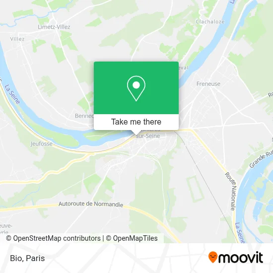
See Bio, Bonnieres-Sur-Seine, on the map
Public Transit to Bio in Bonnieres-Sur-Seine
Wondering how to get to Bio in Bonnieres-Sur-Seine? Moovit helps you find the best way to get to Bio with step-by-step directions from the nearest public transit station.
Moovit provides free maps and live directions to help you navigate through your city. View schedules, routes, timetables, and find out how long does it take to get to Bio in real time.
Looking for the nearest stop or station to Bio? Check out this list of stops closest to your destination: Cimetière; Bonnières-Sur-Seine Gare Routière - Quai 2; Gare Routière; Bonnières-Sur-Seine Gare Routière - Quai 7; Gambetta; Bonnières.
Train: J, TER.Bus: 5412, 5413, 5424, 5432, 5433, 5421, 5431, 5436, 5465, 5477.
Want to see if there’s another route that gets you there at an earlier time? Moovit helps you find alternative routes or times. Get directions from and directions to Bio easily from the Moovit App or Website.
We make riding to Bio easy, which is why over 1.5 million users, including users in Bonnieres-Sur-Seine, trust Moovit as the best app for public transit. You don’t need to download an individual bus app or train app, Moovit is your all-in-one transit app that helps you find the best bus time or train time available.
For information on prices of bus, train and RER, costs and ride fares to Bio, please check the Moovit app.
Use the app to navigate to popular places including to the airport, hospital, stadium, grocery store, mall, coffee shop, school, college, and university.
Bio Address: 25 Rue Marcel Sembat 78270 Bonnières-sur-Seine street in Bonnieres-Sur-Seine
- Msy Charaf,
- La Tribu Modeuse,
- Med,
- Istanbul Grill,
- Nah Sushi Bonnieres,
- Flep,
- Notre Dame Mantes,
- École Et Collège Privés Saint-Louis,
- Institut de Beauté,
- Lay by Chemin du Halage,
- Restaurant le Dragon,
- Eurl Brasserie Fougeroux,
- Nutri'Forme,
- Bonnières-sur-Seine,
- Ouendeno Alexandre,
- Gymnase Municipal,
- Gare de Bonnières,
- Western Union,
- FedEx,
- Cousinade te
Places Near Bio (Bonnieres-Sur-Seine)
- Institut Curie, Paris,
- Marché Saint-Pierre, Paris,
- Hôpital Beaujon, Clichy,
- Atelier Des Lumieres, Paris,
- Gare Routière Flixbus, Paris,
- Hôpital de la Pitié-Salpêtrière, Paris,
- 29 Rue Manin, Paris,
- Hôpital Saint-Joseph, Paris,
- Galeries Lafayette, Paris,
- Fondation Louis Vuitton, Paris,
- Hopital Lariboisière, Paris,
- Hôpital Pitié Salpêtrière, Paris,
- Théâtre Mogador, Paris,
- Hopital Foch, Suresnes,
- Galeries Lafayette Haussmann, Paris,
- Hôpital Henri Mondor, Creteil,
- Créteil Soleil, Creteil,
- Hôpital Necker, Paris,
- Centre Hospitalier des 15/20, Paris,
- Hôpital Cochin, Paris
How to get to popular places in Paris with public transit
Get around Bonnieres-Sur-Seine by public transit!
Traveling around Bonnieres-Sur-Seine has never been so easy. See step by step directions as you travel to any attraction, street or major public transit station. View bus and train schedules, arrival times, service alerts and detailed routes on a map, so you know exactly how to get to anywhere in Bonnieres-Sur-Seine.
When traveling to any destination around Bonnieres-Sur-Seine use Moovit's Live Directions with Get Off Notifications to know exactly where and how far to walk, how long to wait for your line, and how many stops are left. Moovit will alert you when it's time to get off — no need to constantly re-check whether yours is the next stop.
Wondering how to use public transit in Bonnieres-Sur-Seine or how to pay for public transit in Bonnieres-Sur-Seine? Moovit public transit app can help you navigate your way with public transit easily, and at minimum cost. It includes public transit fees, ticket prices, and costs. Looking for a map of Bonnieres-Sur-Seine public transit lines? Moovit public transit app shows all public transit maps in Bonnieres-Sur-Seine with all Bus, Train, Metro, Light Rail, RER, Funicular and Gondola routes and stops on an interactive map.
Paris has 7 transit type(s), including: Bus, Train, Metro, Light Rail, RER, Funicular and Gondola, operated by several transit agencies, including RATP, RER, RER Bus de remplacement, Train, Train Bus de remplacement, Tramway Bus de remplacement, TER, ADP, Magical Shuttle, Argenteuil - Boucles de Seine, Autocars Dominique, Bièvre, Brie et 2 Morin, Le Bus - C.C. du Clermontois and Cœur d’Essonne