How to get to Bioclinic by bus?
Click on the bus route to see step by step directions with maps, line arrival times and updated time schedules.
From Avenue Charles de Gaulle, Neuilly-Sur-Seine
54 minFrom 18e Arrondissement, Paris
60 minFrom 70 Avenue Victor Hugo, Aubervilliers
57 minFrom Salle Cortot, Paris
54 minFrom Musée de Montmartre, Paris
61 minFrom RTL, Neuilly-Sur-Seine
54 minFrom Centre Commercial Les 4 Temps, Puteaux
66 minFrom Centre Cardiologique du Nord, Saint-Denis
44 minFrom Colombes, Colombes
46 minFrom Le Ruban Bleu, Nanterre
74 min
How to get to Bioclinic by train?
Click on the train route to see step by step directions with maps, line arrival times and updated time schedules.
Bus stops near Bioclinic in Saint-Gratien
Train station near Bioclinic in Saint-Gratien
- Champ de Courses D'Enghien, 21 min walk,VIEW
Bus lines to Bioclinic in Saint-Gratien
What are the closest stations to Bioclinic?
The closest stations to Bioclinic are:
- Paul Doumer is 136 meters away, 2 min walk.
- Forum is 306 meters away, 5 min walk.
- Général de Gaulle is 388 meters away, 6 min walk.
- Avenue Mathilde is 550 meters away, 8 min walk.
- Cressonnières is 968 meters away, 13 min walk.
- Champ de Courses D'Enghien is 1601 meters away, 21 min walk.
Which train line stops near Bioclinic?
H (Creil/ Pontoise/ Persan - Beaumont/ Luzarches)
Which RER line stops near Bioclinic?
C (Pontoise/ Saint-Quentin-en-Yvelines/ Versailles-Chantiers/ Versailles-Château-Rive-Gauche)
Which bus lines stop near Bioclinic?
These bus lines stop near Bioclinic: 138, 1516.
What’s the nearest train station to Bioclinic in Saint-Gratien?
The nearest train station to Bioclinic in Saint-Gratien is Champ de Courses D'Enghien. It’s a 21 min walk away.
What’s the nearest bus station to Bioclinic in Saint-Gratien?
The nearest bus station to Bioclinic in Saint-Gratien is Paul Doumer. It’s a 2 min walk away.
What time is the first train to Bioclinic in Saint-Gratien?
The H is the first train that goes to Bioclinic in Saint-Gratien. It stops nearby at 5:00 AM.
What time is the last train to Bioclinic in Saint-Gratien?
The H is the last train that goes to Bioclinic in Saint-Gratien. It stops nearby at 12:58 AM.
What time is the first bus to Bioclinic in Saint-Gratien?
The 1514 is the first bus that goes to Bioclinic in Saint-Gratien. It stops nearby at 5:33 AM.
What time is the last bus to Bioclinic in Saint-Gratien?
The 1514 is the last bus that goes to Bioclinic in Saint-Gratien. It stops nearby at 1:18 AM.
What time is the first RER to Bioclinic in Saint-Gratien?
The C is the first RER that goes to Bioclinic in Saint-Gratien. It stops nearby at 5:08 AM.
What time is the last RER to Bioclinic in Saint-Gratien?
The C is the last RER that goes to Bioclinic in Saint-Gratien. It stops nearby at 12:51 AM.
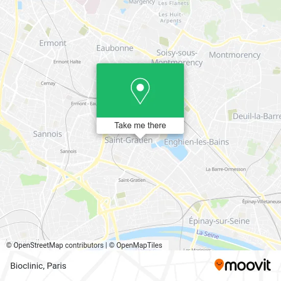
See Bioclinic, Saint-Gratien, on the map
Public Transit to Bioclinic in Saint-Gratien
Wondering how to get to Bioclinic in Saint-Gratien? Moovit helps you find the best way to get to Bioclinic with step-by-step directions from the nearest public transit station.
Moovit provides free maps and live directions to help you navigate through your city. View schedules, routes, timetables, and find out how long does it take to get to Bioclinic in real time.
Looking for the nearest stop or station to Bioclinic? Check out this list of stops closest to your destination: Paul Doumer; Forum; Général de Gaulle; Avenue Mathilde; Cressonnières; Champ de Courses D'Enghien.
Train: H.RER: C.Bus: 138, 1516, 1511, 1514, 1510.
Want to see if there’s another route that gets you there at an earlier time? Moovit helps you find alternative routes or times. Get directions from and directions to Bioclinic easily from the Moovit App or Website.
We make riding to Bioclinic easy, which is why over 1.5 million users, including users in Saint-Gratien, trust Moovit as the best app for public transit. You don’t need to download an individual bus app or train app, Moovit is your all-in-one transit app that helps you find the best bus time or train time available.
For information on prices of bus, train, RER, metro and light rail, costs and ride fares to Bioclinic, please check the Moovit app.
Use the app to navigate to popular places including to the airport, hospital, stadium, grocery store, mall, coffee shop, school, college, and university.
Bioclinic Address: Avenue Danielle Casanova 95210 Saint-Gratien street in Saint-Gratien
- 15 Avenue Danielle Casanova,
- Cfa Saint Jean,
- Franprix,
- Paroisse Saint Gratien,
- Notre Dame de la Fraternité,
- Cabinet Vétérinaire du Forum,
- 4 Place Charles de Gaulle,
- Accueil,
- Lapasse Additives Chemicals,
- Skorp Photos,
- Leconte Céline,
- Place Roger Salengro,
- Cabinet de Psychologie,
- Docteur Jonathan Mimran,
- Divers Diplome,
- Scm Mazal,
- Selarldudrabouza,
- Selarlabouzaglo,
- Sow Bahinde,
- Atol Optique & Audition Saint-Gratien
Places Near Bioclinic (Saint-Gratien)
- Centre Hospitalier des 15/20, Paris,
- Hôpital Necker, Paris,
- Hôpital Cochin, Paris,
- Hôpital Saint-Joseph, Paris,
- 29 Rue Manin, Paris,
- Théâtre Mogador, Paris,
- Hôpital de la Pitié-Salpêtrière, Paris,
- Atelier Des Lumieres, Paris,
- Hôpital Beaujon, Clichy,
- Hôpital Henri Mondor, Creteil,
- Hopital Foch, Suresnes,
- Créteil Soleil, Creteil,
- Galeries Lafayette Haussmann, Paris,
- Fondation Louis Vuitton, Paris,
- Hôpital Pitié Salpêtrière, Paris,
- Gare Routière Flixbus, Paris,
- Galeries Lafayette, Paris,
- Hopital Lariboisière, Paris,
- Marché Saint-Pierre, Paris,
- Beaugrenelle, Paris
How to get to popular places in Paris with public transit
Get around Saint-Gratien by public transit!
Traveling around Saint-Gratien has never been so easy. See step by step directions as you travel to any attraction, street or major public transit station. View bus and train schedules, arrival times, service alerts and detailed routes on a map, so you know exactly how to get to anywhere in Saint-Gratien.
When traveling to any destination around Saint-Gratien use Moovit's Live Directions with Get Off Notifications to know exactly where and how far to walk, how long to wait for your line, and how many stops are left. Moovit will alert you when it's time to get off — no need to constantly re-check whether yours is the next stop.
Wondering how to use public transit in Saint-Gratien or how to pay for public transit in Saint-Gratien? Moovit public transit app can help you navigate your way with public transit easily, and at minimum cost. It includes public transit fees, ticket prices, and costs. Looking for a map of Saint-Gratien public transit lines? Moovit public transit app shows all public transit maps in Saint-Gratien with all Bus, Train, Metro, Light Rail, RER, Funicular and Gondola routes and stops on an interactive map.
Paris has 7 transit type(s), including: Bus, Train, Metro, Light Rail, RER, Funicular and Gondola, operated by several transit agencies, including RATP, RER, RER Bus de remplacement, Train, Train Bus de remplacement, Tramway Bus de remplacement, TER, ADP, Magical Shuttle, Argenteuil - Boucles de Seine, Autocars Dominique, Bièvre, Brie et 2 Morin, Le Bus - C.C. du Clermontois and Cœur d’Essonne