Directions to Biotech Wellness Center (Miami) with public transportation
The following transit lines have routes that pass near Biotech Wellness Center
 Bus: 9, AVTPUR, RED EXPRESS ROUTE, AVTGRN, BLUE EXPRESS ROUTE.
- Train: BLFM.
How to get to Biotech Wellness Center by bus?
Click on the bus route to see step by step directions with maps, line arrival times and updated time schedules.
From Margaritaville Hollywood Beach Resort, Hollywood
57 minFrom Memorial Regional Hospital, Hollywood
88 minFrom Neighbor Transport Services, Miami
82 minFrom Bass Pro Shops Indoor Shooting Range, Hollywood
82 minFrom Oakwood Plaza, Hollywood
73 minFrom Yellow Green Farmers Market, Hollywood
86 minFrom 16900 NW 12th Ave, Miami Gardens
82 minFrom Mall at 163rd Street, Miami
43 minFrom Surfside Beach, Miami Beach
42 minFrom Miramar, FL, Miramar-Pembroke Pines
86 min
How to get to Biotech Wellness Center by train?
Click on the train route to see step by step directions with maps, line arrival times and updated time schedules.
Bus stops near Biotech Wellness Center in Miami
- Waterways Shoppes, 2 min walk,VIEW
Train station near Biotech Wellness Center in Miami
- Aventura, 52 min walk,VIEW
Bus lines to Biotech Wellness Center in Miami
- AVTGRN, Green,VIEW
- AVTPUR, Purple,VIEW
- BLUE EXPRESS ROUTE, Blue Express Route,VIEW
- GREEN EXPRESS ROUTE, Green Express Route,VIEW
- RED EXPRESS ROUTE, Red Express Route,VIEW
- SATURDAY NIGHT EXPRESS NORTH ROUTE, Saturday Night Express North Route,VIEW
- SATURDAY NIGHT EXPRESS SOUTH ROUTE, Saturday Night Express South Route,VIEW
What are the closest stations to Biotech Wellness Center?
The closest stations to Biotech Wellness Center are:
- Waterways Shoppes is 96 yards away, 2 min walk.
- Aventura is 4412 yards away, 52 min walk.
Which bus lines stop near Biotech Wellness Center?
These bus lines stop near Biotech Wellness Center: 9, AVTPUR, RED EXPRESS ROUTE.
Which train line stops near Biotech Wellness Center?
BLFM (Mco)
What’s the nearest bus station to Biotech Wellness Center in Miami?
The nearest bus station to Biotech Wellness Center in Miami is Waterways Shoppes. It’s a 2 min walk away.
What time is the first train to Biotech Wellness Center in Miami?
The BLFM is the first train that goes to Biotech Wellness Center in Miami. It stops nearby at 6:09 AM.
What time is the last train to Biotech Wellness Center in Miami?
The BLFM is the last train that goes to Biotech Wellness Center in Miami. It stops nearby at 12:07 AM.
What time is the first bus to Biotech Wellness Center in Miami?
The BLUE EXPRESS ROUTE is the first bus that goes to Biotech Wellness Center in Miami. It stops nearby at 6:48 AM.
What time is the last bus to Biotech Wellness Center in Miami?
The AVTGRN is the last bus that goes to Biotech Wellness Center in Miami. It stops nearby at 9:23 PM.
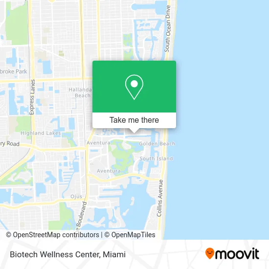
See Biotech Wellness Center, Miami, on the map
Public Transit to Biotech Wellness Center in Miami
Wondering how to get to Biotech Wellness Center in Miami? Moovit helps you find the best way to get to Biotech Wellness Center with step-by-step directions from the nearest public transit station.
Moovit provides free maps and live directions to help you navigate through your city. View schedules, routes, timetables, and find out how long does it take to get to Biotech Wellness Center in real time.
Looking for the nearest stop or station to Biotech Wellness Center? Check out this list of stops closest to your destination: Waterways Shoppes; Aventura.
Bus: 9, AVTPUR, RED EXPRESS ROUTE, AVTGRN, BLUE EXPRESS ROUTE, GREEN EXPRESS ROUTE, SATURDAY NIGHT EXPRESS NORTH ROUTE, SATURDAY NIGHT EXPRESS SOUTH ROUTE.Train: BLFM.
Want to see if there’s another route that gets you there at an earlier time? Moovit helps you find alternative routes or times. Get directions from and directions to Biotech Wellness Center easily from the Moovit App or Website.
We make riding to Biotech Wellness Center easy, which is why over 1.5 million users, including users in Miami, trust Moovit as the best app for public transit. You don’t need to download an individual bus app or train app, Moovit is your all-in-one transit app that helps you find the best bus time or train time available.
For information on prices of bus and train, costs and ride fares to Biotech Wellness Center, please check the Moovit app.
Use the app to navigate to popular places including to the airport, hospital, stadium, grocery store, mall, coffee shop, school, college, and university.
Biotech Wellness Center Address: 3575 NE 207th St Miami, FL 33180 street in Miami
- Eridan,
- Zohar's Gelato,
- Aventura-Waterways,
- Health Systems,
- White Russian Restaurant,
- Mesibabi Candy,
- Instyle Coated Fabric,
- Street Hibachi,
- Reliable Insurance Claims Adjusters,
- Business Productivity Solutions,
- Perulla Yacht Rental,
- Flowers and Collages,
- Joda Nome,
- X5 Studios,
- Abba Locksmith,
- MV Luxury Glass,
- N Country Club Dr & # 3375 ,
- Tattoo Bacata,
- Tali Almog Pai,
- Delvista Townhomes
Places Near Biotech Wellness Center (Miami)
- Miami Freedom Park, Miami,
- Marlins Park, Miami,
- Bayside Marketplace, Miami,
- Aventura Mall, Miami Beach,
- Dolphin Mall Bus, Miami,
- Miami VA Hospital, Miami,
- Miami-Dade County Courthouse, Miami,
- Brickell City Centre, Miami,
- Richard E. Gerstein Justice Building, Miami,
- Keiser University Flagship Campus, West Palm Beach,
- Sawgrass Mall, Miami,
- Miami Design District, Miami,
- Sawgrass mall ( FL ), Miami Beach,
- Wynwood, Miami,
- Aventura Mall, Miami,
- Port of Miami Cruise Terminal, Miami,
- Little Havana, Miami,
- Zoo Miami, Miami,
- Hard Rock Stadium, Miami Gardens,
- Dolphin Mall, Miami
How to get to popular places in Miami with public transit
Get around Miami by public transit!
Traveling around Miami has never been so easy. See step by step directions as you travel to any attraction, street or major public transit station. View bus and train schedules, arrival times, service alerts and detailed routes on a map, so you know exactly how to get to anywhere in Miami.
When traveling to any destination around Miami use Moovit's Live Directions with Get Off Notifications to know exactly where and how far to walk, how long to wait for your line, and how many stops are left. Moovit will alert you when it's time to get off — no need to constantly re-check whether yours is the next stop.
Wondering how to use public transit in Miami or how to pay for public transit in Miami? Moovit public transit app can help you navigate your way with public transit easily, and at minimum cost. It includes public transit fees, ticket prices, and costs. Looking for a map of Miami public transit lines? Moovit public transit app shows all public transit maps in Miami with all Bus, Train, Light Rail and Ferry routes and stops on an interactive map.
Miami has 4 transit type(s), including: Bus, Train, Light Rail and Ferry, operated by several transit agencies, including Broward County Transit, Miami-Dade Transit, Metrorail, Palm Tran, Tri-Rail, Brightline, MARTY, City of Homestead Trolley, Key West Transit, Treasure Coast Connector, GoLine IRT, Amtrak, Greyhound-us, FlixBus-us and Aventura Express Shuttle Bus