Directions to Bir-Hakeim Metro (Paris) with public transportation
The following transit lines have routes that pass near Bir-Hakeim Metro
 Bus: 30, 42, 72, 82, 86.
- Metro: 6.
- RER: C.
How to get to Bir-Hakeim Metro by bus?
Click on the bus route to see step by step directions with maps, line arrival times and updated time schedules.
How to get to Bir-Hakeim Metro by metro?
Click on the metro route to see step by step directions with maps, line arrival times and updated time schedules.
Bus stops near Bir-Hakeim Metro in Paris
- Champ de Mars - Suffren, 1 min walk,
- Bir-Hakeim, 2 min walk,
- Desaix, 4 min walk,
- Pont de Bir-Hakeim, 5 min walk,
Metro station near Bir-Hakeim Metro in Paris
- Passy, 6 min walk,
RER station near Bir-Hakeim Metro in Paris
- Champ de Mars Tour Eiffel, 7 min walk,
Bus lines to Bir-Hakeim Metro in Paris
- 82, Luxembourg,
- 30, Pigalle,
- 42, Gare Saint-Lazare,
- 72, Gare de Lyon - Maison de la Ratp,
What are the closest stations to Bir-Hakeim Metro?
The closest stations to Bir-Hakeim Metro are:
- Champ de Mars - Suffren is 59 meters away, 1 min walk.
- Bir-Hakeim is 128 meters away, 2 min walk.
- Desaix is 249 meters away, 4 min walk.
- Pont de Bir-Hakeim is 371 meters away, 5 min walk.
- Passy is 456 meters away, 6 min walk.
- Champ de Mars Tour Eiffel is 507 meters away, 7 min walk.
Which bus lines stop near Bir-Hakeim Metro?
These bus lines stop near Bir-Hakeim Metro: 30, 42, 72, 82, 86.
Which metro line stops near Bir-Hakeim Metro?
6 (Charles de Gaulle-Etoile)
Which RER line stops near Bir-Hakeim Metro?
C (Pontoise/ Saint-Quentin-en-Yvelines/ Versailles-Chantiers/ Versailles-Château-Rive-Gauche)
What’s the nearest metro station to Bir-Hakeim Metro in Paris?
The nearest metro station to Bir-Hakeim Metro in Paris is Passy. It’s a 6 min walk away.
What’s the nearest bus station to Bir-Hakeim Metro in Paris?
The nearest bus station to Bir-Hakeim Metro in Paris is Champ de Mars - Suffren. It’s a 1 min walk away.
What’s the nearest RER station to Bir-Hakeim Metro in Paris?
The nearest RER station to Bir-Hakeim Metro in Paris is Champ de Mars Tour Eiffel. It’s a 7 min walk away.
What time is the first metro to Bir-Hakeim Metro in Paris?
The 6 is the first metro that goes to Bir-Hakeim Metro in Paris. It stops nearby at 5:31 AM.
What time is the last metro to Bir-Hakeim Metro in Paris?
The 6 is the last metro that goes to Bir-Hakeim Metro in Paris. It stops nearby at 1:09 AM.
What time is the first bus to Bir-Hakeim Metro in Paris?
The 82 is the first bus that goes to Bir-Hakeim Metro in Paris. It stops nearby at 6:22 AM.
What time is the last bus to Bir-Hakeim Metro in Paris?
The 72 is the last bus that goes to Bir-Hakeim Metro in Paris. It stops nearby at 1:02 AM.
What time is the first RER to Bir-Hakeim Metro in Paris?
The C is the first RER that goes to Bir-Hakeim Metro in Paris. It stops nearby at 5:23 AM.
What time is the last RER to Bir-Hakeim Metro in Paris?
The C is the last RER that goes to Bir-Hakeim Metro in Paris. It stops nearby at 11:17 PM.
See Bir-Hakeim Metro, Paris, on the map
Public Transit to Bir-Hakeim Metro in Paris
Wondering how to get to Bir-Hakeim Metro in Paris? Moovit helps you find the best way to get to Bir-Hakeim Metro with step-by-step directions from the nearest public transit station.
Moovit provides free maps and live directions to help you navigate through your city. View schedules, routes, timetables, and find out how long does it take to get to Bir-Hakeim Metro in real time.
Looking for the nearest stop or station to Bir-Hakeim Metro? Check out this list of stops closest to your destination: Champ de Mars - Suffren; Bir-Hakeim; Desaix; Pont de Bir-Hakeim; Passy; Champ de Mars Tour Eiffel.
Bus: 30, 42, 72, 82, 86.Metro: 6.RER: C.
Want to see if there’s another route that gets you there at an earlier time? Moovit helps you find alternative routes or times. Get directions from and directions to Bir-Hakeim Metro easily from the Moovit App or Website.
We make riding to Bir-Hakeim Metro easy, which is why over 1.5 million users, including users in Paris, trust Moovit as the best app for public transit. You don’t need to download an individual bus app or train app, Moovit is your all-in-one transit app that helps you find the best bus time or train time available.
For information on prices of metro, bus, RER and train, costs and ride fares to Bir-Hakeim Metro, please check the Moovit app.
Use the app to navigate to popular places including to the airport, hospital, stadium, grocery store, mall, coffee shop, school, college, and university.
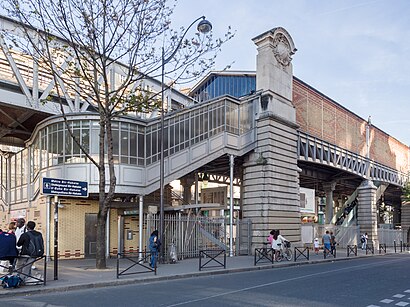
Bir-Hakeim Metro Address: 6-18 bd de Grenelle street in Paris
- Métro Bir-Hakeim [6],
- Castorama Bir Hakeim,
- Correspondances RER C Et Métro 6,
- Ministère de l'Intérieur,
- Mémorial du Vélodrome d'Hiver,
- Tour Eiffel,
- Castorama,
- New Cap Event Rooftop,
- Jardin Mémorial Des Enfants du Vél' D'Hiv',
- Hôtel Eiffel Seine Paris,
- Monument Commémoratif des Victimes de la Rafle du Vel d'Hiv',
- Le Bistrot de la Tour,
- Métro-Bir-Hakeim,
- NewCap Event Center,
- CAP 15,
- 15 Boulevard de Grenelle,
- Square de la Place des Martyrs Juifs du Velodrome d'Hiver,
- Hotel Nikko,
- Monument Commémoratif de la Rafle du Vel'd'Hiv,
- Eramet
Places Near Bir-Hakeim Metro (Paris)
- Hôpital Saint-Joseph, Paris,
- Galeries Lafayette, Paris,
- 29 Rue Manin, Paris,
- Hôpital de la Pitié-Salpêtrière, Paris,
- Créteil Soleil, Creteil,
- Centre Hospitalier des 15/20, Paris,
- Salon de l'Agriculture, Paris,
- Hôpital Pitié Salpêtrière, Paris,
- Porte de Versailles, Paris,
- Le Marché de Sarcelles, Sarcelles,
- Le Grand Rex, Paris,
- Fondation Louis Vuitton, Paris,
- Galeries Lafayette Haussmann, Paris,
- Le Bon Marché, Paris,
- Hopital Foch, Suresnes,
- Gare Routière Flixbus, Paris,
- Atelier Des Lumieres, Paris,
- Théâtre Mogador, Paris,
- Grande Mosquée de Paris, Paris,
- Hôpital Cochin, Paris
How to get to popular places in Paris with public transit
Get around Paris by public transit!
Traveling around Paris has never been so easy. See step by step directions as you travel to any attraction, street or major public transit station. View bus and train schedules, arrival times, service alerts and detailed routes on a map, so you know exactly how to get to anywhere in Paris.
When traveling to any destination around Paris use Moovit's Live Directions with Get Off Notifications to know exactly where and how far to walk, how long to wait for your line, and how many stops are left. Moovit will alert you when it's time to get off — no need to constantly re-check whether yours is the next stop.
Wondering how to use public transit in Paris or how to pay for public transit in Paris? Moovit public transit app can help you navigate your way with public transit easily, and at minimum cost. It includes public transit fees, ticket prices, and costs. Looking for a map of Paris public transit lines? Moovit public transit app shows all public transit maps in Paris with all Bus, Train, Metro, Light Rail, RER, Funicular and Gondola routes and stops on an interactive map.
Paris has 7 transit type(s), including: Bus, Train, Metro, Light Rail, RER, Funicular and Gondola, operated by several transit agencies, including RATP, RER, RER Bus de remplacement, Train, Train Bus de remplacement, TER, ADP, Magical Shuttle, Argenteuil - Boucles de Seine, Autocars Dominique, Bièvre, Brie et 2 Morin, Le Bus - C.C. du Clermontois, Cœur d’Essonne and Essonne Sud Ouest