How to get to Birce Moda Evi by bus?
Click on the bus route to see step by step directions with maps, line arrival times and updated time schedules.
From As Merkez AVM, Osmangazi
36 minFrom Samanlı Minibüsü, Yıldırım
46 minFrom Aquapark, Nilüfer
53 minFrom Özdilek Cafe Yalova Yolu Bursa, Osmangazi
33 minFrom bursa misi köyü, Nilüfer
45 minFrom Hürriyet Otobüs Durakları, Osmangazi
31 minFrom Şehit Ömer Halisdemir Mesleki ve Teknik Anadolu Lisesi, Osmangazi
59 minFrom Demirtaş Organize Sanayi Bölgesi, Osmangazi
49 minFrom Görükle Göçmen Konutları, Nilüfer
42 min
How to get to Birce Moda Evi by metro?
Click on the metro route to see step by step directions with maps, line arrival times and updated time schedules.
Bus stops near Birce Moda Evi in Yıldırım
Light Rail stations near Birce Moda Evi in Yıldırım
Bus lines to Birce Moda Evi in Yıldırım
- 4B, Çekirge D.Hst. - Ring,VIEW
- G4S, Siteler - Teferrüç.,VIEW
- G4T, Siteler-Teferrüç Mah,VIEW
- 37, Temenyeri - Ring,VIEW
- B38, Teferrüç Su Deposu-Acemler İstasyonu,VIEW
- 4A, Uludağ Yolu - Ring,VIEW
- D1B, Millet Mh. - Ring,VIEW
- 94, Gökdere İst. - Terminal,VIEW
- 94B, Terminal - Ring,VIEW
- 1A, Derebahçe - Doburca,VIEW
- 6A, Derebahçe-Altınşehir,VIEW
- 6E, Derebahçe-Özlüce,VIEW
- E13, Uludağ Üniversitesi-Siteler,VIEW
- 24B, Yiğitler - Bursa Devlet Hst. (Ring,VIEW
- 24D, Yiğitler - Ring,VIEW
- 25B, Siteler - Ring,VIEW
- 25D, Siteler - Ring,VIEW
- 27A, 27a - Kaplıkaya - Ring,VIEW
- 35B, Şehreküstü İst. - Ring,VIEW
- 35C, Şehreküstü İst. - Ring,VIEW
What are the closest stations to Birce Moda Evi?
The closest stations to Birce Moda Evi are:
- İpekçilik is 337 meters away, 5 min walk.
- Anadolu İmam Hatip Lisesi is 363 meters away, 5 min walk.
- Irgandı Köprüsü is 369 meters away, 5 min walk.
- Yeşil Cd. 1 (Yıldırım) is 370 meters away, 5 min walk.
- Maviköşe 1 is 374 meters away, 5 min walk.
- Maviköşe 2 is 457 meters away, 6 min walk.
- Namazgah 2 is 611 meters away, 8 min walk.
- İnegöl Çarşısı Peron 1 is 659 meters away, 9 min walk.
- Kayhan is 792 meters away, 11 min walk.
- Gökdere is 895 meters away, 12 min walk.
Which bus lines stop near Birce Moda Evi?
These bus lines stop near Birce Moda Evi: 3İ, 9D, H4, S2.
Which metro lines stop near Birce Moda Evi?
These metro lines stop near Birce Moda Evi: 1, 2.
What’s the nearest light rail station to Birce Moda Evi in Yıldırım?
The nearest light rail station to Birce Moda Evi in Yıldırım is Kayhan. It’s a 11 min walk away.
What’s the nearest bus station to Birce Moda Evi in Yıldırım?
The nearest bus stations to Birce Moda Evi in Yıldırım are İpekçilik, Anadolu İmam Hatip Lisesi, Irgandı Köprüsü, Yeşil Cd. 1 (Yıldırım) and Maviköşe 1. The closest one is a 5 min walk away.
What time is the first light rail to Birce Moda Evi in Yıldırım?
The T1 is the first light rail that goes to Birce Moda Evi in Yıldırım. It stops nearby at 6:38 AM.
What time is the last light rail to Birce Moda Evi in Yıldırım?
The T3 is the last light rail that goes to Birce Moda Evi in Yıldırım. It stops nearby at 11:13 PM.
What time is the first bus to Birce Moda Evi in Yıldırım?
The 38D is the first bus that goes to Birce Moda Evi in Yıldırım. It stops nearby at 3:43 AM.
What time is the last bus to Birce Moda Evi in Yıldırım?
The 38D is the last bus that goes to Birce Moda Evi in Yıldırım. It stops nearby at 2:44 AM.
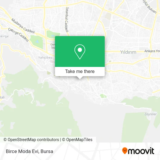
See Birce Moda Evi, Yıldırım, on the map
Public Transit to Birce Moda Evi in Yıldırım
Wondering how to get to Birce Moda Evi in Yıldırım? Moovit helps you find the best way to get to Birce Moda Evi with step-by-step directions from the nearest public transit station.
Moovit provides free maps and live directions to help you navigate through your city. View schedules, routes, timetables, and find out how long does it take to get to Birce Moda Evi in real time.
Looking for the nearest stop or station to Birce Moda Evi? Check out this list of stops closest to your destination: İpekçilik; Anadolu İmam Hatip Lisesi; Irgandı Köprüsü; Yeşil Cd. 1 (Yıldırım); Maviköşe 1; Maviköşe 2; Namazgah 2; İnegöl Çarşısı Peron 1; Kayhan; Gökdere.
Bus: 3İ, 9D, H4, S2, 4B, G4S, G4T, 37, B38, 4A, D1B, 94, 94B, 1A, 6A, 6E, E13, 24B, 3C, E12, 15A, 15B, 38D, S1, 3MU, 3P, 36.Metro: 1, 2.
Want to see if there’s another route that gets you there at an earlier time? Moovit helps you find alternative routes or times. Get directions from and directions to Birce Moda Evi easily from the Moovit App or Website.
We make riding to Birce Moda Evi easy, which is why over 1.5 million users, including users in Yıldırım, trust Moovit as the best app for public transit. You don’t need to download an individual bus app or train app, Moovit is your all-in-one transit app that helps you find the best bus time or train time available.
For information on prices of bus and metro, costs and ride fares to Birce Moda Evi, please check the Moovit app.
Use the app to navigate to popular places including to the airport, hospital, stadium, grocery store, mall, coffee shop, school, college, and university.
Birce Moda Evi Address: İpekçilik Caddesi, 16360 Karaağaç, Bursa street in Yıldırım
- Uysal Manav,
- Yıldırım Rehberlik Araştırma Merkezi,
- Yildirim Rehberlik ve Arastirma Merkezi,
- Karaağaç Mahallesi,
- Akım Elektrik,
- Bursa İl Halk Kütüphanesi,
- Morbeyaz Kuaför Ağda Salonu,
- BİM,
- Ilona Güzellik Merkezi,
- Bursa Günlük Kiralık Daire,
- Kuaför Fatih,
- Ipekcılık Fırını,
- Gorukle otoban,
- İpekçilik Fırını,
- Avea Bayi,
- İpek Kuaför Salonu,
- İpek Bayan Kuaförü,
- Saygn Kent Pasaj,
- Extra Kuaför,
- Donercı Mehmet Usta
Places Near Birce Moda Evi (Yıldırım)
- Bursa Cumalıkızık Köyü, Osmangazi,
- ÖzdilekPark Bursa Nilüfer, Nilüfer,
- bursa mudanya, Mudanya,
- Çekirge Devlet Hastanesi Otobüs Durağı, Osmangazi,
- Şevket Yılmaz Eğitim ve Araştırma Hastanesi, Yıldırım,
- Nilüfer Ağız ve Diş Sağlığı Merkezi, Nilüfer,
- FSM Bulvarı, Nilüfer,
- Sur Yapı Marka, Nilüfer,
- Dörtçelik Çocuk Hastanesi, Nilüfer,
- Sur Yapı Marka Avm, Osmangazi,
- Bursa Teleferik, Yıldırım,
- Ali Osman Sönmez Onkoloji Hastanesi, Osmangazi,
- Mustafakemalpaşa Karacabey Dolmuş Durağı, Mustafakemalpaşa,
- Bursa Hayvanat Bahçesi, Osmangazi,
- Bursa Yüksek İhtisas Eğitim ve Araştırma Hastanesi Nilüfer Ek Binası, Nilüfer,
- Bursa, Osmangazi,
- Podyum Park, Nilüfer,
- Bursa Terminal, Nilüfer,
- Millet Mahallesi,
- Şehir Hastanesi, Nilüfer
How to get to popular places in Bursa with public transit
Get around Yıldırım by public transit!
Traveling around Yıldırım has never been so easy. See step by step directions as you travel to any attraction, street or major public transit station. View bus and train schedules, arrival times, service alerts and detailed routes on a map, so you know exactly how to get to anywhere in Yıldırım.
When traveling to any destination around Yıldırım use Moovit's Live Directions with Get Off Notifications to know exactly where and how far to walk, how long to wait for your line, and how many stops are left. Moovit will alert you when it's time to get off — no need to constantly re-check whether yours is the next stop.
Wondering how to use public transit in Yıldırım or how to pay for public transit in Yıldırım? Moovit public transit app can help you navigate your way with public transit easily, and at minimum cost. It includes public transit fees, ticket prices, and costs. Looking for a map of Yıldırım public transit lines? Moovit public transit app shows all public transit maps in Yıldırım with all Bus, Metro, Light Rail, Cable Car and Gondola routes and stops on an interactive map.
Bursa has 5 transit type(s), including: Bus, Metro, Light Rail, Cable Car and Gondola, operated by several transit agencies, including BursaRay, BurTram, BBBUS, Burulaş, Minibüs, İlçe Otobüsleri and Bursa Teleferik