How to get to Birdcode Hot Chicken by bus?
Click on the bus route to see step by step directions with maps, line arrival times and updated time schedules.
Bus stops near Birdcode Hot Chicken in Vernon
Bus lines to Birdcode Hot Chicken in Vernon
What are the closest stations to Birdcode Hot Chicken?
The closest stations to Birdcode Hot Chicken are:
- Green Cir @ Talcottville Rd is 320 yards away, 5 min walk.
- Green Circle Rd @ Green Circle Rd Park & Ride is 406 yards away, 6 min walk.
Which bus lines stop near Birdcode Hot Chicken?
These bus lines stop near Birdcode Hot Chicken: 84, 903/913.
What’s the nearest bus station to Birdcode Hot Chicken in Vernon?
The nearest bus station to Birdcode Hot Chicken in Vernon is Green Cir @ Talcottville Rd. It’s a 5 min walk away.
What time is the first bus to Birdcode Hot Chicken in Vernon?
The 84 is the first bus that goes to Birdcode Hot Chicken in Vernon. It stops nearby at 5:06 AM.
What time is the last bus to Birdcode Hot Chicken in Vernon?
The 82/84 is the last bus that goes to Birdcode Hot Chicken in Vernon. It stops nearby at 10:30 PM.
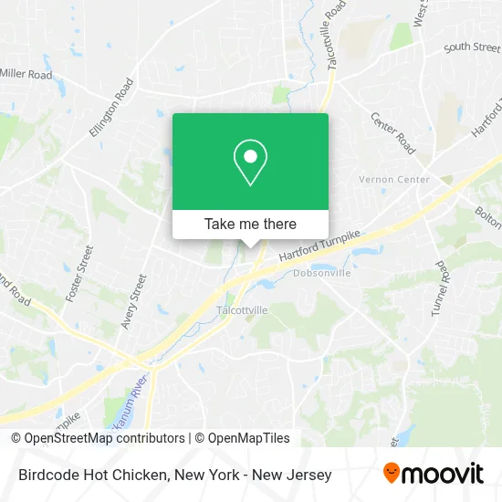
See Birdcode Hot Chicken, Vernon, on the map
Public Transit to Birdcode Hot Chicken in Vernon
Wondering how to get to Birdcode Hot Chicken in Vernon? Moovit helps you find the best way to get to Birdcode Hot Chicken with step-by-step directions from the nearest public transit station.
Moovit provides free maps and live directions to help you navigate through your city. View schedules, routes, timetables, and find out how long does it take to get to Birdcode Hot Chicken in real time.
Looking for the nearest stop or station to Birdcode Hot Chicken? Check out this list of stops closest to your destination: Green Cir @ Talcottville Rd; Green Circle Rd @ Green Circle Rd Park & Ride.
Bus: 84, 903/913, 82/84, 903.
Want to see if there’s another route that gets you there at an earlier time? Moovit helps you find alternative routes or times. Get directions from and directions to Birdcode Hot Chicken easily from the Moovit App or Website.
We make riding to Birdcode Hot Chicken easy, which is why over 1.5 million users, including users in Vernon, trust Moovit as the best app for public transit. You don’t need to download an individual bus app or train app, Moovit is your all-in-one transit app that helps you find the best bus time or train time available.
For information on prices of bus and train, costs and ride fares to Birdcode Hot Chicken, please check the Moovit app.
Use the app to navigate to popular places including to the airport, hospital, stadium, grocery store, mall, coffee shop, school, college, and university.
Birdcode Hot Chicken Address: 35 Talcottville Rd street in Vernon
- Swati Patel, Aprn,
- Hyun Joo Park, Md,
- Richard Lucarelli, Md,
- David & Rhoda Chase Family Movement Disorders Center,
- Jincy Joseph, Aprn,
- A-List Landscaping Llc,
- Homesense,
- Record Nations,
- Xfinity Store,
- Companion Support Resources,
- The Williams Law Group,
- Us Nails,
- Joseph Mascolo, Aprn,
- J. Antonelle De Marcaida Md,
- Jennifer A. Caruso Psyd,
- 7 Brew Coffee,
- Jeffrey Lahrmann, Md,
- Radioshack,
- Sally Beauty,
- Payless Shoesource
Places Near Birdcode Hot Chicken (Vernon)
- qqqq, Manhattan,
- Wall Street, Manhattan,
- 111 Centre New York City Supreme Court, Manhattan,
- San Gennaro Feast, Manhattan,
- 1 Police Plaza, Manhattan,
- Pier 83, Manhattan,
- 26 Federal Plaza, Manhattan,
- Hudson Yards, Manhattan,
- Queens Center Mall, Queens,
- 66 John Street, Manhattan,
- Mountainside Hospital, Glen Ridge,
- SoHo, Manhattan,
- 3 Stone St, Manhattan,
- 911 Memorial, Manhattan,
- 376 Hudson Street, Manhattan,
- Rockefeller Center, Manhattan,
- Katz's Deli, Manhattan,
- Chinatown, Manhattan,
- Times Square, Manhattan,
- Bellevue Hospital, Manhattan
How to get to popular places in New York - New Jersey with public transit
Get around Vernon by public transit!
Traveling around Vernon has never been so easy. See step by step directions as you travel to any attraction, street or major public transit station. View bus and train schedules, arrival times, service alerts and detailed routes on a map, so you know exactly how to get to anywhere in Vernon.
When traveling to any destination around Vernon use Moovit's Live Directions with Get Off Notifications to know exactly where and how far to walk, how long to wait for your line, and how many stops are left. Moovit will alert you when it's time to get off — no need to constantly re-check whether yours is the next stop.
Wondering how to use public transit in Vernon or how to pay for public transit in Vernon? Moovit public transit app can help you navigate your way with public transit easily, and at minimum cost. It includes public transit fees, ticket prices, and costs. Looking for a map of Vernon public transit lines? Moovit public transit app shows all public transit maps in Vernon with all Bus, Train, Subway, Light Rail, Ferry and Cable Car routes and stops on an interactive map.
New York - New Jersey has 6 transit type(s), including: Bus, Train, Subway, Light Rail, Ferry and Cable Car, operated by several transit agencies, including MTA Subway, Metro-North Railroad, LIRR, PATH, MTA New York City Transit - Express routes, MTA Bus, NJ Transit, NYC Ferry, NICE bus, Bee-Line Bus, NJ Transit Rail, Norwalk Transit District, Hartford Line, River Valley Transit and HART