How to get to Birkle by bus?
Click on the bus route to see step by step directions with maps, line arrival times and updated time schedules.
From Gewerbliche Schule, Verwaltungsgemeinschaft Schwäbisch Gmünd
89 minFrom Mömax Restaurant, Verwaltungsgemeinschaft Schwäbisch Gmünd
113 minFrom Kinopark Aalen, Verwaltungsgemeinschaft Aalen
39 minFrom Bucher Stausee, Verwaltungsgemeinschaft Ellwangen (Jagst)
91 minFrom Ostalb-Klinikum, Verwaltungsgemeinschaft Aalen
48 minFrom Schönblick Christliches Tagungszentrum, Verwaltungsgemeinschaft Schwäbisch Gmünd
130 minFrom Prooptik, Verwaltungsgemeinschaft Ellwangen (Jagst)
69 minFrom Amazon-DBX8, Herbrechtingen
93 minFrom Justus-Von-Liebig-Schule Aalen, Verwaltungsgemeinschaft Aalen
42 minFrom Media Markt, Verwaltungsgemeinschaft Schwäbisch Gmünd
112 min
How to get to Birkle by train?
Click on the train route to see step by step directions with maps, line arrival times and updated time schedules.
From Kinopark Aalen, Verwaltungsgemeinschaft Aalen
36 minFrom Ostalb-Klinikum, Verwaltungsgemeinschaft Aalen
41 minFrom Schönblick Christliches Tagungszentrum, Verwaltungsgemeinschaft Schwäbisch Gmünd
82 minFrom Prooptik, Verwaltungsgemeinschaft Ellwangen (Jagst)
51 minFrom Justus-Von-Liebig-Schule Aalen, Verwaltungsgemeinschaft Aalen
47 min
Bus stops near Birkle in Oberkochen
Train stations near Birkle in Oberkochen
- Oberkochen, Bahnhof, 54 min walk,VIEW
Bus lines to Birkle in Oberkochen
What are the closest stations to Birkle?
The closest stations to Birkle are:
- Oberkochen, Volkmarsbergstr is 70 meters away, 2 min walk.
- Oberkochen, Stadtmitte is 733 meters away, 10 min walk.
- Oberkochen, Fa. Zeiss/Tor 2 is 969 meters away, 13 min walk.
- Oberkochen, Bahnhof is 4099 meters away, 54 min walk.
Which train lines stop near Birkle?
These train lines stop near Birkle: RE50, RS 5, RS5.
Which bus lines stop near Birkle?
These bus lines stop near Birkle: 105, 40, 7518, 901.
What’s the nearest bus station to Birkle in Oberkochen?
The nearest bus station to Birkle in Oberkochen is Oberkochen, Volkmarsbergstr. It’s a 2 min walk away.
What time is the first train to Birkle in Oberkochen?
The RS5 is the first train that goes to Birkle in Oberkochen. It stops nearby at 4:51 AM.
What time is the last train to Birkle in Oberkochen?
The RS5 is the last train that goes to Birkle in Oberkochen. It stops nearby at 11:42 PM.
What time is the first bus to Birkle in Oberkochen?
The 104 is the first bus that goes to Birkle in Oberkochen. It stops nearby at 4:28 AM.
What time is the last bus to Birkle in Oberkochen?
The 40 is the last bus that goes to Birkle in Oberkochen. It stops nearby at 12:07 AM.
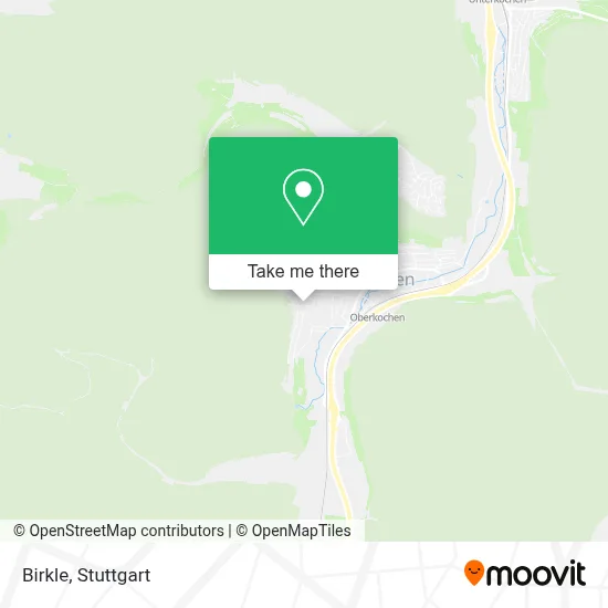
See Birkle, Oberkochen, on the map
Public Transit to Birkle in Oberkochen
Wondering how to get to Birkle in Oberkochen? Moovit helps you find the best way to get to Birkle with step-by-step directions from the nearest public transit station.
Moovit provides free maps and live directions to help you navigate through your city. View schedules, routes, timetables, and find out how long does it take to get to Birkle in real time.
Looking for the nearest stop or station to Birkle? Check out this list of stops closest to your destination: Oberkochen, Volkmarsbergstr; Oberkochen, Stadtmitte; Oberkochen, Fa. Zeiss/Tor 2; Oberkochen, Bahnhof.
Train: RE50, RS 5, RS5, RE3, RS51, RS 51, RE 50, RE 50.Bus: 105, 40, 7518, 901, 104.
Want to see if there’s another route that gets you there at an earlier time? Moovit helps you find alternative routes or times. Get directions from and directions to Birkle easily from the Moovit App or Website.
We make riding to Birkle easy, which is why over 1.5 million users, including users in Oberkochen, trust Moovit as the best app for public transit. You don’t need to download an individual bus app or train app, Moovit is your all-in-one transit app that helps you find the best bus time or train time available.
For information on prices of bus and train, costs and ride fares to Birkle, please check the Moovit app.
Use the app to navigate to popular places including to the airport, hospital, stadium, grocery store, mall, coffee shop, school, college, and university.
Birkle Address: Volkmarsbergstraße street in Oberkochen
- Asv Neresheim,
- Verein für Homöopathie und Naturheilweise Oberkochen,
- Sabine Maria Walter Consulting,
- Bau 30,
- Bau 28,
- Holzkreuz An Der Volkmarsbergstraße,
- Bau 29,
- Nordic Aktiv Oberkochen,
- Wanderparkplatz,
- Brunch Lunch Dinner,
- Bau 11,
- Bau 24,
- Wanderblume,
- Wander Und Rundwanderwege,
- Polizeiposten Oberkochen,
- Parkhaus - Bau 42,
- Bau 10,
- Bau 16,
- Bau 2a,
- Betriebsrestaurant
Places Near Birkle (Oberkochen)
- Im Wizemann (Halle), Bad Cannstatt,
- Porsche-Arena, Bad Cannstatt,
- Hanns-Martin-Schleyer-Halle, Bad Cannstatt,
- Gasometer Pforzheim, Pforzheim,
- FlixBus Haltestelle, Stuttgart,
- Pariser Platz Stuttgart, Stuttgart-Mitte,
- Wilhelma (U-Bahn Wilhelma), Bad Cannstatt,
- Schleyerhalle, Bad Cannstatt,
- Geilhaus Haus 33a, Reutlingen-Betzingen,
- Waldfriedhof, Degerloch,
- Mettingen Eros-Center Puff Laufhaus, Esslingen Am Neckar,
- Marmorsaal Im Weissenburgpark, Stuttgart-Süd,
- Mercedes-Benz Museum (Mercedes Museum Stuttgart), Bad Cannstatt,
- Hauptbahnhof Stuttgart, Stuttgart-Mitte,
- Hanns-Martin-Schleyer-Halle (Stuttgart Hans-Martin-Schleyerhalle), Bad Cannstatt,
- Gleis 101/102 (tief), Stuttgart-Mitte,
- Porsche Museum, Zuffenhausen,
- SI-Centrum, Möhringen,
- Mercedes-Benz Museum, Bad Cannstatt,
- Klinikum Stuttgart - Katharinenhospital, Stuttgart-Mitte
How to get to popular places in Stuttgart with public transit
Get around Oberkochen by public transit!
Traveling around Oberkochen has never been so easy. See step by step directions as you travel to any attraction, street or major public transit station. View bus and train schedules, arrival times, service alerts and detailed routes on a map, so you know exactly how to get to anywhere in Oberkochen.
When traveling to any destination around Oberkochen use Moovit's Live Directions with Get Off Notifications to know exactly where and how far to walk, how long to wait for your line, and how many stops are left. Moovit will alert you when it's time to get off — no need to constantly re-check whether yours is the next stop.
Wondering how to use public transit in Oberkochen or how to pay for public transit in Oberkochen? Moovit public transit app can help you navigate your way with public transit easily, and at minimum cost. It includes public transit fees, ticket prices, and costs. Looking for a map of Oberkochen public transit lines? Moovit public transit app shows all public transit maps in Oberkochen with all Bus, Train, Subway, Light Rail, Ferry, S-Bahn and Funicular routes and stops on an interactive map.
Stuttgart has 7 transit type(s), including: Bus, Train, Subway, Light Rail, Ferry, S-Bahn and Funicular, operated by several transit agencies, including SSB - Stadtbahn, SSB, SSB - Seilbahn / Zacke, S-Bahn Stuttgart, Rhein-Neckar-Verkehr GmbH (rnv), Karlsruher Verkehrsverbund, DB AG, DB Regiobus BW, Arverio Baden-Württemberg GmbH, DB RegioNetz Verkehrs GmbH Westfrankenbahn, DB Regio AG Baden-Württemberg, Südwestdeutsche Verkehrs-AG, DB Regio AG Mitte Region Hessen, DB and Bodensee-Oberschwaben-Bahn