Directions to Blessed Modas (Colombo) with public transportation
The following transit lines have routes that pass near Blessed Modas
How to get to Blessed Modas by bus?
Click on the bus route to see step by step directions with maps, line arrival times and updated time schedules.
From Alto da XV, Alto Da Rua XV
46 minFrom set movie, Alto Da Rua XV
46 minFrom Capão Da Imbuia, Capão Da Imbúia
64 minFrom Rua Manoel Eufrásio, Juvevê
45 minFrom Estação Tubo Moyses Marcondes, Juvevê
52 minFrom Rua XV de Novembro, Colombo
41 minFrom Avenida Victor Ferreira do Amaral, Tarumã
54 minFrom Rua Theodoro Makiolka, Santa Cândida
50 minFrom Hospital Vita Curitiba, Bairro Alto
36 minFrom Campina do Arruda, Almirante Tamandaré
45 min
Bus stops near Blessed Modas in Colombo
Bus lines to Blessed Modas in Colombo
- B15 ANA TERRA (VIA ADRIANE), ANA TERRA (via ADRIANE),VIEW
- B30 ANA TERRA, ANA TERRA,VIEW
- B56 ANA TERRA (VIA ADRIANE) / JARDIM EUCALIPTOS, ANA TERRA (via ADRIANE) / JARDIM EUCALIPTOS,VIEW
- B69 MAD. CURITIBA / SÃO DIMAS, MAD. CURITIBA / SÃO DIMAS,VIEW
- U01 SEDE / MARACANÃ, Terminal Maracanã → Terminal Sede Colombo,VIEW
- S11 ROÇA GRANDE / GUARAITUBA, Terminal Roça Grande → Terminal Guaraituba,VIEW
What are the closest stations to Blessed Modas?
The closest stations to Blessed Modas are:
- Rua Dulcídio Falavinha, 847 is 340 meters away, 5 min walk.
- R. Felício Kania, 1427 is 566 meters away, 8 min walk.
Which bus lines stop near Blessed Modas?
These bus lines stop near Blessed Modas: B03 GUARAITUBA / ALTO DA XV (VIA MARACANÃ), B06 GUARAITUBA / RUI BARBOSA (VIA MARACANÃ / SEMIDIRETO), B76 SÃO SEBASTIÃO / GUADALUPE, U01 SEDE / MARACANÃ.
What’s the nearest bus station to Blessed Modas in Colombo?
The nearest bus station to Blessed Modas in Colombo is Rua Dulcídio Falavinha, 847. It’s a 5 min walk away.
What time is the first bus to Blessed Modas in Colombo?
The B69 MAD. CURITIBA / SÃO DIMAS is the first bus that goes to Blessed Modas in Colombo. It stops nearby at 4:04 AM.
What time is the last bus to Blessed Modas in Colombo?
The B69 MAD. CURITIBA / SÃO DIMAS is the last bus that goes to Blessed Modas in Colombo. It stops nearby at 2:01 AM.
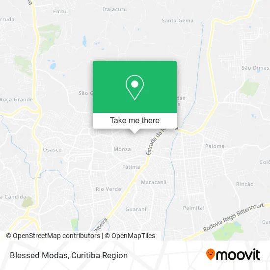
See Blessed Modas, Colombo, on the map
Public Transit to Blessed Modas in Colombo
Wondering how to get to Blessed Modas in Colombo? Moovit helps you find the best way to get to Blessed Modas with step-by-step directions from the nearest public transit station.
Moovit provides free maps and live directions to help you navigate through your city. View schedules, routes, timetables, and find out how long does it take to get to Blessed Modas in real time.
Looking for the nearest stop or station to Blessed Modas? Check out this list of stops closest to your destination: Rua Dulcídio Falavinha; R. Felício Kania.
Bus: B03 GUARAITUBA / ALTO DA XV (VIA MARACANÃ), B06 GUARAITUBA / RUI BARBOSA (VIA MARACANÃ / SEMIDIRETO), B76 SÃO SEBASTIÃO / GUADALUPE, U01 SEDE / MARACANÃ, B15 ANA TERRA (VIA ADRIANE), B30 ANA TERRA, B56 ANA TERRA (VIA ADRIANE) / JARDIM EUCALIPTOS, B69 MAD. CURITIBA / SÃO DIMAS, S11 ROÇA GRANDE / GUARAITUBA.
Want to see if there’s another route that gets you there at an earlier time? Moovit helps you find alternative routes or times. Get directions from and directions to Blessed Modas easily from the Moovit App or Website.
We make riding to Blessed Modas easy, which is why over 1.5 million users, including users in Colombo, trust Moovit as the best app for public transit. You don’t need to download an individual bus app or train app, Moovit is your all-in-one transit app that helps you find the best bus time or train time available.
For information on prices of bus, costs and ride fares to Blessed Modas, please check the Moovit app.
Use the app to navigate to popular places including to the airport, hospital, stadium, grocery store, mall, coffee shop, school, college, and university.
Blessed Modas Address: Rua Ilídio dal'Pra, 695 Guaraituba Colombo-PR 83406-080 street in Colombo
- J Seribelo,
- Aviarioanaterra,
- Trans Santana,
- Comercio Diego Jr,
- Lanchonete e Petiscaria Água na Boca,
- Toledo Lanches Artesanais,
- Joao Antonio,
- Arte Moveis,
- Residencial Vivre,
- Jardim Ana Terra,
- Bosque da Uva Colombo,
- Transbordo Municipal,
- Boneca Distribuidora,
- Ponciano,
- Super Mais Mini Mercado,
- Dom Marino Pizzaria,
- Ivan Ferreira Santos Cia,
- Clube Santa Monica,
- Churrascaria Bela Vista,
- Reação Química - Centro Ind. Maua
Places Near Blessed Modas (Colombo)
- Hospital Da Cruz Vermelha, Batel,
- Hhhhh, Fazendinha,
- Pontifícia Universidade Católica do Paraná (PUCPR), Prado Velho,
- Rua General Mário Tourinho, Campina Do Siqueira,
- Parque Barigui, Mercês,
- Rua Martim Afonso 558, Mercês,
- Jardim Botânico de Curitiba PR, Centro,
- Hospital do Rocio, Campo,
- Hospital Universitário Evangélico de Curitiba, Bigorrilho,
- Hospital Erasto Gaertner, Jardim Das Américas,
- Shopping Estação, Rebouças,
- Hospital Nossa Senhora Das Graças, Mercês,
- Hospital Madalena Sofia, Bairro Alto,
- Hospital de Clínicas (HC - UFPR), Centro,
- Park Shopping Barigüi, Mossunguê,
- Arena Da Baixada - Curitiba,
- Campo Largo, Campo,
- Shopping Palladium, Portão,
- Jockey Plaza Shopping Center, Tarumã,
- Hospital Angelina Caron, Campina Grande Do Sul
How to get to popular places in Curitiba Region with public transit
Get around Colombo by public transit!
Traveling around Colombo has never been so easy. See step by step directions as you travel to any attraction, street or major public transit station. View bus and train schedules, arrival times, service alerts and detailed routes on a map, so you know exactly how to get to anywhere in Colombo.
When traveling to any destination around Colombo use Moovit's Live Directions with Get Off Notifications to know exactly where and how far to walk, how long to wait for your line, and how many stops are left. Moovit will alert you when it's time to get off — no need to constantly re-check whether yours is the next stop.
Wondering how to use public transit in Colombo or how to pay for public transit in Colombo? Moovit public transit app can help you navigate your way with public transit easily, and at minimum cost. It includes public transit fees, ticket prices, and costs. Looking for a map of Colombo public transit lines? Moovit public transit app shows all public transit maps in Colombo with all Bus and Cable Car routes and stops on an interactive map.
Curitiba Region has 2 transit type(s), including: Bus and Cable Car, operated by several transit agencies, including Sistema Integrado de Mobilidade (URBS), Sistema Integrado de Mobilidade (AMEP), URBS (Cartões bancários e Dinheiro), URBS (Cartões bancários / Cartão URBS), AMEP (Cartões bancários / Cartão MetroCard), AMEP (Cartões bancários / Cartão MetroCard / Dinheiro), Viação Colombo (Dinheiro), TRIAR (Cartão TRIAR / Dinheiro), Empresa Curitiba Cerro Azul (Dinheiro), Expresso Nossa Senhora da Penha (Dinheiro), Empresa Campo Alto Tijucas (Dinheiro), Auto Viação São José (Cartão VEM / Dinheiro), BRT S/A (Cartão VEM / Dinheiro), TransPiedade (Cartão Cidadão / Dinheiro) and Oceânica Sul (Cartão Transporte / Dinheiro)