How to get to Blind Date Charters by bus?
Click on the bus route to see step by step directions with maps, line arrival times and updated time schedules.
Bus stops near Blind Date Charters in Norfolk
Bus lines to Blind Date Charters in Norfolk
What are the closest stations to Blind Date Charters?
The closest stations to Blind Date Charters are:
- Shore & Dunning is 423 yards away, 6 min walk.
- Little Creek & Shore is 827 yards away, 11 min walk.
- Joint Exp Base Little Creek is 899 yards away, 11 min walk.
Which bus line stops near Blind Date Charters?
001 (Joint Exp Base Little Creek)
What’s the nearest bus station to Blind Date Charters in Norfolk?
The nearest bus station to Blind Date Charters in Norfolk is Shore & Dunning. It’s a 6 min walk away.
What time is the first bus to Blind Date Charters in Norfolk?
The 001 is the first bus that goes to Blind Date Charters in Norfolk. It stops nearby at 5:19 AM.
What time is the last bus to Blind Date Charters in Norfolk?
The 001 is the last bus that goes to Blind Date Charters in Norfolk. It stops nearby at 1:26 AM.
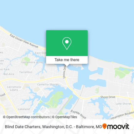
See Blind Date Charters, Norfolk, on the map
Public Transit to Blind Date Charters in Norfolk
Wondering how to get to Blind Date Charters in Norfolk? Moovit helps you find the best way to get to Blind Date Charters with step-by-step directions from the nearest public transit station.
Moovit provides free maps and live directions to help you navigate through your city. View schedules, routes, timetables, and find out how long does it take to get to Blind Date Charters in real time.
Looking for the nearest stop or station to Blind Date Charters? Check out this list of stops closest to your destination: Shore & Dunning; Little Creek & Shore; Joint Exp Base Little Creek.
Bus: 001, 021, 027, 036.
Want to see if there’s another route that gets you there at an earlier time? Moovit helps you find alternative routes or times. Get directions from and directions to Blind Date Charters easily from the Moovit App or Website.
We make riding to Blind Date Charters easy, which is why over 1.5 million users, including users in Norfolk, trust Moovit as the best app for public transit. You don’t need to download an individual bus app or train app, Moovit is your all-in-one transit app that helps you find the best bus time or train time available.
For information on prices of bus, costs and ride fares to Blind Date Charters, please check the Moovit app.
Use the app to navigate to popular places including to the airport, hospital, stadium, grocery store, mall, coffee shop, school, college, and university.
Blind Date Charters Address: 8166 Shore Dr Norfolk, VA 23518 street in Norfolk
- Morningstar Marinas,
- Vinings Landing Marina,
- Stony's Dockside Bar & Grill,
- Faith Communications Groups,
- Marva Outdoors,
- Harrison Marina,
- Finao Sportfishing,
- Sailtime Chesapeake Bay South,
- Marine Concepts,
- Dynamic Marine Surveys,
- Norfolksailing,
- Blue Dragon Fishing Charters,
- Karios,
- Marina Villa,
- Trident Marine Electronics,
- Abiouness Alfred E,
- Checkmark Air Specialits,
- Surf Rider,
- Noah's Ark Bilingual Learning Center,
- Angel's Place Daycare Center
Places Near Blind Date Charters (Norfolk)
- Basilica of the National Shrine, Washington,
- Warner Theatre, Washington,
- Sibley Memorial Hospital, Washington,
- Marriott Marquis Washington, DC, Washington,
- M&T Bank Stadium, Baltimore,
- Camden Yards, Baltimore,
- Capital One Arena, Washington,
- Georgetown, Washington,
- Westfield Montgomery Mall, Montgomery County,
- The Anthem, Washington,
- National Zoo, Washington,
- PG Mall, Prince George's County,
- Washington DC VA Medical Center, Washington,
- Washington National Cathedral, Washington,
- National Mall, Washington,
- Amazon Hq2, Arlington County,
- Museum Of The Bible, Washington,
- National Museum of African American History and Culture, Washington,
- Pennsylvania Ave NW (3rd st and pennsylvania), Washington,
- Rock Creek Tennis Center, Washington
How to get to popular places in Washington, D.C. - Baltimore, MD with public transit
Get around Norfolk by public transit!
Traveling around Norfolk has never been so easy. See step by step directions as you travel to any attraction, street or major public transit station. View bus and train schedules, arrival times, service alerts and detailed routes on a map, so you know exactly how to get to anywhere in Norfolk.
When traveling to any destination around Norfolk use Moovit's Live Directions with Get Off Notifications to know exactly where and how far to walk, how long to wait for your line, and how many stops are left. Moovit will alert you when it's time to get off — no need to constantly re-check whether yours is the next stop.
Wondering how to use public transit in Norfolk or how to pay for public transit in Norfolk? Moovit public transit app can help you navigate your way with public transit easily, and at minimum cost. It includes public transit fees, ticket prices, and costs. Looking for a map of Norfolk public transit lines? Moovit public transit app shows all public transit maps in Norfolk with all Bus, Train, Metro, Light Rail and Ferry routes and stops on an interactive map.
Washington, D.C. - Baltimore, MD has 5 transit type(s), including: Bus, Train, Metro, Light Rail and Ferry, operated by several transit agencies, including WMATA, Montgomery County Ride On, Fairfax Connector, TheBus, PRTC, DASH - Alexandria, Arlington Transit (ART), RTA of Central Maryland, MDOT MTA, MDOT MTA Light RailLink, MDOT MTA Commuter Bus, MDOT MTA Local Bus, FXBGO!, Virginia Railway Express (VRE) and MARC