How to get to Block by bus?
Click on the bus route to see step by step directions with maps, line arrival times and updated time schedules.
How to get to Block by train?
Click on the train route to see step by step directions with maps, line arrival times and updated time schedules.
Bus stops near Block in Verwaltungsverband Mittleres Schussental
Train station near Block in Verwaltungsverband Mittleres Schussental
- Ravensburg, 19 min walk,VIEW
Bus lines to Block in Verwaltungsverband Mittleres Schussental
- 1, Ravensburg Rümelinplatz,VIEW
- 3, Rv Weißenau, Torplatz - Zfp,VIEW
- 700, Konstanz Bahnhof,VIEW
- 7537, Meersburg, Fähre,VIEW
- 7539, Ravensburg Polizeipräsidium,VIEW
- N3, Friedrichshafen Stadtbahnhof,VIEW
- R45, Friedrichshafen Stadtbahnhof,VIEW
- R70, Ravensburg Bahnhof,VIEW
- 4, Ravensburg Frauentor,VIEW
- 12, Berg (Kr Ravensburg) Ettishofen - Weingarten Schulzentrum,VIEW
- 20, Wolpertswende Rathaus - Ravensburg Bahnhof Bstg 10,VIEW
- 21, Bodnegg Schule - Ravensburg Bahnhof Bstg 10,VIEW
- 31, Wolfegg Hofgarten - Ravensburg Bahnhof Bstg 3,VIEW
- 5, Baienfurt Achtalschule - Niederbiegen Bahnhof,VIEW
- 61, Ravensburg Bahnhof Bstg 8 - Berg, Wilhelm-Gindele-Straße Steig 1,VIEW
- 7534, Ravensburg Bahnhof Bstg 11 - Schlier Hintermoos,VIEW
- 7535, Ravensburg Bahnhof Bstg 13 - Vogt Schützenweg,VIEW
- R30, BW, Döchtbühlstadion Bstg 1 - Ravensburg Bahnhof Bstg 3,VIEW
- R40, Ravensburg Bahnhof Bstg 7 - Wangen Busbahnhof Bstg 3,VIEW
- R60, Fleischwangen Kirche - Ravensburg Bahnhof Bstg 8,VIEW
What are the closest stations to Block?
The closest stations to Block are:
- Ravensburg Karlstraße is 213 meters away, 3 min walk.
- Ravensburg Heilig-Geist-Spital is 217 meters away, 3 min walk.
- Ravensburg Bahnhof is 404 meters away, 6 min walk.
- Ravensburg is 1449 meters away, 19 min walk.
Which train lines stop near Block?
These train lines stop near Block: RB 91, RE 3, RE 5, RE5.
Which bus lines stop near Block?
These bus lines stop near Block: 700, R45, R70, S30, S40.
What’s the nearest train station to Block in Verwaltungsverband Mittleres Schussental?
The nearest train station to Block in Verwaltungsverband Mittleres Schussental is Ravensburg. It’s a 19 min walk away.
What’s the nearest bus station to Block in Verwaltungsverband Mittleres Schussental?
The nearest bus stations to Block in Verwaltungsverband Mittleres Schussental are Ravensburg Karlstraße and Ravensburg Heilig-Geist-Spital. The closest one is a 3 min walk away.
What time is the first train to Block in Verwaltungsverband Mittleres Schussental?
The RE5 is the first train that goes to Block in Verwaltungsverband Mittleres Schussental. It stops nearby at 5:02 AM.
What time is the last train to Block in Verwaltungsverband Mittleres Schussental?
The RE 5 is the last train that goes to Block in Verwaltungsverband Mittleres Schussental. It stops nearby at 1:13 AM.
What time is the first bus to Block in Verwaltungsverband Mittleres Schussental?
The 1 is the first bus that goes to Block in Verwaltungsverband Mittleres Schussental. It stops nearby at 4:32 AM.
What time is the last bus to Block in Verwaltungsverband Mittleres Schussental?
The 1 is the last bus that goes to Block in Verwaltungsverband Mittleres Schussental. It stops nearby at 1:23 AM.
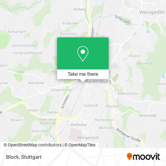
See Block, Verwaltungsverband Mittleres Schussental, on the map
Public Transit to Block in Verwaltungsverband Mittleres Schussental
Wondering how to get to Block in Verwaltungsverband Mittleres Schussental? Moovit helps you find the best way to get to Block with step-by-step directions from the nearest public transit station.
Moovit provides free maps and live directions to help you navigate through your city. View schedules, routes, timetables, and find out how long does it take to get to Block in real time.
Looking for the nearest stop or station to Block? Check out this list of stops closest to your destination: Ravensburg Karlstraße; Ravensburg Heilig-Geist-Spital; Ravensburg Bahnhof; Ravensburg.
Train: RB 91, RE 3, RE 5, RE5, RE3, RE3, RB91, RB91.Bus: 700, R45, R70, S30, S40, 1, 3, 7537, 7539, 4, 12, 20, 21, 31, 5.
Want to see if there’s another route that gets you there at an earlier time? Moovit helps you find alternative routes or times. Get directions from and directions to Block easily from the Moovit App or Website.
We make riding to Block easy, which is why over 1.5 million users, including users in Verwaltungsverband Mittleres Schussental, trust Moovit as the best app for public transit. You don’t need to download an individual bus app or train app, Moovit is your all-in-one transit app that helps you find the best bus time or train time available.
For information on prices of train and bus, costs and ride fares to Block, please check the Moovit app.
Use the app to navigate to popular places including to the airport, hospital, stadium, grocery store, mall, coffee shop, school, college, and university.
Block Address: Pfannenstiel 29 88214 Ravensburg street in Verwaltungsverband Mittleres Schussental
- Villa Emma,
- Johanniter,
- Johanniter-Unfall-Hilfe e.V. - Ortsverband Ravensburg,
- Delphi,
- Maidel Schreinerei,
- Gebäudereinigung Crystal Team,
- Häfele,
- Integrationsfachdienst, Arkade-Pauline 13,
- Eutb Ravensburg Sigmaringen,
- Barmenia Versicherung - Karin Schitterle,
- Wir Abt,
- Dieter Kuohn,
- Synestesia Culture Zone,
- Douala,
- Stamina Club,
- Autopflege-Service Lang,
- Friseursalon Pfleghar,
- Kosmetikstudio Inh. Treier Andrea,
- Douala Entertainment,
- Schulz Engineering GmbH 2.Og, Lok-Center
Places Near Block (Verwaltungsverband Mittleres Schussental)
- Im Wizemann (Halle), Bad Cannstatt,
- Hauptbahnhof Stuttgart, Stuttgart-Mitte,
- Hanns-Martin-Schleyer-Halle (Stuttgart Hans-Martin-Schleyerhalle), Bad Cannstatt,
- Gleis 101/102 (tief), Stuttgart-Mitte,
- FlixBus Haltestelle, Stuttgart,
- Schleyerhalle, Bad Cannstatt,
- Mercedes-Benz Museum, Bad Cannstatt,
- Geilhaus Haus 33a, Reutlingen-Betzingen,
- Waldfriedhof, Degerloch,
- Gasometer Pforzheim, Pforzheim,
- Marmorsaal Im Weissenburgpark, Stuttgart-Süd,
- Wilhelma (U-Bahn Wilhelma), Bad Cannstatt,
- Mettingen Eros-Center Puff Laufhaus, Esslingen Am Neckar,
- SI-Centrum, Möhringen,
- Klinikum Stuttgart - Katharinenhospital, Stuttgart-Mitte,
- Mercedes-Benz Museum (Mercedes Museum Stuttgart), Bad Cannstatt,
- Pariser Platz Stuttgart, Stuttgart-Mitte,
- Porsche-Arena, Bad Cannstatt,
- Hanns-Martin-Schleyer-Halle, Bad Cannstatt,
- Porsche Museum, Zuffenhausen
How to get to popular places in Stuttgart with public transit
Get around Verwaltungsverband Mittleres Schussental by public transit!
Traveling around Verwaltungsverband Mittleres Schussental has never been so easy. See step by step directions as you travel to any attraction, street or major public transit station. View bus and train schedules, arrival times, service alerts and detailed routes on a map, so you know exactly how to get to anywhere in Verwaltungsverband Mittleres Schussental.
When traveling to any destination around Verwaltungsverband Mittleres Schussental use Moovit's Live Directions with Get Off Notifications to know exactly where and how far to walk, how long to wait for your line, and how many stops are left. Moovit will alert you when it's time to get off — no need to constantly re-check whether yours is the next stop.
Wondering how to use public transit in Verwaltungsverband Mittleres Schussental or how to pay for public transit in Verwaltungsverband Mittleres Schussental? Moovit public transit app can help you navigate your way with public transit easily, and at minimum cost. It includes public transit fees, ticket prices, and costs. Looking for a map of Verwaltungsverband Mittleres Schussental public transit lines? Moovit public transit app shows all public transit maps in Verwaltungsverband Mittleres Schussental with all Bus, Train, Subway, Light Rail, Ferry, S-Bahn and Funicular routes and stops on an interactive map.
Stuttgart has 7 transit type(s), including: Bus, Train, Subway, Light Rail, Ferry, S-Bahn and Funicular, operated by several transit agencies, including SSB - Stadtbahn, SSB, SSB - Seilbahn / Zacke, S-Bahn Stuttgart, Rhein-Neckar-Verkehr GmbH (rnv), Karlsruher Verkehrsverbund, DB AG, DB Regiobus BW, Arverio Baden-Württemberg GmbH, DB RegioNetz Verkehrs GmbH Westfrankenbahn, DB Regio AG Baden-Württemberg, Südwestdeutsche Verkehrs-AG, DB Regio AG Mitte Region Hessen, DB and Bodensee-Oberschwaben-Bahn