How to get to Blue2me by bus?
Click on the bus route to see step by step directions with maps, line arrival times and updated time schedules.
From Friedhof Käfertal, Käfertal
67 minFrom FH 1863, Neckarstadt-Ost/Wohlgelegen
56 minFrom Thoraxklinik Heidelberg, Neuenheim
124 minFrom Hans-Warsch-Platz,Ludwigshafen Oggersheim, Ludwigshafen-Oggersheim
83 minFrom Globus Getränkemarkt, Ludwigshafen-Oggersheim
108 minFrom Universitätsklinikum Heidelberg-Notaufnahme, Neuenheim
130 minFrom Marie-Baum-Schule Heidelberg, Wieblingen
121 minFrom Neuenheimer Feld, Neuenheim
117 minFrom Möbel Höffner, Schwetzingen
49 minFrom GRN-Klinik Schwetzingen, Schwetzingen
73 min
How to get to Blue2me by train?
Click on the train route to see step by step directions with maps, line arrival times and updated time schedules.
Bus stops near Blue2me in Lindenhof
Light Rail stations near Blue2me in Lindenhof
Bus lines to Blue2me in Lindenhof
What are the closest stations to Blue2me?
The closest stations to Blue2me are:
- Lindenhof, Pfalzplatz is 684 meters away, 9 min walk.
- Franz-Sigel-Straße is 966 meters away, 13 min walk.
- Neckarau, Franz-Sigel-Straße Bstg B is 974 meters away, 13 min walk.
- Neckarau, Franz-Sigel-Straße is 1033 meters away, 14 min walk.
Which bus lines stop near Blue2me?
These bus lines stop near Blue2me: 711, 74, 76, RNV 50, RNV 63.
Which train lines stop near Blue2me?
These train lines stop near Blue2me: RB35, RE60, S10, S6.
Which light rail lines stop near Blue2me?
These light rail lines stop near Blue2me: 3, RNV 3.
What’s the nearest light rail station to Blue2me in Lindenhof?
The nearest light rail stations to Blue2me in Lindenhof are Franz-Sigel-Straße and Neckarau, Franz-Sigel-Straße Bstg B. The closest one is a 13 min walk away.
What’s the nearest bus station to Blue2me in Lindenhof?
The nearest bus station to Blue2me in Lindenhof is Lindenhof, Pfalzplatz. It’s a 9 min walk away.
What time is the first light rail to Blue2me in Lindenhof?
The RNV 3 is the first light rail that goes to Blue2me in Lindenhof. It stops nearby at 4:59 AM.
What time is the last light rail to Blue2me in Lindenhof?
The RNV 3 is the last light rail that goes to Blue2me in Lindenhof. It stops nearby at 1:28 AM.
What time is the first bus to Blue2me in Lindenhof?
The 3 is the first bus that goes to Blue2me in Lindenhof. It stops nearby at 4:03 AM.
What time is the last bus to Blue2me in Lindenhof?
The RNV 63 is the last bus that goes to Blue2me in Lindenhof. It stops nearby at 8:49 PM.
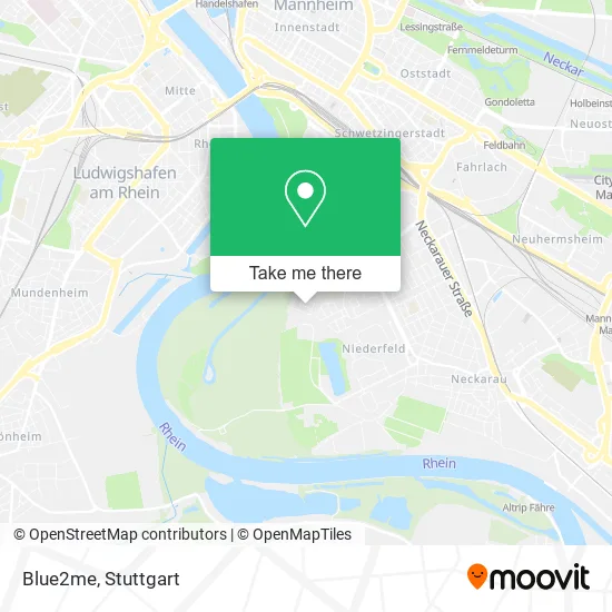
See Blue2me, Lindenhof, on the map
Public Transit to Blue2me in Lindenhof
Wondering how to get to Blue2me in Lindenhof? Moovit helps you find the best way to get to Blue2me with step-by-step directions from the nearest public transit station.
Moovit provides free maps and live directions to help you navigate through your city. View schedules, routes, timetables, and find out how long does it take to get to Blue2me in real time.
Looking for the nearest stop or station to Blue2me? Check out this list of stops closest to your destination: Lindenhof, Pfalzplatz; Franz-Sigel-Straße; Neckarau; Neckarau.
Bus: 711, 74, 76, RNV 50, RNV 63, 3, RNV 3.Train: RB35, RE60, S10, S6.Light Rail: 3, RNV 3.
Want to see if there’s another route that gets you there at an earlier time? Moovit helps you find alternative routes or times. Get directions from and directions to Blue2me easily from the Moovit App or Website.
We make riding to Blue2me easy, which is why over 1.5 million users, including users in Lindenhof, trust Moovit as the best app for public transit. You don’t need to download an individual bus app or train app, Moovit is your all-in-one transit app that helps you find the best bus time or train time available.
For information on prices of bus, light rail and train, costs and ride fares to Blue2me, please check the Moovit app.
Use the app to navigate to popular places including to the airport, hospital, stadium, grocery store, mall, coffee shop, school, college, and university.
Blue2me Address: Hochfirststraße 6 Neckarau, 68163 Mannheim street in Lindenhof
- Number 17,
- Dipl.-Ing. Wolfgang Handreck,
- Dr. med. H. Zeitz,
- Gabriele Heißler,
- H. Theurer Verwaltungs,
- Bonn GmbH&Co.Kg,
- Kordes Gert Dipl.Ing,
- Hermann Hornauer, Stahlhandel,
- Fanti,
- Deut,
- Riemann Dieter,
- Schwarzwaldviertel,
- Schmieder Beteiligungsges.M.B.H,
- Erstes Ludwigshafener Bestattungsinstitut Henss,
- Sommer Research,
- Hofmann Peter,
- Somibo,
- Michael Bode Geschäftsführungs,
- Sethea,
- Oase Restaurant und Imbiss-Betriebs
Places Near Blue2me (Lindenhof)
- Marmorsaal Im Weissenburgpark, Stuttgart-Süd,
- Porsche-Arena, Bad Cannstatt,
- Wilhelma (U-Bahn Wilhelma), Bad Cannstatt,
- Hanns-Martin-Schleyer-Halle (Stuttgart Hans-Martin-Schleyerhalle), Bad Cannstatt,
- Im Wizemann (Halle), Bad Cannstatt,
- Pariser Platz Stuttgart, Stuttgart-Mitte,
- Klinikum Stuttgart - Katharinenhospital, Stuttgart-Mitte,
- Geilhaus Haus 33a, Reutlingen-Betzingen,
- Hanns-Martin-Schleyer-Halle, Bad Cannstatt,
- Hauptbahnhof Stuttgart, Stuttgart-Mitte,
- FlixBus Haltestelle, Stuttgart,
- Porsche Museum, Zuffenhausen,
- Mercedes-Benz Museum, Bad Cannstatt,
- SI-Centrum, Möhringen,
- Mettingen Eros-Center Puff Laufhaus, Esslingen Am Neckar,
- Mercedes-Benz Museum (Mercedes Museum Stuttgart), Bad Cannstatt,
- Waldfriedhof, Degerloch,
- Gasometer Pforzheim, Pforzheim,
- Gleis 101/102 (tief), Stuttgart-Mitte,
- Schleyerhalle, Bad Cannstatt
How to get to popular places in Stuttgart with public transit
Get around Lindenhof by public transit!
Traveling around Lindenhof has never been so easy. See step by step directions as you travel to any attraction, street or major public transit station. View bus and train schedules, arrival times, service alerts and detailed routes on a map, so you know exactly how to get to anywhere in Lindenhof.
When traveling to any destination around Lindenhof use Moovit's Live Directions with Get Off Notifications to know exactly where and how far to walk, how long to wait for your line, and how many stops are left. Moovit will alert you when it's time to get off — no need to constantly re-check whether yours is the next stop.
Wondering how to use public transit in Lindenhof or how to pay for public transit in Lindenhof? Moovit public transit app can help you navigate your way with public transit easily, and at minimum cost. It includes public transit fees, ticket prices, and costs. Looking for a map of Lindenhof public transit lines? Moovit public transit app shows all public transit maps in Lindenhof with all Bus, Train, Subway, Light Rail, Ferry, S-Bahn and Funicular routes and stops on an interactive map.
Stuttgart has 7 transit type(s), including: Bus, Train, Subway, Light Rail, Ferry, S-Bahn and Funicular, operated by several transit agencies, including SSB - Stadtbahn, SSB, SSB - Seilbahn / Zacke, S-Bahn Stuttgart, Rhein-Neckar-Verkehr GmbH (rnv), Karlsruher Verkehrsverbund, DB AG, DB Regiobus BW, Arverio Baden-Württemberg GmbH, DB RegioNetz Verkehrs GmbH Westfrankenbahn, DB Regio AG Baden-Württemberg, Südwestdeutsche Verkehrs-AG, DB Regio AG Mitte Region Hessen, DB and Bodensee-Oberschwaben-Bahn